Download
3D Flyover
Add to list
More
65.0 km
~3 days
174 m
Point-to-Point
“The Military Ridge State Trail offers a scenic, historical journey through Wisconsin's diverse landscapes and charming towns.”
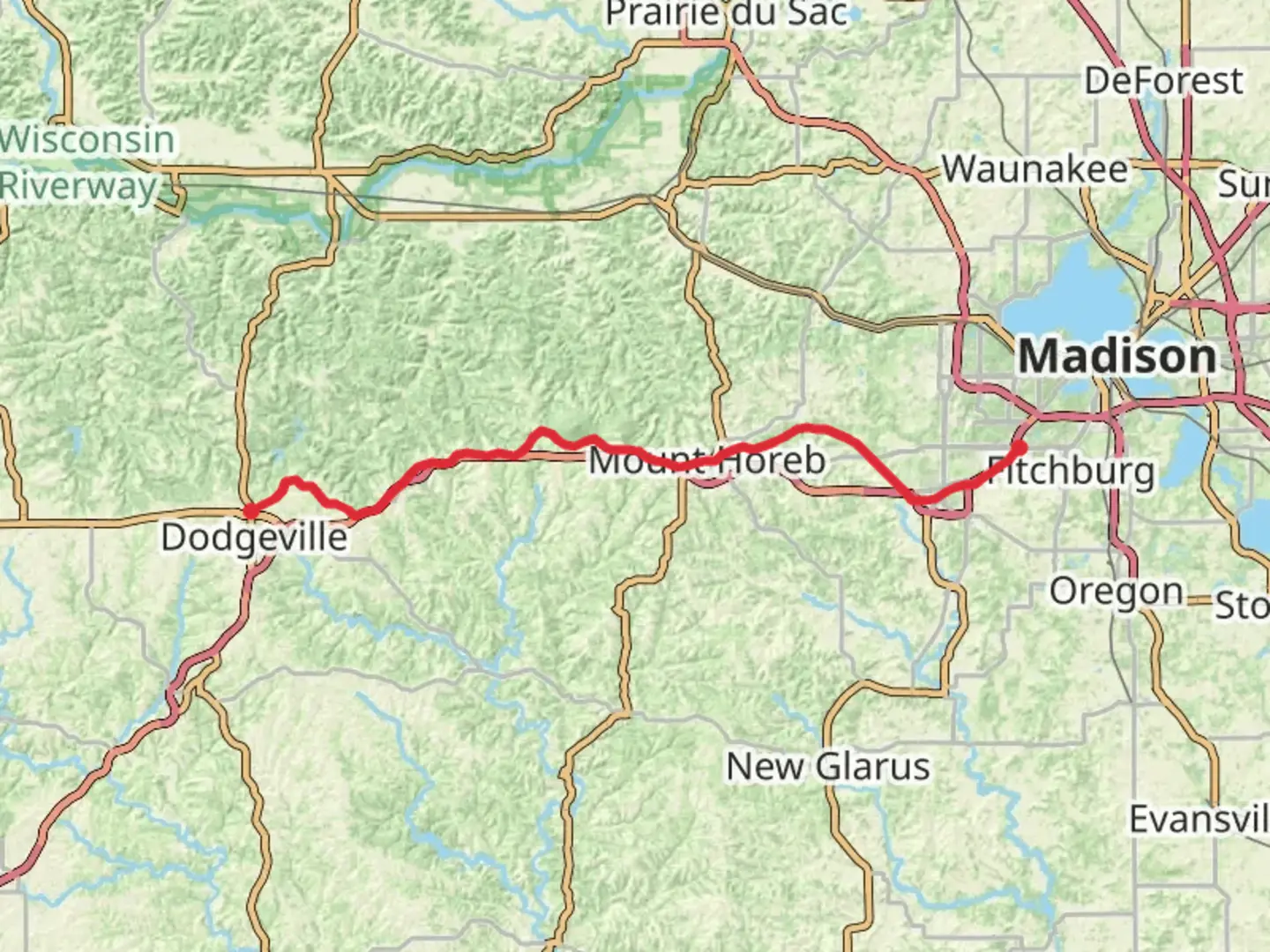
The Military Ridge State Trail stretches approximately 65 kilometers (about 40 miles) through the scenic landscapes of southwestern Wisconsin, offering a gentle elevation gain of around 100 meters (328 feet). This point-to-point trail begins near Iowa County, Wisconsin, and is renowned for its easy difficulty rating, making it accessible to hikers of all skill levels.
Getting There
To reach the trailhead, you can drive to Dodgeville, Wisconsin, which is conveniently located near the start of the trail. For those relying on public transport, the nearest major city is Madison, Wisconsin. From Madison, you can take a bus to Dodgeville, which is approximately 45 miles (72 kilometers) away. Once in Dodgeville, local taxi services or rideshare options can take you to the trailhead.
Trail Highlights
The Military Ridge State Trail follows a former railroad corridor, providing a relatively flat and smooth path ideal for hiking, biking, and even horseback riding. As you traverse the trail, you'll pass through a variety of landscapes, including lush woodlands, open prairies, and charming small towns. The trail is well-marked and maintained, ensuring a pleasant journey.
Historical Significance
The trail is named after the Military Ridge, a geographical feature that played a significant role in the region's history. During the Black Hawk War of 1832, the ridge served as a strategic route for military troops. As you hike, you'll be walking along a path steeped in history, with interpretive signs along the way providing insights into the area's past.
Nature and Wildlife
The trail is a haven for nature enthusiasts, with opportunities to observe a diverse array of wildlife. Keep an eye out for white-tailed deer, red foxes, and a variety of bird species, including hawks and songbirds. The trail also passes through several wetlands, where you might spot turtles and frogs.
Notable Landmarks
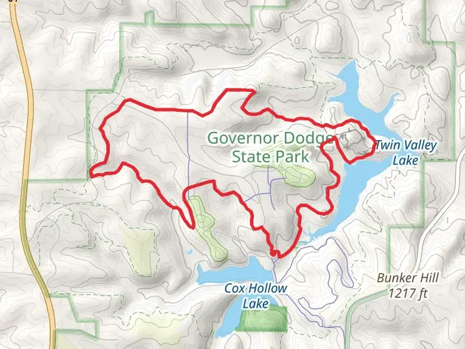
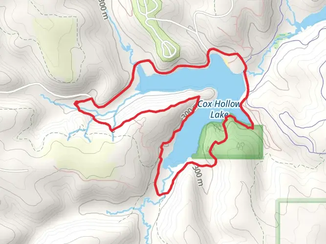
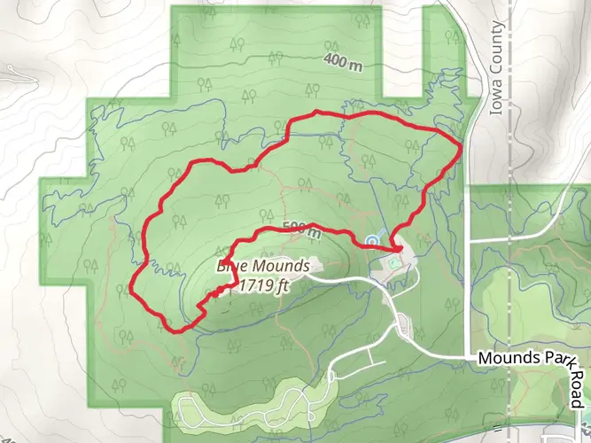
Blue Mounds State Park: Approximately 16 kilometers (10 miles) from the trailhead, this park offers stunning views from the highest point in southern Wisconsin. It's a great spot for a detour if you're interested in exploring more of the area's natural beauty.
Ridgeway Pine Relict State Natural Area: Around 24 kilometers (15 miles) into the trail, this area is home to unique pine relicts and offers a glimpse into the region's ecological history.
Mount Horeb: At about 40 kilometers (25 miles) along the trail, this charming town is known for its Norwegian heritage and whimsical "Trollway," featuring carved troll statues along the main street.
Navigation
For navigation, consider using the HiiKER app, which provides detailed maps and real-time updates to ensure you stay on track throughout your journey. The app can also help you locate nearby amenities and points of interest.
Trail Amenities
The trail is equipped with several rest areas and picnic spots, making it easy to take breaks and enjoy the surroundings. In the towns along the route, you'll find cafes, restaurants, and shops where you can replenish supplies or enjoy a meal.
Whether you're a history buff, nature lover, or simply seeking a leisurely hike, the Military Ridge State Trail offers a delightful experience through one of Wisconsin's most picturesque regions.

What to expect?
Activity types
Comments and Reviews
User comments, reviews and discussions about the Military Ridge State Trail, Wisconsin.
average rating out of 5
0 rating(s)