Download
3D Flyover
Add to list
More
85.7 km
~4 days
3129 m
Multi-Day
“Embark on a breathtaking 53-mile trek through Tennessee's rugged Cumberland range, rich with history and natural splendors.”
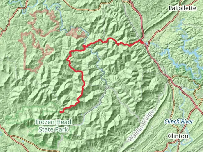
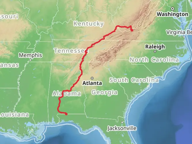
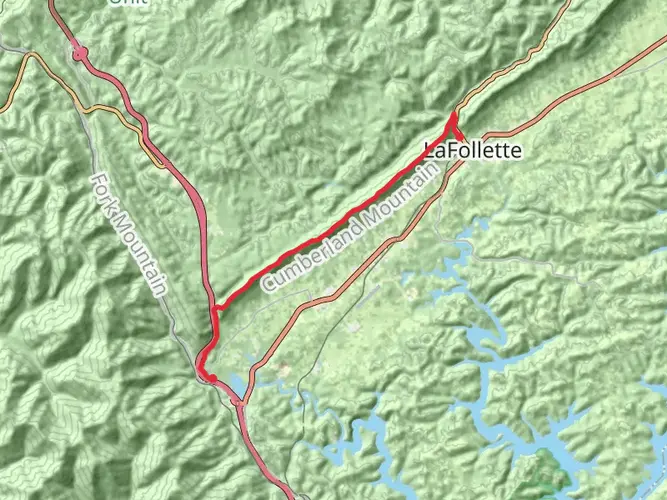
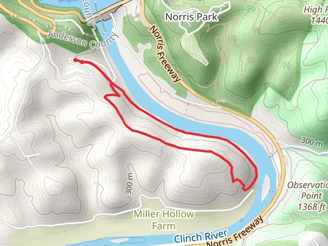
Spanning approximately 86 kilometers (about 53 miles) with an elevation gain of around 3100 meters (approximately 10,170 feet), the Cumberland Trail from La Follette to Flat Fork Road is a challenging point-to-point trek that offers hikers a diverse and rewarding experience. The trailhead is situated near Campbell County, Tennessee, and is recognized for its difficult terrain, making it a suitable adventure for experienced hikers.
Getting to the Trailhead
To reach the starting point of the Cumberland Trail near La Follette, hikers can drive to the vicinity of Campbell County. If you're relying on public transportation, it's important to check the local schedules for any available services that can get you close to the trailhead. Once you're in the area, you may need to arrange a taxi or a shuttle service to reach the exact starting location.
Navigating the Trail
Hikers should prepare to navigate the trail using the HiiKER app, which provides detailed maps and GPS coordinates to ensure you stay on the right path. The trail is well-marked in most sections, but having a reliable navigation tool is crucial, especially on longer and more remote stretches.
Trail Experience
As you embark on this journey, you'll traverse a variety of landscapes, including dense forests, rocky outcrops, and serene streams. The trail offers a mix of steep climbs and descents, with some flat sections providing a respite from the more strenuous parts.
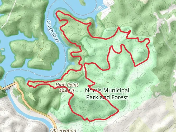
Landmarks and Natural Features
One of the highlights of the trail is the scenic overlooks that offer expansive views of the surrounding mountains and valleys. These vantage points are perfect for taking a break and soaking in the natural beauty of the region.
Wildlife and Flora
The Cumberland Trail is home to a rich array of wildlife. Hikers may encounter deer, black bears, and a variety of bird species. The trail also winds through diverse ecosystems, showcasing a range of flora, from towering hardwoods to vibrant wildflowers, especially in the spring and summer months.
Historical Significance
The region holds historical significance, with the trail passing through areas that were once inhabited by indigenous peoples and later by European settlers. Hikers will find remnants of the past, such as old homesteads and coal mining operations, which provide a glimpse into the area's rich cultural heritage.
Preparation and Safety
Given the trail's difficulty, it's essential to be well-prepared with adequate supplies, including water, food, and appropriate gear for changing weather conditions. Hikers should also be aware of the potential for sudden weather changes and prepare accordingly.
Conclusion
The Cumberland Trail from La Follette to Flat Fork Road is a demanding yet rewarding hike that offers a glimpse into the natural and historical tapestry of Tennessee. With proper preparation and respect for the trail's challenges, hikers can enjoy a memorable experience immersed in the beauty of the Cumberland range.

What to expect?
Activity types
Frequently asked questions
How long is the Cumberland Trail - La Follette To Flat Fork Rd and how hard is it?
The Cumberland Trail - La Follette To Flat Fork Rd is 85.72 kilometers long, or about 53.3 miles, with 3,129 meters of elevation gain, roughly 10,266 feet. It is rated difficult and is best treated as a multi-day point-to-point hike rather than a casual day hike.
How many days does it take to hike the Cumberland Trail - La Follette To Flat Fork Rd?
Most hikers should plan on several days for the Cumberland Trail - La Follette To Flat Fork Rd because the route covers 85.72 kilometers with more than 3,100 meters of climbing. A strong backpacking pace might split it into 3 to 5 days, while a more conservative itinerary allows extra time for steep terrain, navigation, and shuttle logistics.
Is the Cumberland Trail - La Follette To Flat Fork Rd a loop or point-to-point hike?
The Cumberland Trail - La Follette To Flat Fork Rd is a point-to-point hike, not a loop. That means the start near La Follette and the finish at Flat Fork Road are in different places, so transportation planning matters before setting out on an 85.72-kilometer route.
Are dogs allowed on the Cumberland Trail - La Follette To Flat Fork Rd?
Dogs are allowed on the Cumberland Trail, but they must be kept on a leash. The trail is managed as a foot-traffic-only State Scenic Trail, so hikers with dogs should expect a backcountry route intended for hiking rather than bikes or motorized use.
Where do hikers access the Flat Fork Road end of the Cumberland Trail - La Follette To Flat Fork Rd?
The Flat Fork Road end is reached from the Frozen Head State Park side of the Cumberland Trail corridor. Trail directions for that section place the access off TN 62 at Flat Fork Road, then about 3.2 miles north on Flat Fork Road past the Morgan County Correctional Complex to the trail area, which helps with end-to-end shuttle planning.
Is the Cumberland Trail - La Follette To Flat Fork Rd suitable for beginners or kids?
The Cumberland Trail - La Follette To Flat Fork Rd is not a beginner-friendly outing. At 85.72 kilometers with 3,129 meters of elevation gain and a difficult rating, it is better suited to experienced hikers and backpackers who are comfortable with long mileage, sustained climbing, and remote trail conditions.
Comments and Reviews
User comments, reviews and discussions about the Cumberland Trail - La Follette To Flat Fork Rd, Tennessee.
4.75
average rating out of 5
16 rating(s)