Download
3D Flyover
Add to list
More
823.5 km
~30 days
6464 m
Multi-Day
“Embarking on the Palmetto Trail promises a scenic journey through South Carolina's rich landscapes and history.”
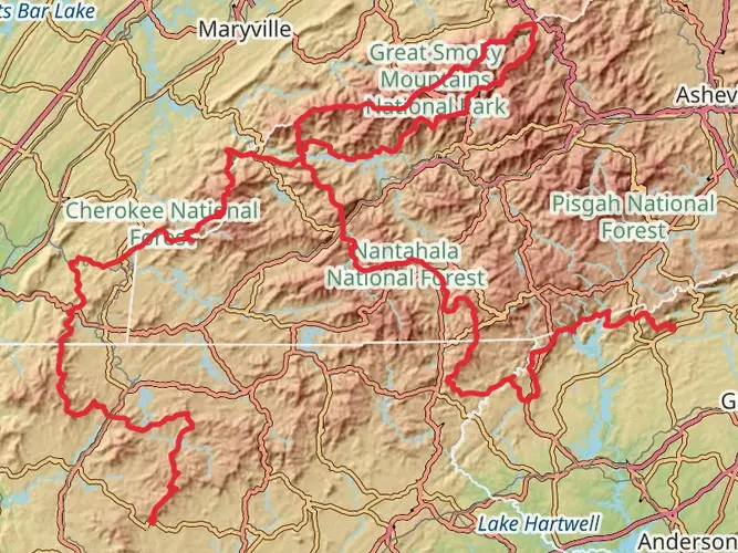
Spanning approximately 823 kilometers (about 511 miles) and with an elevation gain of around 6400 meters (approximately 21,000 feet), the Palmetto Trail is a point-to-point trek that offers a diverse South Carolina experience. Starting near Oconee County, hikers can find the trailhead in the upstate region, which is accessible by car from nearby towns or cities. Public transportation options may be limited to regional bus services, so it's advisable to research the nearest bus stops and plan for a taxi or rideshare to reach the trailhead.
Navigating the Trail
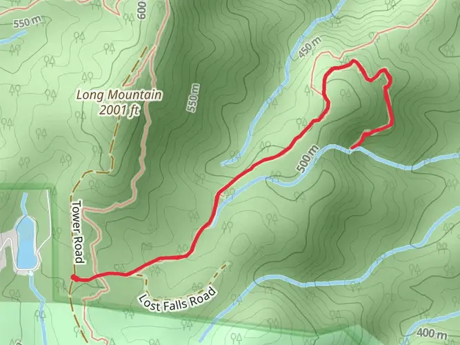
The Palmetto Trail is divided into several passages, each with its own unique characteristics and challenges. Hikers can use the HiiKER app to navigate the trail, ensuring they stay on the correct path and can plan their journey through each section. The app provides detailed maps and information about the trail, which is especially useful for the more remote segments where cell service may be unreliable.
Natural Beauty and Wildlife
As you traverse the Palmetto Trail, you'll encounter a variety of landscapes, from the mountainous terrain of the Blue Ridge Mountains to the coastal plains and swamps. The trail offers a chance to see South Carolina's rich biodiversity, including longleaf pines, palmetto trees, and a variety of wildlife such as white-tailed deer, wild turkeys, and possibly even the elusive bobcat.
Historical Significance
The Palmetto Trail passes through areas steeped in history. Hikers will walk paths that have been influenced by Native American culture, colonial settlements, and the Civil War. Landmarks along the way, such as old mills, battlefields, and historic towns, provide a living history lesson.
Preparing for the Hike
Given the trail's length and varied terrain, hikers should prepare for a long-distance trek. It's essential to pack appropriately for the weather, which can change from the mountains to the coast. Water sources are available but carrying a water filter is recommended. Resupply points are located in towns along the trail, so plan your stops accordingly.
Elevation and Distance Between Key Points
The trail's elevation gain is gradual in some sections and more pronounced in others, particularly in the mountainous regions. Hikers should be prepared for some strenuous climbs, especially in the upstate areas. The distance between key points varies, with some passages being short day hikes and others requiring multiple days to complete.
End of the Trail
The trail concludes near the coast in Charleston County, where hikers can celebrate their accomplishment. From here, transportation back to civilization is more readily available, with options for buses, taxis, or rideshare services to take you to the nearest city or airport.

What to expect?
Activity types
Frequently asked questions
How long does it take to hike the entire Palmetto Trail in South Carolina?
The Palmetto Trail is about 823.48 km, or roughly 511 miles, so a full thru-hike is a major multi-day undertaking rather than a weekend trip. Hiking time depends on pace and resupply planning, but most hikers should expect several weeks to cover the full route from the Upstate toward the coast.
How difficult is the Palmetto Trail and is the full Palmetto Trail suitable for beginners?
The full Palmetto Trail is rated difficult, with about 6,464 m of total elevation gain spread across a very long point-to-point route. Some individual passages are easier, but taking on all 823.48 km requires strong endurance, logistics planning, and comfort with multi-day hiking across very different terrain.
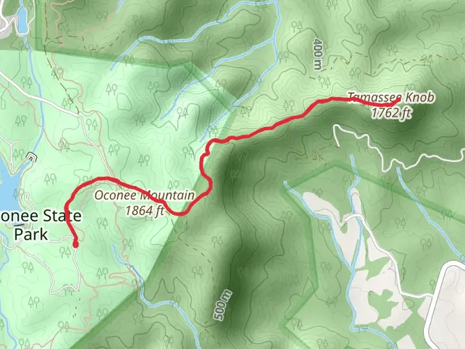
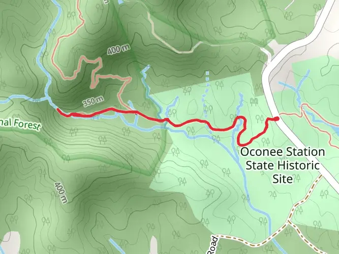
Where does the Palmetto Trail start near Oconee County, and where can hikers park for that section of the Palmetto Trail?
In Oconee County, the western end of the Palmetto Trail is the Oconee Passage near Oconee State Park. Official trail mapping shows access and parking at the Station Cove Falls Trailhead and at Oconee State Park trailheads, making that area one of the clearest starting points for hikers beginning in the Upstate.
How long is the Oconee section of the Palmetto Trail near Oconee County?
The Oconee Passage of the Palmetto Trail is about 3.73 miles long. It links the Station Cove Falls Trailhead area with Oconee State Park Road and includes mountain terrain in the northwestern corner of South Carolina, so it gives a short but steeper taste of the trail’s Upstate character.
Are dogs allowed on the Palmetto Trail in South Carolina?
Dog rules on the Palmetto Trail vary by passage rather than staying the same for all 511 miles. Some sections allow dogs under normal trail rules, but others have specific restrictions; for example, the Lake Marion Passage states that dogs are not allowed on refuge lands, so each passage needs to be checked before setting out.
What kind of scenery and terrain does the Palmetto Trail cover from Oconee County to the coast?
The Palmetto Trail crosses a wide range of South Carolina landscapes, starting with mountain terrain near Oconee County and continuing through Midlands rail-trail and forest sections before reaching lowcountry lakes, swamps, and coastal plain country. That variety is one reason the route totals more than 823 km while still feeling very different from passage to passage.
Can the Palmetto Trail be hiked in shorter sections instead of as one thru-hike?
Yes. The Palmetto Trail is built as a long route made up of named passages, so many hikers tackle it section by section rather than all at once. Examples include the 3.73-mile Oconee Passage in the Upstate, the 13.9-mile Santee Passage, and the 35.9-mile Lake Marion Passage, each with its own access points and rules.
Comments and Reviews
User comments, reviews and discussions about the Palmetto Trail, South Carolina.
4.44
average rating out of 5
18 rating(s)