Download
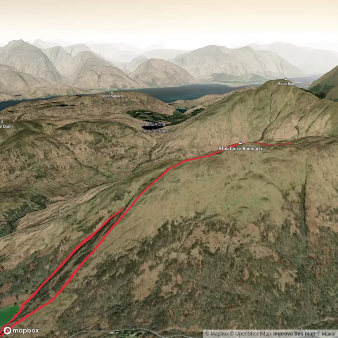
3D Flyover
Add to list
More
6.4 km
~2 hrs 16 min
596 m
Loop
“A steep, boggy Highland sweep rewards prepared walkers with stirring vistas over Glen Coe and Rannoch Moor.”
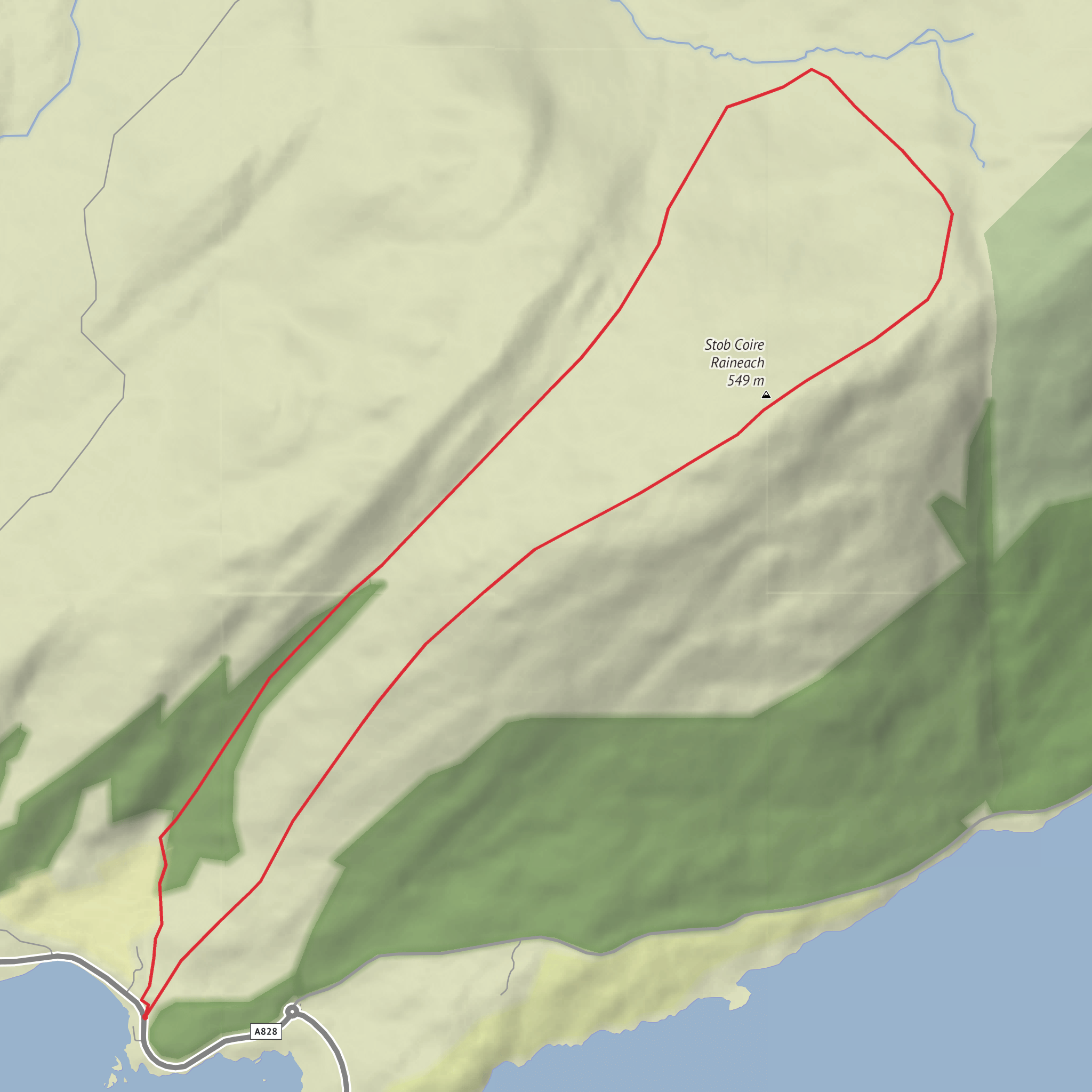
This is a short but demanding hill circuit in the eastern Glencoe area, climbing roughly 6 km / 3.7 miles with about 600 m / 1,970 ft of ascent. The route is best understood as a steep, rough outing above the A82 near Altnafeadh, Glencoe, Ballachulish PH49, close to the Kingshouse Hotel and the well-known Devil’s Staircase / West Highland Way access point. Altnafeadh is the nearest clear landmark and the usual roadside starting area for walks on this side of Glen Coe. (walkhighlands.co.uk)
The ground here rises quickly from the roadside into open Highland hill terrain, so despite the modest distance, the walk feels serious. Expect steep climbing early on, intermittent or faint paths, sections of heather and wet ground, and potentially confusing navigation if cloud drops over the tops. In dry, clear weather the reward is a superb elevated circuit with wide views over Rannoch Moor, the head of Glen Coe, and the dramatic skyline of Buachaille Etive Mòr and Buachaille Etive Beag. Stob Coire Raineach is one of the Munro summits of Buachaille Etive Beag at 925 m / 3,035 ft, while nearby Beinn a’ Chrùlaiste is widely regarded as one of the finest viewpoints in the district. (stevenfallon.co.uk)
Getting to the start
By car, the usual approach is via the A82 at Altnafeadh, east of Glencoe village and west of Rannoch Moor. Parking is typically in roadside lay-bys near Altnafeadh, but this is an area with well-documented congestion and road-safety issues, so arrive early, park only in established spaces, and avoid verges or informal pull-offs on bends. The A82 here is fast, busy, and exposed. (walkhighlands.co.uk)
By public transport, there is a bus service along the A82 between Glasgow and Fort William, with access near Kingshouse / Glencoe depending on the operator and current timetable. From the roadside stop, allow a short walk to the start. Because services in this corridor can be limited and seasonal, it is worth checking the day’s timetable carefully before setting out. (walkhighlands.co.uk)
What the route feels like
The opening section is usually the most abrupt. From the roadside, the route heads onto open hillside and begins climbing the broad western side of the hill. Even where a line exists on the ground, it can be weak or broken, and after rain the lower slopes can be soft and boggy. A climb of around 2 to 2.5 km / 1.2 to 1.6 miles gains most of the day’s height, so pacing matters from the start. (walkhighlands.co.uk)
Higher up, the terrain becomes more open and rounded, with broad ridges rather than narrow scrambling ground. One of the notable intermediate features in this area is Stob Beinn a’ Chrùlaiste, a rounded top around 639 m / 2,096 ft that acts as a natural stepping stone on the way to the main high ground. Beyond it, shallow dips can hold water and peat, so even on a relatively short loop, waterproof footwear is a real advantage. (walkhighlands.co.uk)
If your loop links toward Stob Coire Raineach, the character changes from broad moorland hill to more mountainous ground. The upper slopes around Buachaille Etive Beag are steeper, rockier, and more exposed to wind. In mist, the transition between rounded shoulder, summit dome, and descending ridges can be deceptively featureless, so careful line-finding is important. For navigation, plan the route in advance on HiiKER and be ready to follow bearings rather than relying on visible trods alone.
Comments and Reviews
User comments, reviews and discussions about the Stob Coire Raineach and Beinn Churalain Loop, Scotland.
average rating out of 5
0 rating(s)
