
Download
3D Flyover
Add to list
More
12.5 km
~3 hrs 45 min
758 m
Out and Back
“A demanding Black Mount climb through boggy wilds to sweeping views over Loch Tulla and Rannoch Moor.”
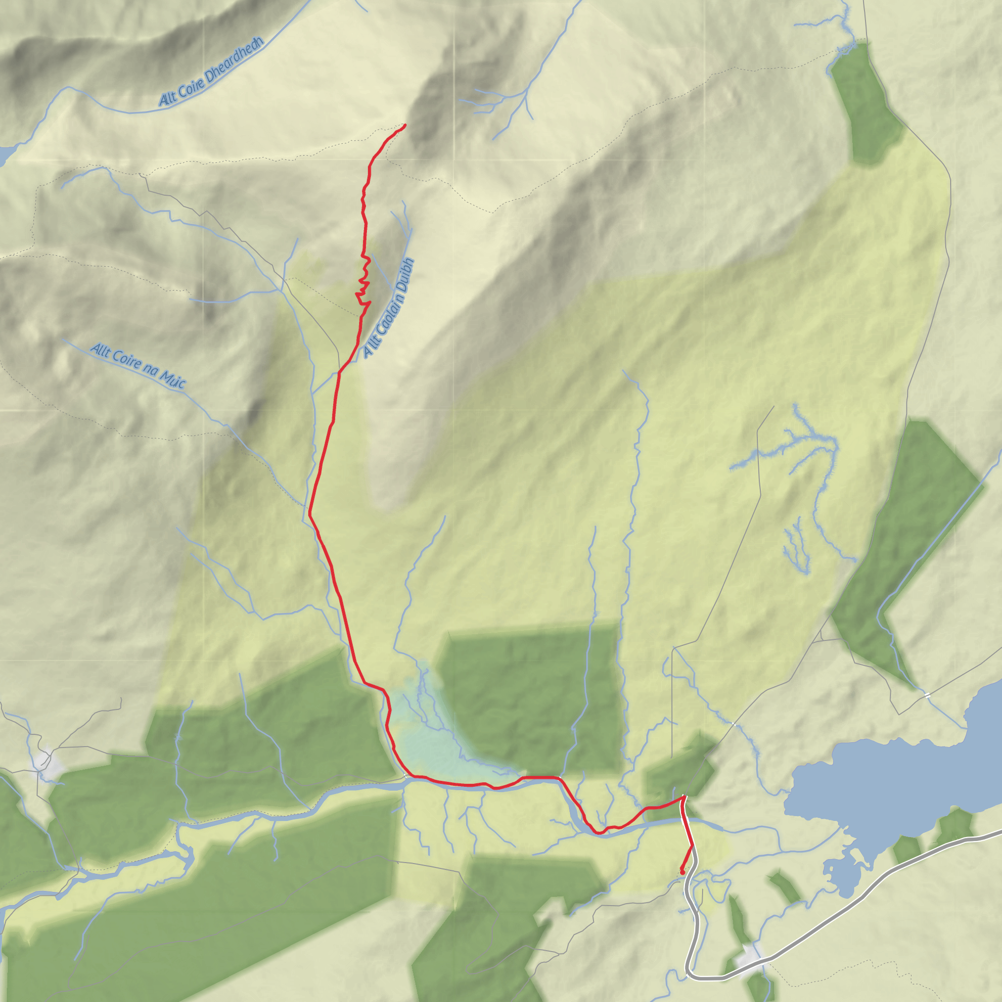
This is a tough Highland outing of about 12 km / 7.5 miles with roughly 800 m / 2,625 ft of ascent, climbing from the Bridge of Orchy area into the southern Black Mount for a fine summit above Loch Tulla and Rannoch Moor. Although Stob a’ Choire Odhair is often linked with neighbouring Stob Ghabhar on a much longer day, this shorter version is still a serious mountain walk: expect a long approach, steep hill ground, rough and often wet terrain, and a high, exposed summit at 945 m / 3,100 ft. The mountain lies around 8 km / 5 miles northwest of Bridge of Orchy and is one of the most recognizable peaks above the A82 corridor. (en.wikipedia.org)
The usual starting point for this hike is near Victoria Bridge / Forest Lodge on the A82, just south of Bridge of Orchy, rather than from the village center itself. That is the nearest clear landmark for the trailhead and the most useful place to navigate to. If arriving by car, walkers generally use the small roadside parking area by Forest Lodge near Victoria Bridge on the A82. If using public transport, Bridge of Orchy station, Station Brae, Bridge of Orchy, PA36 4AD, is the key rail access point; from there, the start is reached by road and track heading toward Victoria Bridge and Inveroran. Bridge of Orchy is also served by long-distance bus links on the A82 corridor, so it is possible to plan the day by train or coach, but timetables should be checked carefully because services are limited and the mountain day is not short. (nationalrail.co.uk)
Route and terrain
From the Victoria Bridge / Forest Lodge area, the route begins on estate track and lower hill paths, giving a relatively gentle start before the mountain work begins. The first few kilometres can feel deceptively straightforward, with broad Highland views opening toward Loch Tulla, the Black Mount, and the surrounding glens. Underfoot, however, this is often a wet landscape: peaty ground, drainage channels, and boggy patches are common, especially after rain. Good waterproof footwear and careful pacing matter from the outset. (stevenfallon.co.uk)
After roughly 3 to 4 km / 2 to 2.5 miles, the route steepens markedly as it leaves the easier approach and climbs onto the mountain’s southeastern slopes. This is where the day starts to earn its Difficult rating. The ascent is sustained rather than technical in dry summer conditions, but it can be tiring and slippery, with loose stones, wet grass, and eroded sections. In mist, the broad upper ground can feel much bigger and less obvious than it appears from below, so carrying and knowing how to use HiiKER for route guidance is sensible. The final pull to the summit cairn comes after most of the height gain has already been done, but the exposed setting means wind and low cloud can make the last section feel much more serious. (outdoorscot.co.uk)
At the summit, the reward is a wide-ranging panorama over Loch Tulla, Rannoch Moor, and the surrounding Black Mount hills, with Stob Ghabhar dominating nearby. On a clear day, the setting feels notably wild and remote despite the A82 being relatively close by in geographic terms. The descent usually retraces the ascent route, and that return can be slower than expected if the ground is wet or if fatigue sets in on the steep lower slopes. Allow enough time for a careful descent rather than treating this as a quick half-day hill. (stevenfallon.co.uk)
Landmarks, landscape, and what to watch for
One of the defining landmarks of the day is Victoria Bridge, the crossing near the start that leads toward Inveroran and the old routes into the Black Mount. The mountain itself rises from a landscape of moor, burns, corries, and open deer country. The upper slopes are broad and rounded in places, but the surrounding terrain has a more dramatic character, especially where corries and ridges cut into the massif. This contrast is part of what makes the hill so appealing: the route is comparatively straightforward in line, yet the setting feels properly mountainous. (scotways.com)
Wildlife is typical of Scotland’s uplands and moorlands. Red deer are among the most likely larger animals to be seen in the Black Mount area, and upland birds may include red grouse, with raptors such
Surfaces
Unknown
Asphalt
Unpaved
Dirt
Comments and Reviews
User comments, reviews and discussions about the Stob a'Choire Odhair from Bridge of Orchy, Scotland.
average rating out of 5
0 rating(s)

