
Sgorr nam Faoileann, Glas Bheinn, Beinn Bheigier, Rubha Biorach and Sound of Islay
Download
3D Flyover
Add to list
More
34.5 km
~2 days
1351 m
Point to Point
“A wild Islay odyssey of sea-cliff solitude, boggy approaches, and rugged summits above the Sound.”
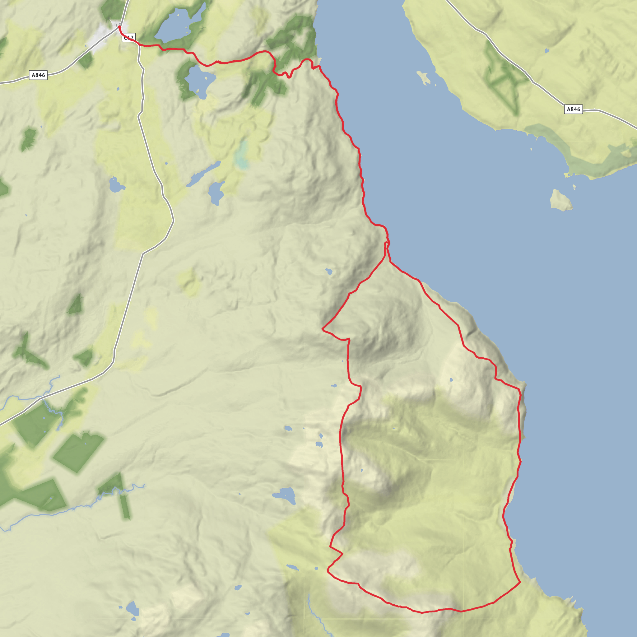
This is a long, committing hill-and-coast circuit on Islay’s south-east side, linking a string of rugged summits above the Sound of Islay with remote shoreline terrain and a very isolated feel. At around 34 km / 21.1 miles with roughly 1,400 m / 4,593 ft of ascent, it is better thought of as a full mountain day or a strenuous expedition-style outing than a casual “medium” walk, especially if the ground is wet, the burns are up, or visibility is poor. The high points include Sgorr nam Faoileann, Glas Bheinn and Beinn Bheigier, with Beinn Bheigier the highest hill on Islay at about 491 m / 1,611 ft. (walkhighlands.co.uk)
The route is most naturally associated with the road end at Claggain Bay / Ardtalla, near the small parking area by the gate at the north end of Claggain Bay on Islay’s south-east coast. That is the clearest practical trailhead landmark for planning purposes, and it sits beyond Ardbeg and Kildalton on the island’s narrowing single-track road. (walkhighlands.co.uk)
Getting there by car is the simplest option. Most visitors reach Islay by CalMac ferry from Kennacraig to either Port Askaig or Port Ellen, though as of June 2026 CalMac notes that Port Ellen is closed for some services and advises checking current status before travel; the main Islay route remains Kennacraig–Port Askaig / Port Ellen depending on operations. From Port Ellen, drive east and south past Laphroaig, Lagavulin and Ardbeg, continue past Kildalton Cross and Chapel, then follow the single-track road to Claggain Bay and the small parking area near the gate at Ardtalla. From Port Askaig, allow a longer cross-island drive. (calmac.co.uk)
Public transport is possible but awkward for a route of this scale. Islay’s 450/451 bus corridor links Port Askaig, Bowmore, Port Ellen and Ardbeg, but the regular bus network stays on the main roads and does not run all the way out to the Claggain Bay road end. In practice, bus users usually need to ride as far as Ardbeg and then arrange a taxi or add extra road walking before the hike even begins. Services are also limited, generally daytime Monday to Saturday, with no Sunday service noted by local visitor information. (islayinfo.com)
Terrain and route character
The opening section from the road end is deceptive: it begins low and coastal, but the ground quickly shows the character of this side of Islay. The established line toward Ardtalla and Proaig is known for boggy track, wet fields, rough pasture and repeated burn crossings. Walkhighlands specifically notes boggy ground, a metal-sheet burn crossing, and a more substantial crossing near Proaig that may be impossible in high water. That matters on a 34 km circuit, because any delay or retreat here can have a big effect on timing. (walkhighlands.co.uk)
Once the route turns into the hills, the feel changes from coastal access walking to broad, heathery ridge travel. The summits are not especially high by mainland Scottish standards, but they rise directly above the sea and can feel exposed in wind. Expect a mixture of pathless moor, peat hags, short steep pulls, wet hollows and lochans between the tops. Distances between summits can look modest on paper, yet progress is often slower than expected because of soft ground and uneven footing. On a day with low cloud, the rounded uplands
AI Planner
Days planned around your pace, with somewhere to stay each night.
Surfaces
Unknown
Ground
Comments and Reviews
User comments, reviews and discussions about the Sgorr nam Faoileann, Glas Bheinn, Beinn Bheigier, Rubha Biorach and Sound of Islay, Scotland.
average rating out of 5
0 rating(s)


