Download
Preview
Add to list
More
6.6 km
~1 hrs 29 min
109 m
Loop
“A gentle island ramble through whispering woods, old paths, and sea-bright Ulva history.”
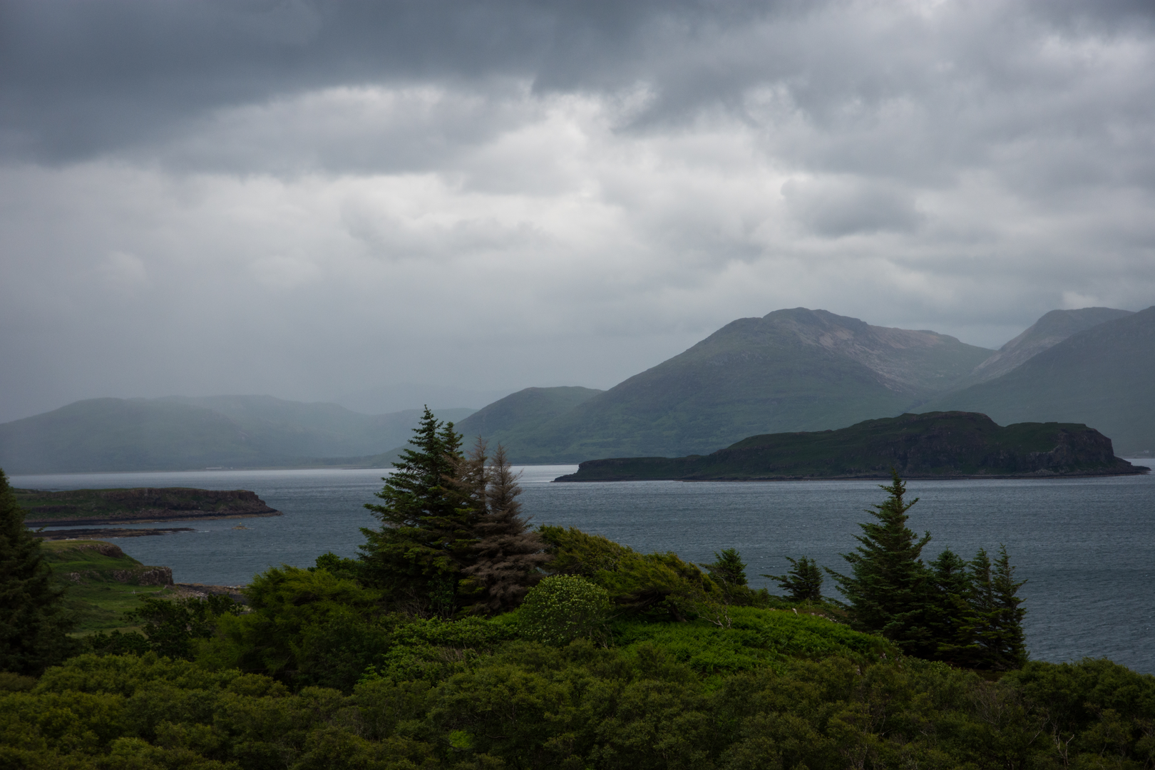
This easy circuit of about 7 km / 4.3 miles with roughly 100 m / 330 ft of ascent is a gentle way to explore the wooded edge of Coille a’ Mhinisteir on the Isle of Ulva, just off the west coast of Mull. Expect a relaxed outing rather than a strenuous hillwalk: the gradients are generally mild, the terrain is varied but not severe, and the main challenges are more likely to be underfoot conditions, exposure to weather, and the logistics of reaching the island than the walking itself. Coille a’ Mhinisteir lies near Ulva Ferry and the south side of Ulva, with the woodland positioned close to the old route often referred to as the minister’s road. Mapping places the forest near Ulva Ferry, Achleck, and the south Ulva shore, with the nearest practical landmark for the start being the Ulva passenger ferry landing and Boathouse area on Ulva. (mapcarta.com)
The walk suits hikers looking for a half-day route with a strong sense of place. The distance is short enough for families and casual walkers, but it still has enough variety to reward anyone interested in island landscapes, old routes, crofting history, and wildlife. Paths and tracks in this part of Ulva can be grassy, uneven, and boggy in patches, especially after rain, so waterproof footwear is a sensible choice even on an easy-rated day. The island is also open and coastal, so wind and showers can make it feel more serious than the numbers suggest. (alltrails.com)
What the route feels like
From the ferry landing area, the route typically begins on clear estate tracks or worn paths near the shore before moving inland toward the woodland and open ground around Coille a’ Mhinisteir. Early on, the walking is straightforward, with only slight undulations as you leave the immediate coast. Within the first 1 to 2 km / 0.6 to 1.2 miles, the route settles into the rhythm that defines most of the outing: easy progress on mixed surfaces, occasional wetter sections, and broad views opening between wooded stretches and rougher moorland. The total ascent of around 100 m / 330 ft is spread gently enough that most walkers will barely notice any sustained climbing.
As you move through or alongside Coille a’ Mhinisteir, the character becomes more sheltered and intimate. This is one of the most distinctive sections of the walk, with the woodland giving contrast to the open island scenery. The old minister’s road is one of the notable historic route lines in this area, and nearby walks on Ulva are described as passing through Coille a’ Mhinisteir before continuing by a standing stone and across moorland, which helps place this route in a landscape shaped by long-standing local travel rather than modern recreational trail-building. (alltrails.com)
Beyond the trees, the route is likely to feel more open again, with views across the surrounding coast and toward the larger Mull landscape. On a clear day, this part of northwest Mull and Ulva is especially rewarding for wide sea-and-hill panoramas. Even on a shorter knot-style walk, the scenery tends to alternate between enclosed woodland, rough pasture or moor, and glimpses of the shoreline, which keeps the route interesting throughout its modest distance.
Landmarks, nature, and wildlife
One of the most meaningful landmarks in the wider area is the old network of crofting and estate routes on Ulva, including the minister’s road itself. There is also a standing stone near Coille a’ Mhinisteir, adding an archaeological note to the landscape and reminding walkers that this is not just scenic ground but a place occupied and travelled through for centuries. (mapcarta.com)
Ulva is especially rich in cultural landscape. Ulva House, on the south side of the island, is one of the island’s most significant buildings; the current house incorporates elements from earlier structures and stands on the site associated with Clan MacQuarrie, who held Ulva until 1777. The island later became part of the wider story of Highland social change, and by the late 18th century Ulva had a population of more than 800 people living in scattered crofting settlements before depopulation

Surfaces
Unknown
Paved
Comments and Reviews
User comments, reviews and discussions about the Coille a' Mhinisteir Knot, Scotland.
average rating out of 5
0 rating(s)