
Download
3D Flyover
Add to list
More
14.7 km
~4 hrs 31 min
946 m
Out and Back
“A wild Highland haul, where boggy toil gives way to a broad ridge and sea-bright horizons.”
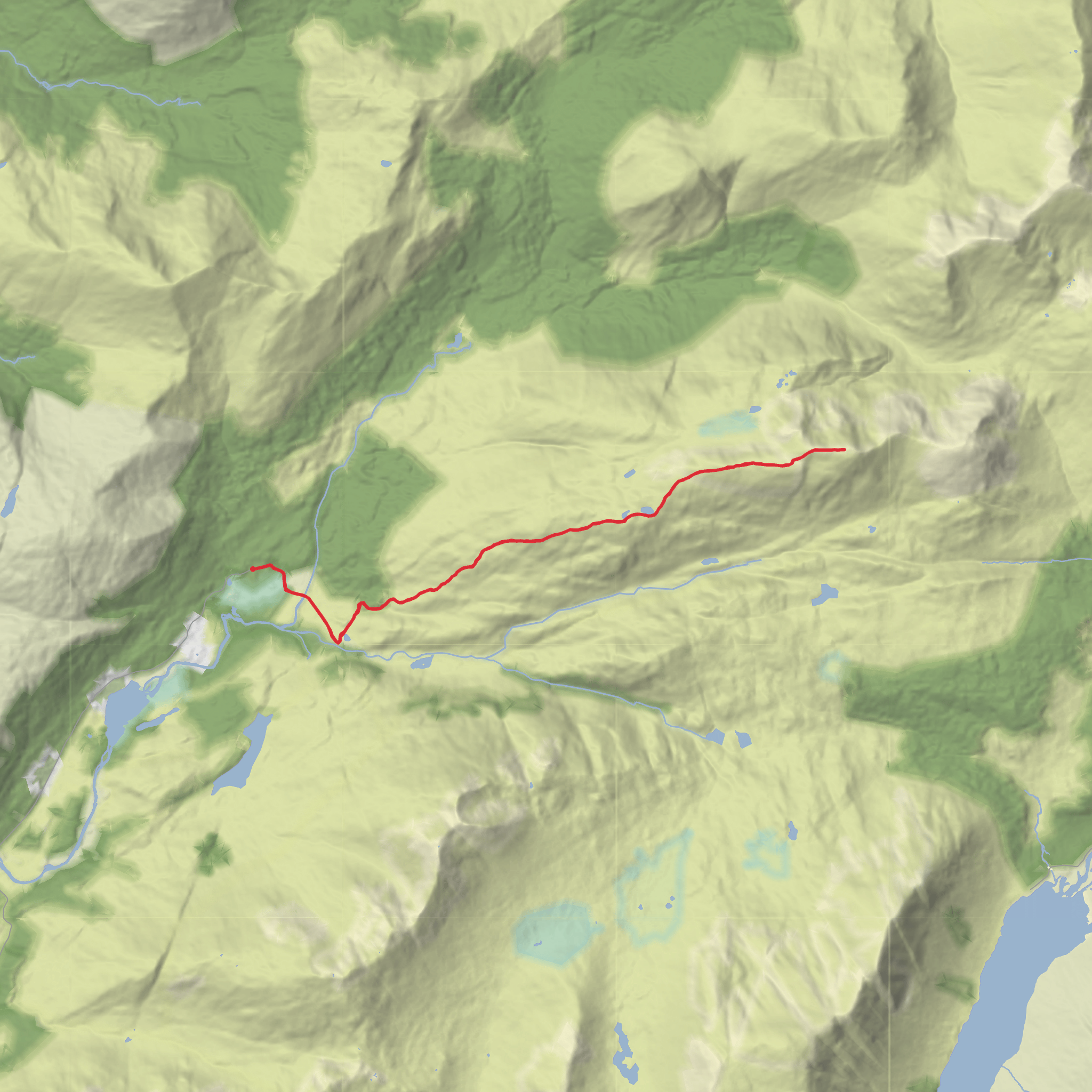
This is a serious Highland mountain day rather than a simple hillwalk: roughly 15 km / 9.3 miles with about 900 m / 2,950 ft of ascent, usually taking most hikers around 5 to 7 hours depending on ground conditions, weather, and how efficiently they move on the ridge. Beinn Fhionnlaidh rises above Glen Creran in Argyll and reaches 959 m / 3,146 ft, with a long broad crest that gives wide views over Loch Creran and west toward the sea, while also opening up a less familiar angle on Glen Etive and the mountains around Glencoe. The standard line from Elleric is considered the more straightforward approach because it avoids the rougher forestry complications found on the Glen Etive side, but it is still a difficult outing with boggy sections, pathless stretches, and a sustained climb. (walkhighlands.co.uk)
The walk starts at the parking area at the end of the public road in Glen Creran, near Elleric, with the nearest clear landmark being the road-end car park by Glenure at grid reference NN036488. That places the trailhead near Glenure Lodge in upper Glen Creran, southeast of Appin and northeast of Oban. If you are driving, the usual approach is via the A828 and the minor road up Glen Creran to the public road end, where there is a small parking area used for several local walks. Public transport is limited: Walkhighlands notes there is no direct public transport to this start, so without a car you would usually need to reach the wider Appin or Oban area first and then arrange a taxi for the final leg into Glen Creran. (walkhighlands.co.uk)
The opening section is gentle by Highland standards. From the car park, you pass through gateposts and follow the signed track toward Glen Etive and Glenure Lodge, crossing the River Creran and continuing on estate ground before branching left near the white cottage. This first 2 to 3 km / 1.2 to 1.9 miles can feel deceptively easy, with only modest height gain, so it is worth settling into a sustainable pace early rather than burning energy before the main climb begins. The estate track also gives you one of the last straightforward navigation legs of the day; once you leave it, the route becomes much more dependent on careful line choice, especially in mist. HiiKER is the tool to have ready before you leave the track. (walkhighlands.co.uk)
The climb onto the ridge
After the lower track section, the route turns uphill onto open ground and begins the real ascent. Expect a steep pull as you gain the main ridge, with the bulk of the day’s 900 to 980 m / 2,950 to 3,215 ft of ascent concentrated in the middle part of the walk. The terrain is generally non-technical in dry summer conditions, but “straightforward” here should not be mistaken for easy. The ground can be wet, peaty, and energy-sapping, and there are pathless or faint-path sections where progress slows. In poor visibility, the broad upper mountain can be confusing because the ridge undulates and the summit area is not a dramatic needle but part of a longer crest. (walkhighlands.co.uk)
As height is gained, the character of the route changes from estate approach to open Highland mountain. The ridge is long and spacious, and that is part of the appeal: instead of a single abrupt summit cone, you get a gradual sense of entering bigger country. On a clear day, the western outlook reaches toward Loch Creran and the coast, while inland views reveal Glen Etive and neighboring peaks from an unusual angle. That broad exposure also means wind can become a major factor. Even when conditions are calm at the car park, the upper ridge can be cold and fully exposed. (walkhighlands.co.uk)
What to expect on the summit plateau and descent
The summit of Beinn Fhionnlaidh sits at 959 m / 3,146 ft and is high enough for weather to become the defining challenge. Cloud can flatten the terrain, making the return line less obvious than it seemed on the way up. Because the ridge is broad and undulating, many hikers find the
Surfaces
Unpaved
Paved
Unknown
Comments and Reviews
User comments, reviews and discussions about the Beinn Fhionnlaidh from Elleric, Scotland.
5.0
average rating out of 5
1 rating(s)

