Download
3D Preview
Add to list
More
19.6 km
~4 hrs 58 min
629 m
Multi-Day
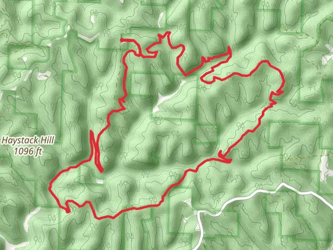
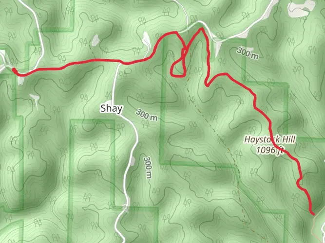
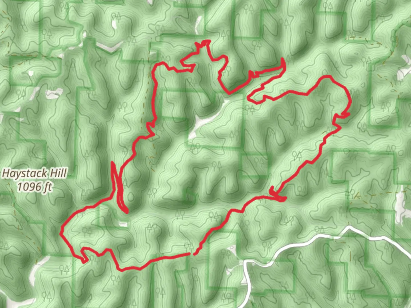
The Archers Fork Loop Trail is a 19.6 km trail that starts in Ludlow, Washington County, Ohio. Based on our data, the hike is graded as Medium. For information on how we grade trails, please read measuring the difficulty of a hiking trail on hiiker. Also, check our latest community posts for trail updates. This hike can be completed in approx 4 hrs 58 mins. Caution is advised on trail times as this depends on multiple variables. For more info read about how we calculate hike time.

Frequently asked questions
How long does it take to hike the Archers Fork Loop Trail in Washington County, Ohio?
Archers Fork Loop Trail is 19.63 km long with 629 m of elevation gain, so it is usually tackled as a long day hike or a short overnight backpack. Many hikers moving at a steady pace on this rugged loop spend roughly 6.5 to 8 hours on the trail, especially if stopping at Irish Run Natural Bridge and the Great Cave Rockshelter.
Where do you start the Archers Fork Loop Trail and is there parking at the trailhead?
The primary trailhead for Archers Fork is beside historic St. Patricks Cemetery in the Marietta Unit of Wayne National Forest near New Matamoras. The Forest Service lists the St Patricks Cemetery trailhead at 39°31'26"N, 81°10'51"W, and that is the standard access point for the loop.
What are the main landmarks on the Archers Fork Loop Trail?
The standout landmark on Archers Fork Loop Trail is Irish Run Natural Bridge, one of only seven natural bridges in Ohio. The Forest Service describes the arch as 51 feet long, 16 feet thick, and 39 feet above the ground, and the loop also passes the Great Cave Rockshelter, rock outcrops, and old oil and gas well sites.
Is the Archers Fork Loop Trail a good backpacking trail?
Yes. At 19.63 km with 629 m of climbing, Archers Fork Loop Trail fits well as a beginner-friendly overnight or a demanding single-day hike. It is in Wayne National Forest and is widely used for hiking and backpacking, with enough distance and terrain to feel like a true backcountry loop rather than a short nature walk.
Are dogs allowed on the Archers Fork Loop Trail?
Dogs are allowed on Archers Fork Loop Trail, but they need to stay on a leash. That makes the route workable for experienced trail dogs, though the length, elevation gain, and rugged footing around rock features mean it is better suited to dogs that are comfortable on longer hikes.
How difficult is the Archers Fork Loop Trail?
Archers Fork Loop Trail is generally a medium to moderately strenuous hike, but the numbers explain why it can feel harder than that rating suggests. The route covers 19.63 km and climbs 629 m through rugged Appalachian terrain, with rock shelters, outcrops, and repeated ups and downs that add effort over the full loop.
When is the best time of year to hike the Archers Fork Loop Trail?
Spring through fall is the most common hiking season for Archers Fork Loop Trail, with March to October often considered the sweet spot. Those months usually offer better footing, longer daylight, and easier access to features like Irish Run Natural Bridge, while leaf-off periods in early spring and late fall can open up wider views through the forest.
Comments and Reviews
User comments, reviews and discussions about the Archers Fork Loop Trail, Ohio.
5.0
average rating out of 5
1 rating(s)