Download
3D Flyover
Add to list
More
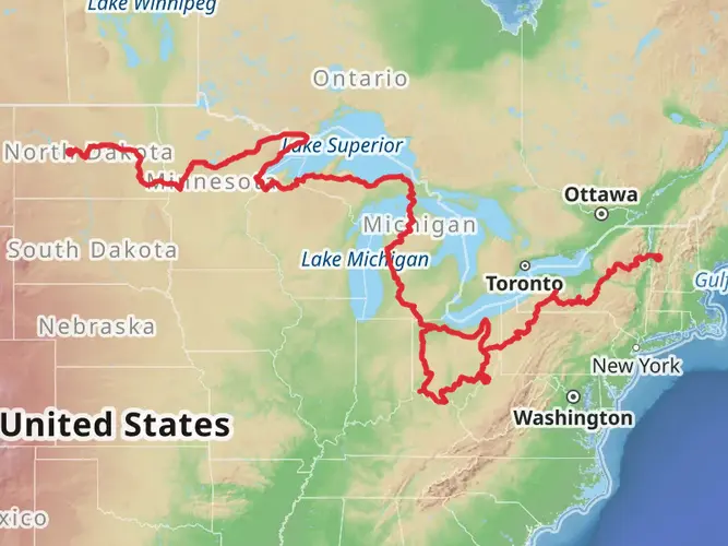
1689.6 km
~60 days
11519 m
Multi-Day
“Embark on Ohio's North Country Trail for a scenic trek steeped in history and natural splendor.”
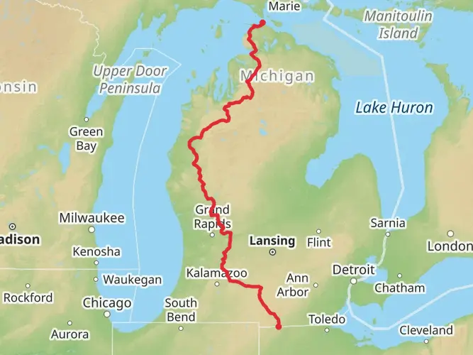
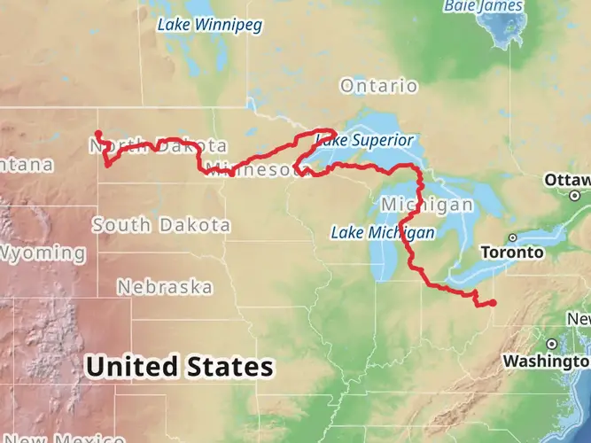
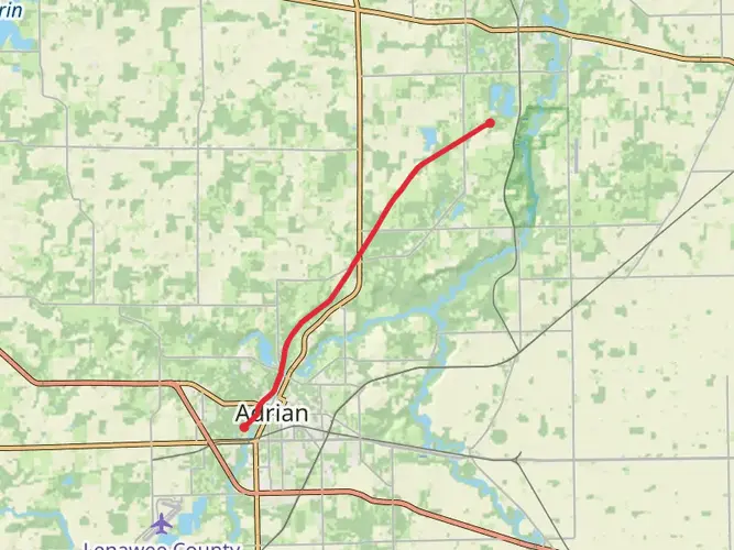
Spanning approximately 1690 kilometers (1050 miles) and with an elevation gain of around 11500 meters (37730 feet), the North Country Trail in Ohio offers a diverse and enriching hiking experience. This point-to-point trail begins near Hillsdale County, Michigan, and winds its way through a variety of landscapes, including dense forests, rolling hills, and serene river valleys.
Getting to the Trailhead
To reach the starting point of the North Country Trail in Ohio, hikers can drive to the vicinity of Hillsdale County, Michigan. For those relying on public transportation, the nearest major city with bus and train services is Toledo, Ohio. From there, one can rent a car or arrange for a shuttle service to the trailhead.
Trail Experience
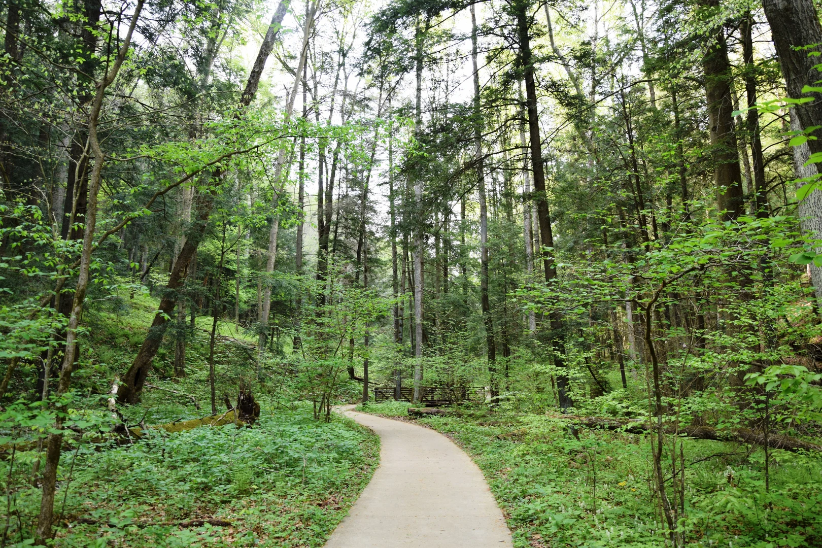
As you embark on the North Country Trail, you'll traverse through the lush greenery of Ohio's woodlands. The trail is well-marked, but carrying a reliable navigation tool like HiiKER is advisable to stay on track and be aware of upcoming waypoints.
Historical Significance
The trail passes through areas rich in history, such as remnants of the Great Black Swamp, which early settlers had to drain to create arable land. Hikers will also encounter paths that follow old Native American trails and trade routes, providing a sense of the region's past.
Landmarks and Nature
One of the significant landmarks along the trail is the Maumee River, which played a pivotal role during the War of 1812. As you hike, you'll likely spot a variety of wildlife, including white-tailed deer, wild turkeys, and numerous bird species. The trail also offers a chance to see the changing seasons, with vibrant fall foliage and wildflowers in spring and summer.
Trail Conditions and Preparation
The trail's difficulty is rated as medium, but it's important to prepare for sections with steep inclines or uneven terrain. Weather conditions can vary, so pack appropriate gear for rain, cold, or heat, depending on the season. Water sources are available, but it's crucial to treat water before drinking.
Navigation and Safety
While the trail is well-signed, it's essential to have a reliable navigation tool like HiiKER to help with planning and staying on course. Always let someone know your itinerary and expected return time, and be prepared with a first aid kit and knowledge of basic wilderness first aid.
By preparing adequately and respecting the trail and its natural surroundings, hikers can look forward to an immersive experience on the North Country Trail in Ohio, filled with natural beauty and historical intrigue.

What to expect?
Activity types
Frequently asked questions
How long is the North Country Trail - Ohio and how many days does it take to hike?
The North Country Trail - Ohio is about 1,689.59 km, or roughly 1,050 miles, long. Most hikers treat it as a multi-day thru-hike rather than a short backpacking trip, and total time depends on pace, resupply stops, and how much of the route is covered each day. With 11,519 m of total elevation gain, it is a substantial long-distance hike even though the overall difficulty is rated medium.
What kind of terrain is on the North Country Trail - Ohio?
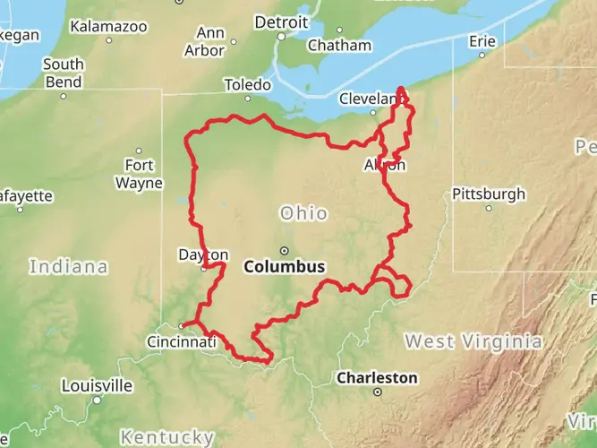
The North Country Trail - Ohio crosses a wide mix of terrain, including rail trails, canal towpaths, state and county parks, forested sections, and some road-walk miles. Notable public-land sections include Maumee and Shawnee State Forests, Wayne National Forest, Hocking Hills, Beaver Creek State Park, and the Edge of Appalachia area. Eastern Ohio is known for having more on-road segments than some hikers expect.
Is the North Country Trail - Ohio hard?
The North Country Trail - Ohio is generally considered medium difficulty, but the challenge comes from its scale more than from constant steep climbing. The route covers about 1,689.59 km with 11,519 m of elevation gain, so fatigue, logistics, and back-to-back days matter more than any single climb. Southern and eastern Ohio tend to feel hillier and more rugged than the flatter western sections.
Can you camp along the North Country Trail - Ohio?
Camping is possible on parts of the North Country Trail - Ohio, especially where it passes through larger public lands, but it is not consistent across the whole route. Much of eastern Ohio includes on-road sections with fewer camping options, so overnight planning needs to be done carefully around public land, towns, and legal access. The route passes through areas such as Wayne National Forest and several state forests and parks where camping opportunities are more likely.
Is the North Country Trail - Ohio dog friendly?
The North Country Trail - Ohio can be hiked with a dog on many sections, but dog rules depend on the land manager for each segment. On the North Country National Scenic Trail, pets are generally expected to be leashed and under control, and some parks or protected areas may restrict dogs entirely. Because this Ohio route crosses multiple jurisdictions, dog access can change from one section to the next.
Which towns are on the North Country Trail - Ohio for resupply and overnight stops?
The North Country Trail - Ohio passes through or near several established trail communities that are useful for resupply and overnight logistics. Official Trail Towns on the Ohio route include Dayton, Zoar, and Lisbon, and Buckeye Trail towns along the shared corridor include places such as Napoleon, Defiance, Delphos, Piqua, Xenia, Loveland, Milford, Shawnee, and Deersville. More populated areas like Dayton and Xenia are especially useful for food and services.
What are the main landmarks on the North Country Trail - Ohio?
The North Country Trail - Ohio links together a broad cross-section of Ohio landscapes rather than one single landmark corridor. Highlights named on the route include Maumee and Shawnee State Forests, Wayne National Forest, Hocking Hills, Beaver Creek State Park, and the Edge of Appalachia Nature Preserve. In places such as Lisbon and Zoar, the trail also follows historic canal and river corridors with strong cultural history.
Comments and Reviews
User comments, reviews and discussions about the North Country Trail - Ohio, Michigan.
4.57
average rating out of 5
14 rating(s)