Download
3D Flyover
Add to list
More
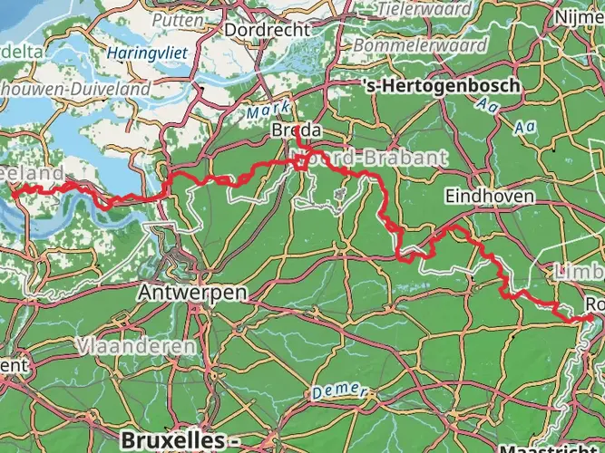
159.2 km
~6 days
172 m
Multi-Day
“Embark on the Oosterscheldepad to savor Zeeland's serene vistas, vibrant birdlife, and monumental Dutch engineering.”
The Oosterscheldepad is a scenic long-distance walking path that stretches approximately 159 kilometers (about 99 miles) along the Oosterschelde, an estuary in the southwestern Netherlands. With a minimal elevation gain of around 100 meters (328 feet), the trail is considered easy and is accessible to hikers of all skill levels.
Starting Point and How to Get There The trailhead is located near Reimerswaal, a municipality in the province of Zeeland. To reach the starting point, hikers can drive to Reimerswaal or use public transportation. The nearest train station is in Kruiningen-Yerseke, from where you can take a bus to Reimerswaal. Parking is available in the area for those who prefer to drive.
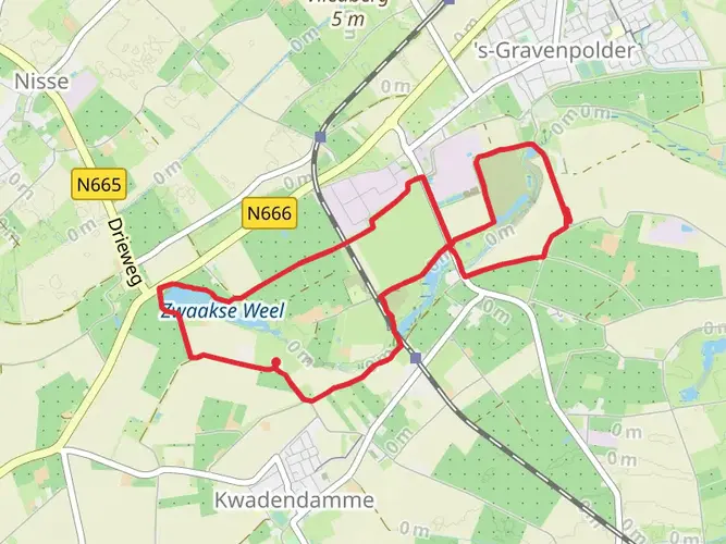
Navigating the Trail As you embark on the Oosterscheldepad, you can rely on HiiKER for detailed maps and navigation assistance. The trail is well-marked, with signage guiding you along the route. The path takes you through a variety of landscapes, including dykes, polders, and picturesque villages.
Landmarks and Scenery The trail offers stunning views of the Oosterschelde estuary, with its dynamic tidal changes and rich marine life. Birdwatchers will delight in the variety of birds that can be spotted along the coast, including oystercatchers, avocets, and spoonbills. Seals are also a common sight, especially near the artificial island Neeltje Jans, which is a highlight of the trail.
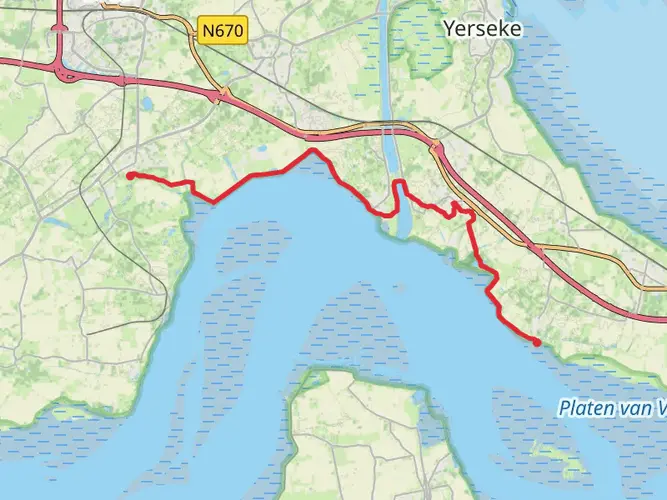
Historical Significance The region is steeped in history, with the Oosterschelde being a key location for the Dutch struggle against the sea. The Delta Works, a series of construction projects designed to protect the area from flooding, is a testament to the engineering prowess of the Dutch. The Oosterscheldekering, the largest of the Delta Works structures, is an impressive sight and a significant point of interest along the trail.
Accommodations and Facilities Throughout the journey, there are various accommodations available, ranging from campsites to bed and breakfasts, allowing hikers to rest and recharge. It's advisable to book in advance, especially during peak seasons.
Safety and Preparation While the trail is easy, it's important to be prepared for the elements. The coastal weather can be unpredictable, so pack appropriate clothing and gear. Always check the weather forecast before setting out and be mindful of the tides, as they can affect certain parts of the trail.
Conclusion The Oosterscheldepad offers a unique hiking experience, combining natural beauty, wildlife, and a glimpse into the Netherlands' historical battle with the sea. Whether you're a seasoned hiker or a casual walker, this trail provides an opportunity to explore the serene landscapes and rich cultural heritage of Zeeland.

Frequently asked questions
How long is the Oosterscheldepad and how difficult is the full walk?
The Oosterscheldepad on this route page is 159.25 km long with 172 m of total elevation gain, so it is a long-distance walk with very little climbing. That profile makes it an easy multi-day trail by Dutch standards, with the challenge coming more from the total distance and exposed coastal sections than from steep terrain.
How many stages does the Oosterscheldepad have?
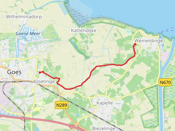
The Oosterscheldepad is commonly divided into 16 stages in the current long-distance route format around the Oosterschelde. The full Streekpad is published as a stage-based walk around the national park area, and one listed stage runs from Station Kruiningen-Yerseke to Wemeldinge for 16.5 km.
Where does the Oosterscheldepad start and finish?
The current published Oosterscheldepad begins and ends in Goes, making it a circular long-distance route around the Oosterschelde. Along the way it passes Zeeland landscapes such as dikes, polders, villages, bird areas, and major Delta Works infrastructure.
Can you walk over the Oosterscheldekering on the Oosterscheldepad?
Yes. The Oosterscheldepad includes sections along and over Delta Works landscapes, and walking over the Oosterscheldekering is one of the standout experiences associated with the route. The storm surge barrier itself is about 9 km long, with 65 concrete piers and 62 steel gates, so it is one of the most distinctive engineered sections on the trail.
What kind of scenery does the Oosterscheldepad pass through?
The Oosterscheldepad follows the edge of the Oosterschelde through classic Zeeland scenery including sea dikes, open polders, tidal water, historic towns, and bird-rich coastal zones. Notable landscapes linked with the route include the Oosterschelde estuary itself, the Delta Works, and viewpoints over places such as the Verdronken Land van Zuid-Beveland.
Is the Oosterscheldepad suitable for beginner long-distance hikers?
Yes. With 159.25 km of distance but only 172 m of ascent on this route page, the Oosterscheldepad is much more about endurance and planning than technical hiking. The easy rating fits walkers who are comfortable covering repeated daily distances on flat, often exposed terrain through Zeeland.
Can you reach the Oosterscheldepad by train in Zeeland?
Yes. One practical rail access point on the Oosterscheldepad is Station Kruiningen-Yerseke, which is used as the start of a published 16.5 km stage to Wemeldinge. That makes the route workable for stage walking as well as for a longer end-to-end trip around the Oosterschelde region.
Comments and Reviews
User comments, reviews and discussions about the Oosterscheldepad, Netherlands.
4.75
average rating out of 5
4 rating(s)