Download
3D Flyover
Add to list
More
19.6 km
~3 hrs 56 min
6 m
Point-to-Point
“Embrace open skies, tidal shores, and blossoming orchards on this peaceful journey through Zeeland’s storied fields.”
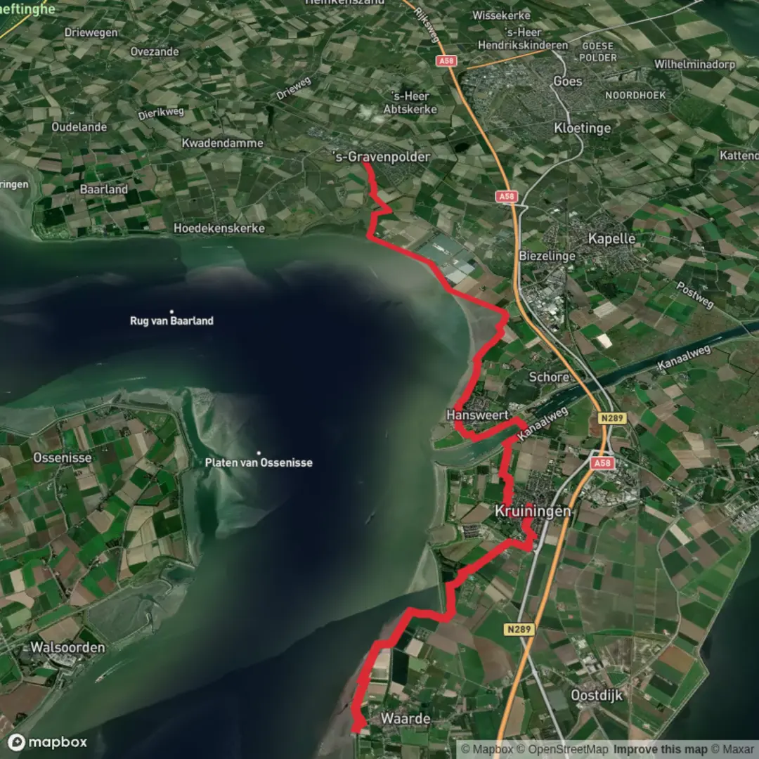
Starting out from the small town of Waarde, nestled along the banks of the Western Scheldt in Zeeland, this section of the Grenslandpad offers a gentle, flat walk of approximately 20 km (12.4 miles) with virtually no elevation gain, making it accessible for most walkers. The trailhead is conveniently located near the Waarde village center, close to the intersection of Dorpsstraat and the dike road, which is easily reached by local bus from Goes or by car, with parking available in the village.
Getting Oriented and Setting Off
The route heads eastward, quickly leaving behind the dike-protected village and entering the open, agricultural landscape that characterizes much of Zeeland. The Grenslandpad is well-marked, but for added confidence, HiiKER provides reliable navigation tools and up-to-date trail information. Early on, you’ll skirt the edge of the Scheldt estuary, with wide views across tidal mudflats and salt marshes—a haven for wading birds and waterfowl, especially during migration seasons.
Landmarks and Points of Interest
About 4 km (2.5 miles) in, the trail passes near the hamlet of Kruiningen, known for its historic windmill, De Oude Molen, and the nearby ferry terminal that once connected Zeeland to North Brabant before the construction of the Westerscheldetunnel. The route continues through a patchwork of polders—reclaimed land protected by dikes—where you’ll see traditional Dutch farmhouses, grazing sheep, and fields of crops depending on the season.
At roughly the halfway point, you’ll cross the Reimerswaal polder, an area with a rich history of land reclamation dating back to the 16th century. The remnants of old dikes and drainage canals are visible, and interpretive signs occasionally explain the ongoing battle against the sea that has shaped Zeeland’s landscape.
Nature and Wildlife
The flat terrain and open skies make this section ideal for birdwatching. Marsh harriers, storks, and various species of geese are commonly spotted, especially in spring and autumn. The hedgerows and small woodlots along the route provide habitat for songbirds and small mammals. In summer, wildflowers line the ditches, attracting butterflies and bees.
Approaching Gravenpolder
The final stretch leads you toward Gravenpolder, a village surrounded by orchards and known for its fruit production. The approach is marked by rows of apple and pear trees, and in late spring, the blossoms are a highlight. The trail ends near the village center, close to the intersection of Stationsstraat and the main road, where you’ll find a few cafes and shops.
Practical Information
Public transport connections are available at both ends of the route. Waarde is served by regional buses from Goes, which has a train station with connections to major Dutch cities. Gravenpolder is also accessible by bus, making it easy to plan a linear walk without needing to return to your starting point. Facilities along the route are limited, so bring sufficient water and snacks, and be prepared for exposure to wind and sun, as shade is scarce.
For navigation, HiiKER offers detailed maps and waypoints, ensuring you stay on track throughout this scenic and historic walk through Zeeland’s reclaimed landscapes.

Surfaces
Asphalt
Unknown
Unpaved
Gravel
Paved
Comments and Reviews
User comments, reviews and discussions about the Waarde to Gravenpolder via Grenslandpad, Netherlands.
average rating out of 5
0 rating(s)