Download
3D Flyover
Add to list
More
46.8 km
~2 days
105 m
Point-to-Point
“Experience Missouri's beauty and history on the serene, accessible Katy Trail - Augusta adventure.”
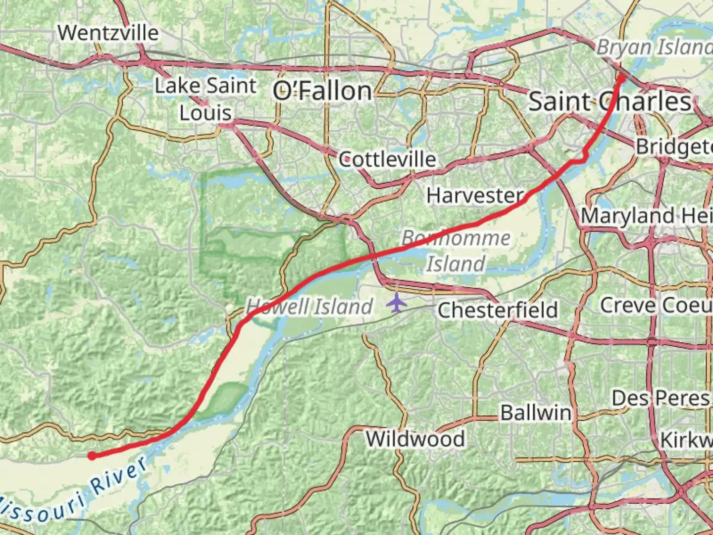
Nestled in the heart of Missouri, the Katy Trail - Augusta offers a serene and picturesque journey through the state's rich landscapes and history. Spanning approximately 47 kilometers (about 29 miles) with a gentle elevation gain of around 100 meters (328 feet), this point-to-point trail is perfect for hikers of all skill levels, especially those seeking an easy and leisurely adventure.
Getting There
The trailhead is conveniently located near St. Charles County, Missouri. For those traveling by car, you can easily access the starting point by heading towards the town of Augusta. If you're relying on public transport, the nearest major city is St. Louis, from where you can take a combination of train and bus services to reach Augusta. Once in Augusta, local taxi services or rideshares can take you to the trailhead.
Trail Highlights
As you embark on the Katy Trail - Augusta, you'll find yourself immersed in the lush greenery and tranquil surroundings that define this region. The trail follows the path of the former Missouri-Kansas-Texas Railroad, offering a unique blend of natural beauty and historical significance.
Historical Significance
The Katy Trail is part of the longest rail-trail conversion in the United States, and its history is palpable as you walk along the old railway line. This trail is a testament to the region's rich railroad heritage, and you'll encounter several historical markers and remnants of the past along the way. Keep an eye out for the preserved railway bridges and stations that dot the trail, each telling a story of the bygone era of rail travel.
Nature and Wildlife
The trail meanders through a variety of landscapes, including dense woodlands, open fields, and alongside the majestic Missouri River. This diverse environment is home to a wide array of wildlife, so be sure to bring your binoculars for birdwatching. You might spot species such as bald eagles, herons, and a variety of songbirds. The flora is equally captivating, with wildflowers blooming in vibrant colors during the spring and summer months.
Notable Landmarks
Approximately 10 kilometers (6 miles) into your hike, you'll come across the charming town of Defiance. This is a great spot to take a break and explore the local shops and eateries. Continuing along the trail, around the 30-kilometer (18-mile) mark, you'll reach the scenic Klondike Park. This park offers stunning views of the Missouri River and is an ideal place for a picnic or a short detour to explore its trails and rock formations.
Navigation and Safety
While the trail is well-marked and easy to follow, it's always wise to have a reliable navigation tool on hand. The HiiKER app is an excellent resource for detailed maps and real-time updates on trail conditions. As with any outdoor adventure, ensure you have plenty of water, snacks, and appropriate clothing for the weather. The trail is mostly flat, but comfortable footwear is essential for a pleasant hiking experience.
The Katy Trail - Augusta is a delightful journey through Missouri's natural and historical landscapes, offering a peaceful escape and a chance to connect with the region's past and present.

What to expect?
Activity types
Comments and Reviews
User comments, reviews and discussions about the Katy Trail - Augusta, Missouri.
average rating out of 5
0 rating(s)