Download
3D Preview
Add to list
More
61.7 km
~3 days
1638 m
Multi-Day
“Embark on a scenic hike through Hampshire County's diverse landscapes on the Robert Frost Trail, a journey of natural beauty and poetic inspiration.”
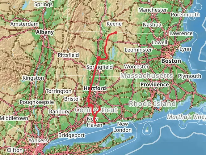
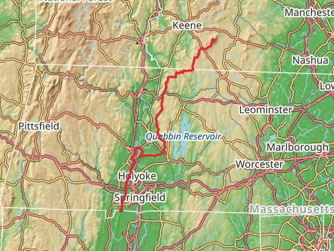
The Robert Frost Trail, winding through the picturesque Hampshire County in Massachusetts, offers a diverse hiking experience over its approximately 62 kilometers (about 38.5 miles) stretch. With an elevation gain of around 1600 meters (approximately 5250 feet), the trail presents a medium difficulty level, making it accessible to hikers with a reasonable level of fitness and experience.
Getting to the Trailhead
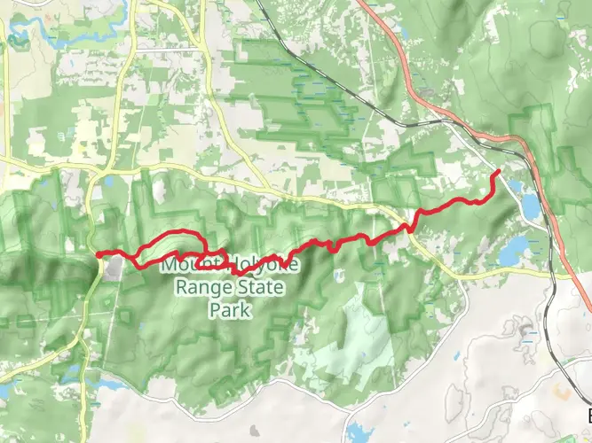
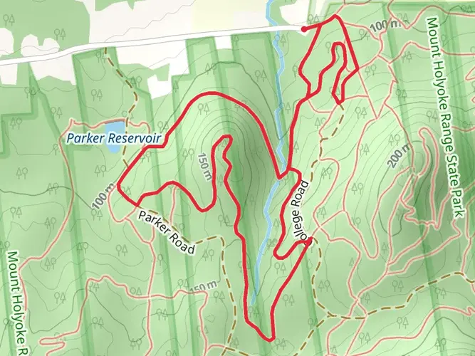
To begin your journey on the Robert Frost Trail, you'll want to make your way to the trailhead located near the Notch Visitor Center of the Holyoke Range State Park, which is the most common starting point. If you're driving, you can reach this point by navigating to 1500 West Street, Amherst, MA. For those opting for public transportation, there are bus services available from nearby towns and cities that can drop you close to the visitor center, from where you can walk to the trailhead.
Navigating the Trail
As you embark on the trail, it's advisable to use a reliable navigation tool like HiiKER to keep track of your progress and ensure you're following the correct path. The trail is marked with yellow blazes, which you should look out for to stay on course.
Landmarks and Scenery
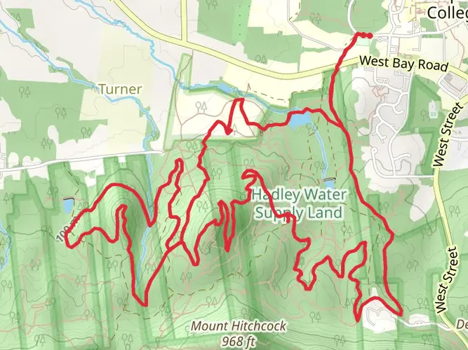
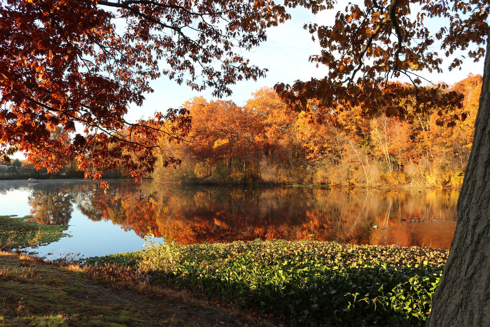
The Robert Frost Trail meanders through a variety of landscapes, including dense forests, wetlands, and open meadows. One of the early highlights is the ascent of Mount Orient, where you'll be rewarded with sweeping views of the surrounding valley. As you continue, you'll cross several streams and pass by tranquil ponds, perfect spots for a rest and to enjoy the natural beauty.
Wildlife and Flora
The trail offers ample opportunities to observe local wildlife, including deer, beavers, and a variety of bird species. The forests are rich with a mix of hardwoods and conifers, and in the spring and summer months, the meadows burst with wildflowers, adding a splash of color to the landscape.
Historical Significance
The trail is named after the renowned poet Robert Frost, who lived in the region and drew inspiration from its natural beauty. As you hike, you'll be treading paths that echo the pastoral and reflective qualities found in Frost's poetry.
Preparation and Planning
Before setting out, ensure you have adequate supplies, including water, food, and layers of clothing to adapt to the changing weather conditions that can occur in this region. The trail can be completed in sections for those not wishing to tackle the entire length in one go. There are several access points along the route, allowing for shorter hikes.
Accommodation and Camping
For multi-day treks, there are designated camping areas along the trail where you can pitch a tent for the night. It's important to plan your stops in advance and be aware of the rules and regulations regarding camping in these areas to minimize your impact on the environment.
Remember, the Robert Frost Trail is not just a physical journey but also an opportunity to connect with the natural world and the poetic legacy that this beautiful region has inspired. Whether you're looking for a challenging hike or a peaceful walk in the woods, this trail offers something for every nature lover and outdoor enthusiast.

What to expect?
Activity types
Frequently asked questions
How long is the Robert Frost Trail in Massachusetts and how many days does it take to hike?
The Robert Frost Trail is 61.72 km, or about 38.5 miles, with 1,638 meters of climbing. Most hikers treat it as a 2 to 4 day route depending on pace, weather, and whether they are covering the full trail from the South Hadley area to Wendell State Forest.
Where does the Robert Frost Trail start and end in Massachusetts?
The Robert Frost Trail runs north-south across the Pioneer Valley, linking the Connecticut River in South Hadley with the Ruggles Pond area in Wendell State Forest. Along the way it passes through towns including Amherst, Pelham, Shutesbury, Leverett, Sunderland, and Montague.
Where can you park for the Robert Frost Trail near Amherst and the Holyoke Range?
One of the most commonly used access points for the Robert Frost Trail is at The Notch in Mount Holyoke Range State Park near Amherst, where the visitor center and trail parking provide a practical southern access point. This section gives access to the Holyoke Range portion of the route, including the ridge near Mount Hitchcock, Bare Mountain, and Mount Norwottuck.
Is the Robert Frost Trail hard to hike?
Yes. The Robert Frost Trail is generally considered a difficult long-distance hike because it packs 1,638 meters of elevation gain into 61.72 km. The toughest stretches are in the Holyoke Range and around Mount Toby, where repeated climbs, rocky footing, and longer mileage make it better suited to experienced hikers.
Are dogs allowed on the Robert Frost Trail in Massachusetts?
Dogs are generally allowed on much of the Robert Frost Trail, including state park sections, but leash rules can apply depending on the land manager and the specific parcel the trail crosses. Because the route passes through a mix of public and conservation land, dog handlers should expect to keep dogs under close control, especially near road crossings, wildlife habitat, and other trail users.
Can you camp on the Robert Frost Trail?
Camping is not allowed on the Robert Frost Trail itself. That makes the route better suited to a long day hike, a section hike with a shuttle, or a multi-day trip using legal off-trail lodging or established accommodations in nearby towns rather than backcountry camping along the footpath.
What are the main landmarks and viewpoints on the Robert Frost Trail?
Major highlights on the Robert Frost Trail include the Holyoke Range, Mount Orient, Puffer's Pond, and Mount Toby. The route also passes through forest, wetland, and meadow landscapes, with notable ridge walking near The Notch and broad valley views from higher points in the range.
Comments and Reviews
User comments, reviews and discussions about the Robert Frost Trail, Massachusetts.
4.71
average rating out of 5
17 rating(s)