Download
3D Flyover
Add to list
More
34.1 km
~2 days
975 m
Multi-Day
“Traverse Fly Rod Crosby Trail's diverse terrains, celebrating Maine's wilderness heritage on a medium-difficulty, scenic 21-mile hike.”
The Fly Rod Crosby Trail, spanning approximately 34 kilometers (about 21 miles) with an elevation gain of around 900 meters (nearly 2950 feet), offers a medium-difficulty hiking experience through the scenic landscapes of Franklin County, Maine. This point-to-point trail is named after Cornelia "Fly Rod" Crosby, a famous outdoorswoman and the first registered Maine Guide, who promoted the Maine outdoors in the late 19th and early 20th centuries.
Getting to the Trailhead
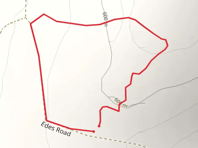
To reach the trailhead, hikers can drive to the vicinity of Phillips in Franklin County, where the southern terminus is located. There is no direct public transportation to the trailhead, so a personal vehicle or a taxi service is necessary. Parking is available near the start of the trail, which is typically accessed via Reeds Mill Road.
Trail Experience
As you embark on the Fly Rod Crosby Trail, you'll traverse a variety of terrains including dense forests, open meadows, and alongside streams and rivers. The trail is well-marked, but carrying a map or using a navigation tool like HiiKER is recommended to stay on track.
Landmarks and Scenery
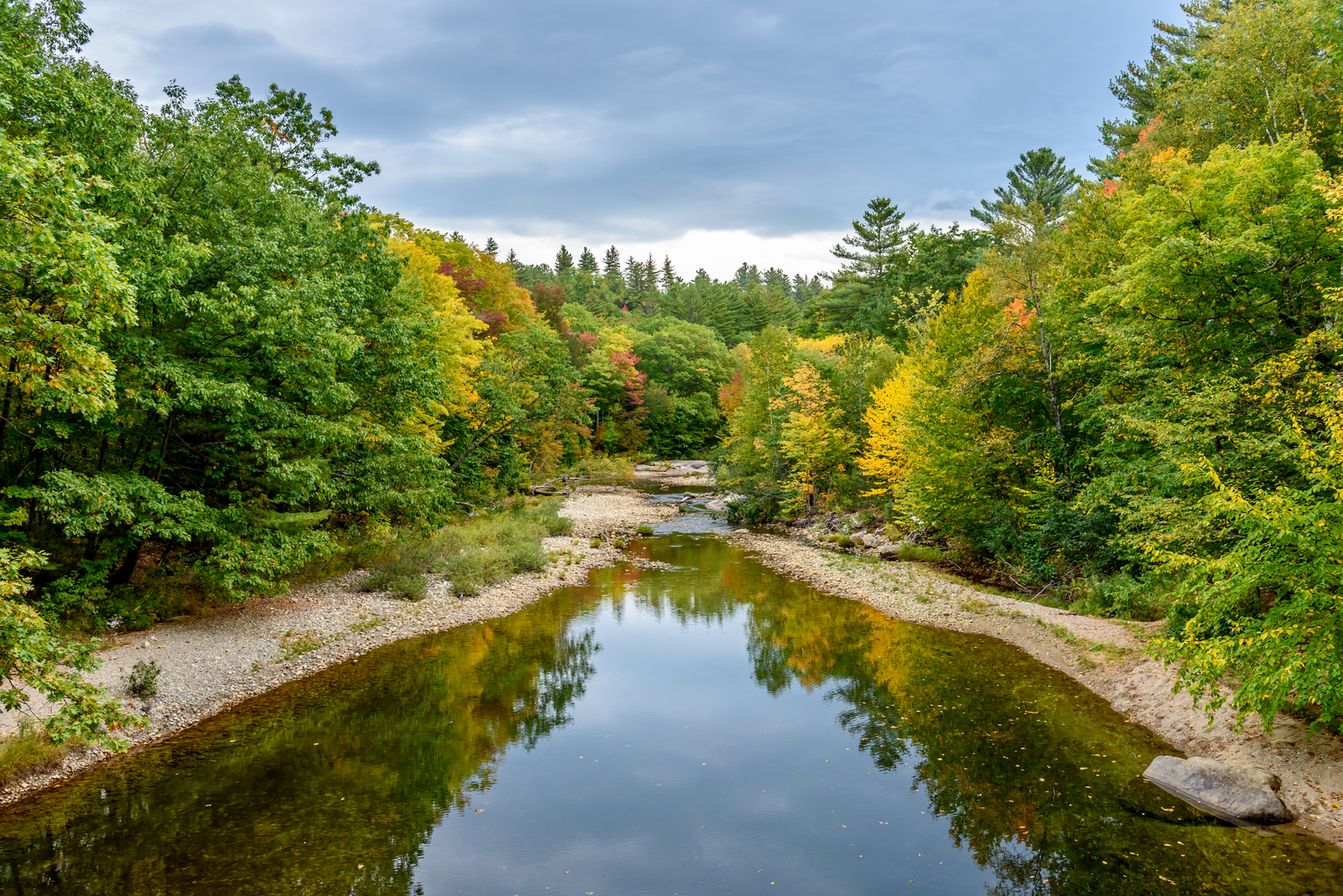
One of the first significant landmarks you'll encounter is the Sandy River, a picturesque waterway that offers a serene backdrop for the early part of your hike. As you progress, the trail will lead you through the charming small town of Phillips, where you can appreciate local architecture and perhaps stop for a rest or to resupply.
Continuing on, you'll ascend through mixed hardwood and coniferous forests, with the trail offering occasional clearings that provide stunning views of the surrounding mountains. The elevation gain is gradual but noticeable, and the highest points on the trail afford panoramic vistas of the Western Maine landscape.
Flora and Fauna
The region is rich in biodiversity, with opportunities to spot wildlife such as white-tailed deer, moose, and a variety of bird species, including the iconic Maine state bird, the chickadee. The trail also winds through areas abundant with wildflowers in the spring and summer, and spectacular foliage during the fall.
Historical Significance
The trail's namesake, Fly Rod Crosby, was an advocate for the Maine wilderness and its potential for tourism. Her legacy is celebrated along the trail, and hikers can reflect on the history of outdoor recreation and conservation in the area as they follow in her footsteps.
Preparation and Planning
Before setting out, ensure you have adequate supplies, including water, food, and layers for changing weather conditions. The trail can be completed in a series of day hikes or as an overnight backpacking trip, with several designated camping areas along the route. Always check the weather forecast and trail conditions in advance, and be prepared for remote sections where cell service may be limited.
Remember to practice Leave No Trace principles to preserve the beauty and integrity of the trail for future hikers. Whether you're seeking solitude, a physical challenge, or a chance to connect with Maine's natural and historical heritage, the Fly Rod Crosby Trail offers a rewarding experience for hikers of all levels.

What to expect?
Activity types
Frequently asked questions
How long is the Fly Rod Crosby Trail in Maine and how many days does it take to hike?
The Fly Rod Crosby Trail is 34.13 km, or about 21.2 miles, with roughly 975 m of climbing. Most hikers treat it as a short multi-day point-to-point route, though strong hikers can cover it in a long day. The medium rating reflects both the distance and the cumulative elevation gain rather than any single extreme climb.
Where do you park for the Fly Rod Crosby Trail near Phillips or Madrid?
Parking for the Fly Rod Crosby Trail is available at trail access points tied to Phillips and Madrid. A commonly used Madrid trailhead is on Reeds Mill Road near the Star Barn area, and the route also connects through downtown Phillips, where the southern end has historically been accessed. Reeds Mill Road is the key road name to know when driving to the trail.
Is the Fly Rod Crosby Trail a loop or a point-to-point hike?
The Fly Rod Crosby Trail is a point-to-point route rather than a loop. That matters for logistics because a full hike usually requires a car shuttle or pickup plan between trail access points in the Phillips and Madrid area. At 34.13 km, it is long enough that transportation planning is part of the trip.
What is the terrain like on the Fly Rod Crosby Trail in Franklin County, Maine?
The Fly Rod Crosby Trail crosses mixed terrain that includes forest, open sections, streamside walking, and developed connectors through the Phillips area. The route is known as a heritage trail as well as a hiking route, so it combines natural sections with places tied to Cornelia "Fly Rod" Crosby and the Sandy River valley. The 975 m of ascent is spread across the route, giving it a steady medium difficulty.
What towns or landmarks does the Fly Rod Crosby Trail pass near?
The Fly Rod Crosby Trail is closely associated with Phillips and Madrid in Franklin County and follows the Sandy River valley landscape. In Phillips, the route passes through the historic downtown area connected with Cornelia "Fly Rod" Crosby, who grew up there. Reeds Mill Road is another named landmark corridor on the trail’s Madrid side.
Who was Fly Rod Crosby, and why is the Fly Rod Crosby Trail named after her?
The trail is named for Cornelia "Fly Rod" Crosby, a pioneering Maine outdoorswoman from Phillips who became Maine’s first registered guide. The route was created in part to honor her legacy in the High Peaks region and to connect communities and landscapes associated with her life. That local history is one of the defining features that sets this trail apart from a standard backcountry route.
Comments and Reviews
User comments, reviews and discussions about the Fly Rod Crosby Trail, Maine.
4.62
average rating out of 5
13 rating(s)