
Download
3D Flyover
Add to list
More
760.8 km
33 days
1786 m
Multi Day
“A sweeping Louisiana odyssey through bayous and levees, where culture, weather, and endurance shape every step.”
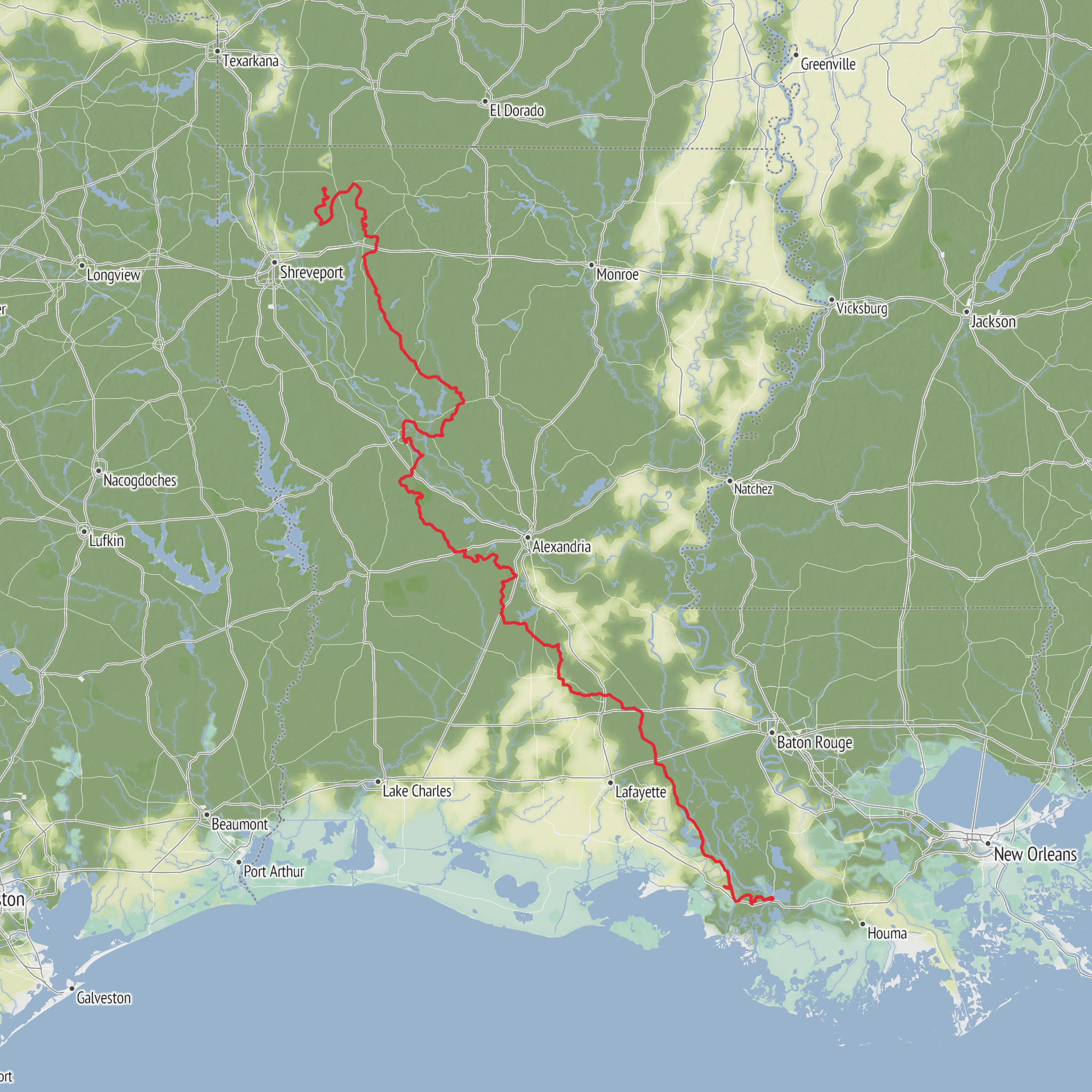
Stretching for about 761 km (473 miles) with roughly 1,900 m (6,230 ft) of total elevation gain, this is a long, low-gradient journey across Louisiana that is far more about endurance, changing landscapes, weather, and logistics than steep climbing. With an estimated medium difficulty, the challenge comes from its length, exposed sections, humidity, seasonal flooding, road or levee walking in places, and the need to plan resupply and overnight stops carefully rather than from sustained mountain terrain. Hikers should expect a route that moves through bayou country, river landscapes, wetlands, small towns, agricultural corridors, and culturally rich communities shaped by French, Spanish, Acadian, Indigenous, and African American history.
Because the trailhead information is incomplete, the best practical approach is to identify the nearest signed access point, trail town, or major public access area before setting out. If coordinates are available, they should be matched to the nearest town center, park entrance, road crossing, or visitor area before final planning. For a route of this scale in Louisiana, likely access points are near established communities or recreation corridors rather than a remote mountain-style trailhead. If arriving by car, most hikers will find access easiest via state highways, parish roads, or public recreation areas with legal parking. If using public transport, options are usually limited and may involve reaching a larger city first—such as Baton Rouge, Lafayette, New Orleans, or Shreveport depending on the segment—then arranging a taxi, shuttle, or local ride to the nearest access point. For a point-to-point hike of this length, it is often more practical to begin near a town with lodging, food, and reliable transport connections rather than at the most isolated mapped start.
What the route feels like
This is not a classic alpine or wilderness thru-hike. The terrain is generally gentle, and the cumulative elevation gain is modest for the distance, averaging only small rises over levees, ridges, bridges, embankments, and natural high ground. That makes daily mileage potentially high for strong walkers, but the environment can be deceptively demanding. Heat and humidity are often the defining factors, especially from late spring into early autumn. Even on flat ground, long days in warm, moisture-heavy air can drain energy quickly.
Underfoot, hikers may encounter a mix of paved paths, gravel, levee tops, dirt track, boardwalk, roadside shoulders, and occasionally muddy or water-affected sections. After rain, footing can become slick, especially on clay-rich surfaces, grassy levees, and low-lying paths. Mosquitoes and biting insects can be intense in wet seasons and near standing water, so protective clothing and repellent are essential.
The route is best approached as a long cultural and environmental traverse. Daily planning should account for shade, water access, resupply intervals, and the possibility that some sections feel more like a long-distance walking route through inhabited landscapes than a remote backcountry trail.
Landmarks, landscapes, and regional character
Louisiana’s defining scenery is likely to be the main attraction here. Depending on the exact alignment, hikers can expect cypress-tupelo wetlands, bayous edged with moss-draped trees, slow rivers, marshland, bottomland hardwood forest, and open agricultural country. In drier or more settled stretches, the route may pass through small towns with churches, historic main streets, cemeteries, old rail corridors, and riverfront infrastructure.
Bayous are among the most distinctive features. These slow-moving waterways are central to the ecology and identity of the state. They support fish, amphibians, reptiles, wading birds, and dense wetland vegetation, and they also tell the story of how people have traveled, traded, and lived in the region for centuries. Levees and river control structures, where present, are reminders of the constant relationship between settlement and water in Louisiana.
If the trail crosses or parallels parts of the Mississippi River system, Atchafalaya Basin country, Red River landscapes, or coastal plain wetlands, hikers should pay attention to how dramatically the environment shifts even without major elevation change. One day may feel enclosed and green beneath cypress canopy; the next may be broad, open, and sun-exposed along fields or flood-control embankments.
Wildlife and seasonal conditions
Wildlife is one of the route’s major draws, but it requires awareness. Birds are especially abundant: herons, egrets, ibises, hawks, vultures, songbirds, and migratory species may all be present depending on season. Wetlands and waterways also support turtles, frogs, snakes, and alligators. Alligators are a normal part of many Louisiana ecosystems; hikers should keep a respectful distance, never feed them, avoid lingering at water edges at dawn or dusk, and keep pets well controlled if pets are allowed on any segment.
Venomous snakes may occur in suitable habitat, including water-associated species and pit vipers in brushy or wooded areas. Watch hand and foot placement in tall grass, near logs, and around debris. Fire ants can be a nuisance or worse if disturbed. Feral hogs may also be present in some rural areas; they are usually avoided by hikers but should be given plenty of space.
Weather is often the biggest hazard. Summer brings heat index concerns, thunderstorms, and the risk of dehydration or heat illness. Winter and shoulder seasons are generally more manageable for long-distance walking, though cold rain, wind, and sudden temperature swings can still be uncomfortable. In low-lying Louisiana, flooding can alter access quickly. A section that is straightforward in one month may be muddy, submerged, or impassable in another.
Planning, water, and resupply
For a 761 km (473 mile) route, most hikers will need to break the trail into logical sections based on towns,
AI Planner
Days planned around your pace, with somewhere to stay each night.
Surfaces
Unknown
Gravel
Asphalt
Unpaved
Dirt
Paved
Concrete
Ground
Wood
Comments and Reviews
User comments, reviews and discussions about the Bayou State Trail, Louisiana.
average rating out of 5
0 rating(s)


