Download
3D Flyover
Add to list
More
75.0 km
~3 days
1336 m
Multi-Day
“Embark on a scenic hike through Franconia's wine country, steeped in history and natural beauty.”
Embarking on the Fränkischer Rotwein Wanderweg, hikers will traverse approximately 75 kilometers (around 47 miles) through the rolling hills of Franconia, a region renowned for its viticulture and picturesque landscapes. With an elevation gain of roughly 1300 meters (about 4265 feet), the trail offers a medium difficulty level, suitable for hikers with some experience.
Getting to the Trailhead
The journey begins near the charming town of Miltenberg, Germany, which is accessible by public transport or car. For those arriving by train, Miltenberg is well-connected to major cities, and from the station, the trailhead is just a short walk or taxi ride away. If driving, parking is available in the town, allowing for a convenient start to the hike.
Navigating the Trail
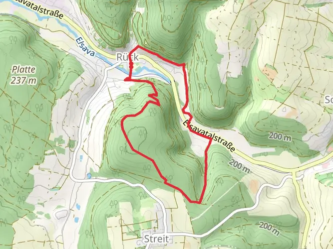
As you set out from Miltenberg, the trail will lead you through a mosaic of vineyards, dense forests, and open fields, offering a diverse hiking experience. The path is well-marked, but carrying a navigation tool like HiiKER on your smartphone can help ensure you stay on track and can also provide information on the trail's many points of interest.
Landmarks and Historical Significance
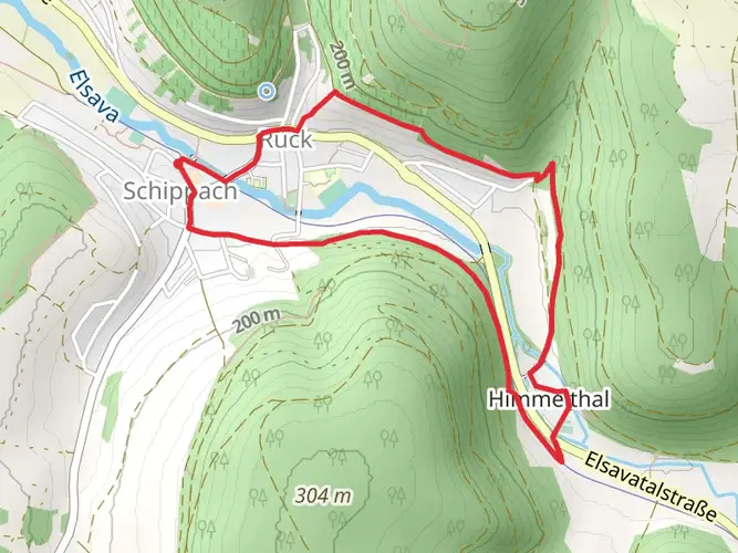
The Fränkischer Rotwein Wanderweg is not only a journey through nature but also a passage through history. The region is steeped in viticultural heritage, with terraced vineyards that have been cultivated for centuries. Along the route, hikers will encounter historical towns and villages, each with its own unique charm. Notable stops include the medieval town of Klingenberg, famous for its red wine, and the historic castle ruins of Clingenburg, which offer panoramic views of the surrounding countryside.
Flora and Fauna
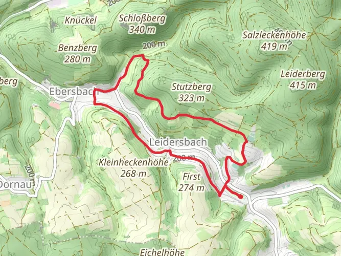
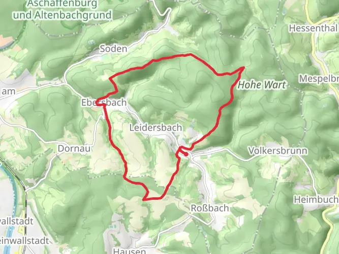
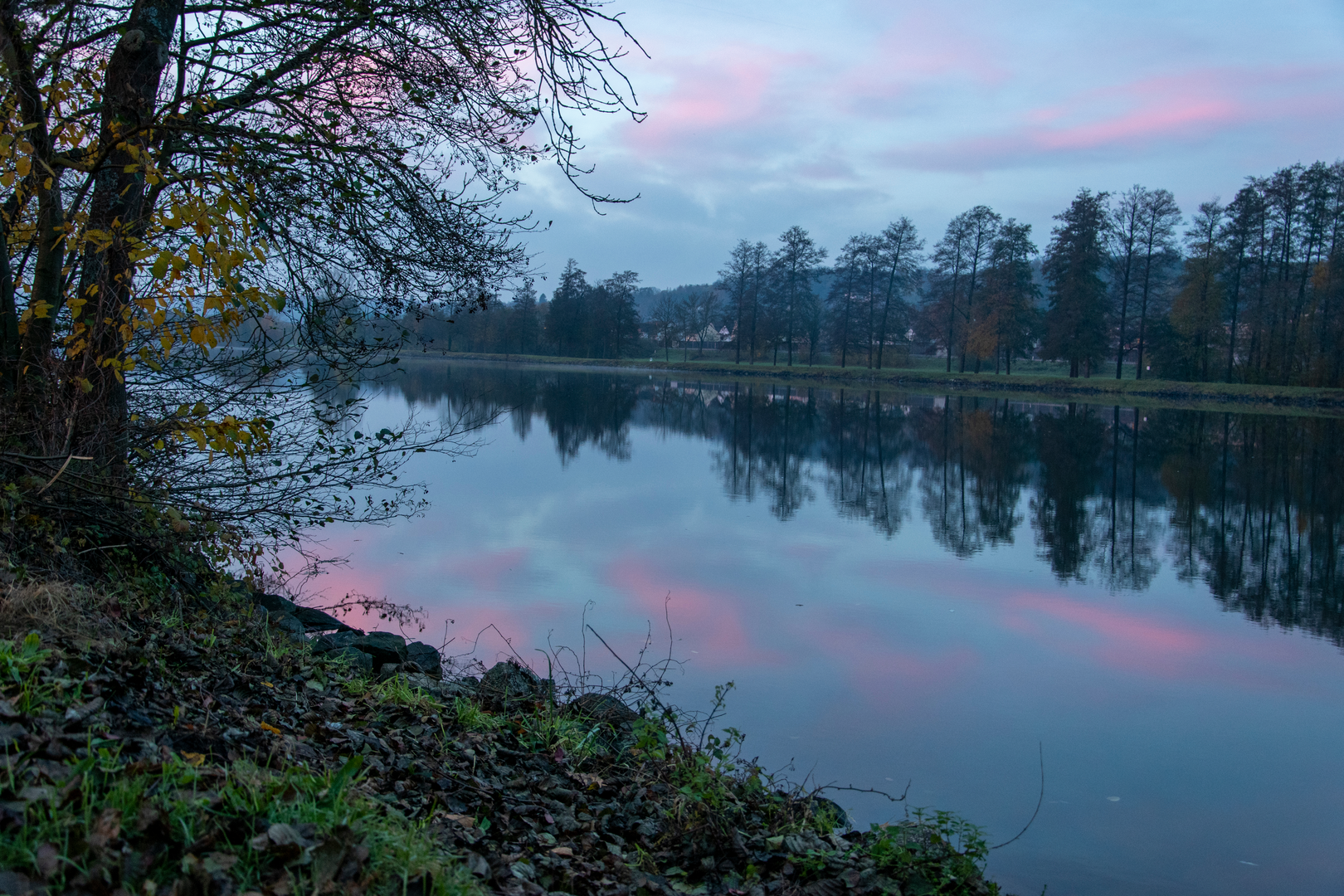
The trail meanders through a variety of ecosystems, providing opportunities to observe a rich array of flora and fauna. The mixed forests are home to species such as European Beech and Norway Spruce, while the open countryside features wildflowers and grasses that attract butterflies and birds. Keep an eye out for wildlife such as deer, foxes, and a variety of bird species that inhabit this region.
Preparing for the Hike
Given the trail's length and elevation gain, it's advisable to plan for a multi-day hike, with accommodations available in the towns along the route. Ensure you have suitable hiking boots, as the terrain can be uneven, and pack layers to accommodate the changing weather. Water is available in the towns, but carrying a refillable bottle is recommended to stay hydrated between stops.
Conclusion
The Fränkischer Rotwein Wanderweg is a trail that offers more than just a physical challenge; it's a cultural experience that immerses hikers in the beauty and history of Franconia. Whether you're a wine enthusiast, a history buff, or simply in search of stunning landscapes, this trail promises an unforgettable adventure through the heart of Germany's wine country.

Frequently asked questions
What is the Fränkischer Rotwein Wanderweg in Miltenberg, Germany?
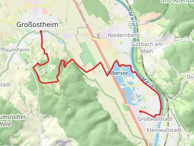
The Fränkischer Rotwein Wanderweg is a multi-day hiking trail through the red wine country of Churfranken in Bavaria. The full route is about 75.04 km on this listing, with 1,336 m of climbing, and it links vineyard towns including Großwallstadt, Großostheim, Erlenbach, Klingenberg am Main, Miltenberg, and Bürgstadt.
Where does the Fränkischer Rotwein Wanderweg start and finish?
The route begins in Großwallstadt and runs south through the Main valley wine region to Bürgstadt. Official tourism information describes the trail as connecting the vineyard areas from Großwallstadt and Großostheim in the north to Bürgstadt’s Centgrafenberg in the south, passing towns such as Klingenberg am Main and Miltenberg on the way.
How is the Fränkischer Rotwein Wanderweg divided into stages?
The Fränkischer Rotwein Wanderweg is commonly split into six stages. Those stages follow the wine towns along the Main, with the final section running from Großheubach through Miltenberg to Bürgstadt. For a 75 km route, that usually means moderate day distances rather than one very long push.
Is the Fränkischer Rotwein Wanderweg steep or difficult?
Overall, the Fränkischer Rotwein Wanderweg is considered an easy long-distance hike, but it is not completely flat. The route has 1,336 m of total ascent and includes vineyard slopes and hillside sections, especially around places such as Klingenberg am Main and Bürgstadt, where steep terraced wine-growing areas are a defining feature of the landscape.
Does the Fränkischer Rotwein Wanderweg go through Miltenberg?
Yes. Miltenberg is one of the best-known towns on the Fränkischer Rotwein Wanderweg, and the trail passes through it on the way to Bürgstadt. The last stage is described as running from Großheubach through Miltenberg and ending in Bürgstadt, making Miltenberg a practical overnight stop or access point.
What towns and landmarks does the Fränkischer Rotwein Wanderweg pass through?
The Fränkischer Rotwein Wanderweg follows the Churfranken wine belt and passes through a string of Main valley towns including Großwallstadt, Großostheim, Erlenbach, Klingenberg am Main, Großheubach, Miltenberg, and Bürgstadt. Named wine landscapes along the route include Klingenberger Schlossberg and Bürgstadter Centgrafenberg, two of the area’s best-known red wine sites.
Can the Fränkischer Rotwein Wanderweg be hiked as a multi-day trip from Miltenberg?
Yes. Because the trail is a multi-day route of about 75 km, Miltenberg works well as a mid-route base, start point for a shorter section, or overnight stop. Hikers who do not want to complete the full trail in one trip often break it into stage walks centered on towns such as Klingenberg am Main, Großheubach, Miltenberg, and Bürgstadt.
Comments and Reviews
User comments, reviews and discussions about the Fränkischer Rotwein Wanderweg, Germany.
5.0
average rating out of 5
5 rating(s)