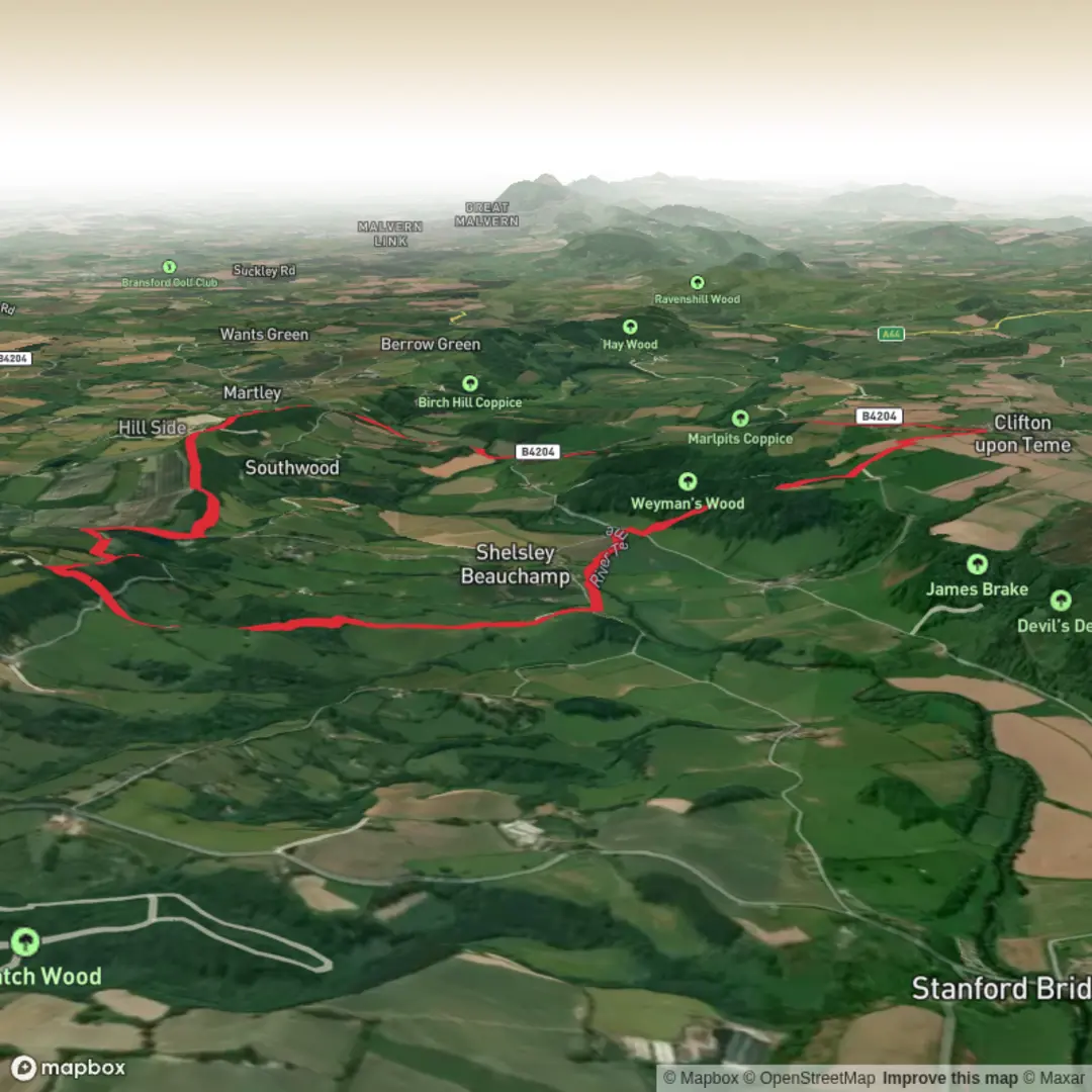
Witchery Hole, New Mill Bridge, Rodge Hill and Pudford Hill Loop
Download
3D Flyover
Add to list
More
13.1 km
~3 hrs 18 min
403 m
Loop
“A richly varied Worcestershire loop of haunted hollows, wooded dingles, and rewarding hilltop views.”
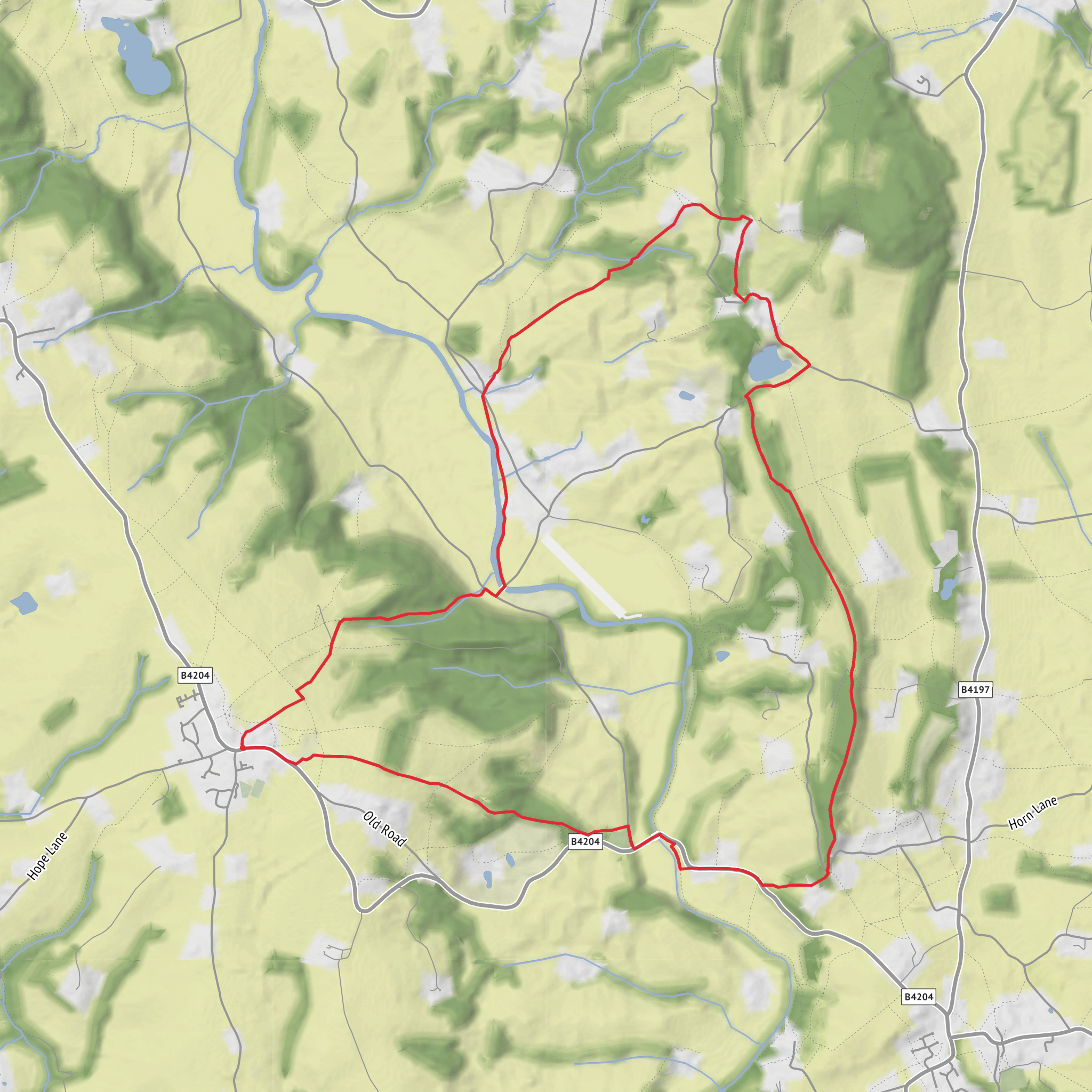
This 13 km (8.1 mile) loop in rural Worcestershire packs a surprising amount into a medium outing: steep-sided wooded dingles, quiet lanes, open farmland, and a sequence of named hills and hollows that give the route a distinctly old-country character. With around 400 m (about 1,312 ft) of ascent, it is not especially long, but the repeated climbs and descents mean it feels more substantial than the distance alone suggests. Expect a mix of field-edge paths, woodland tracks, minor roads, and uneven sections that can become muddy after rain.
The route lies in the Martley and Shelsley area of Worcestershire, with the most practical access point being near Pudford Hill, Martley, Worcestershire WR6 5QW, which is the nearest clearly identifiable address published for this part of the walking area on HiiKER. HiiKER describes the broader area as a loop in Worcestershire with a mix of scenic views, woodland, riverside character, and wildlife interest. (hiiker.app)
Getting there by car is usually the simplest option. Approaching from Worcester, Martley is the main village hub for the area, and local lanes then lead out toward Pudford Hill and the surrounding high ground. Parking in these small rural lanes is often limited, so it is best to use obvious roadside spaces considerately and avoid blocking gates, farm entrances, or passing places. By public transport, Martley is the key access village: First Bus services on the Clifton corridor serve Martley, Crown Inn from Worcester, and current timetable information shows regular links on routes including the 310/311/313/314 group, though frequency varies by day. From Martley, you should expect an additional walk out toward the start. (firstbus.co.uk)
The terrain begins gently enough through rolling agricultural country, but the character of the walk changes as you move toward the more deeply cut valleys. The first few kilometres are likely to feel open and pastoral, with hedged fields, scattered farms, and broad views across the Worcestershire countryside. These higher sections are where you will most notice the cumulative ascent, especially on the approaches around Rodge Hill and Pudford Hill. Rodge Hill itself is a recognised local high point at about 188 m (617 ft), so even though this is not mountain terrain, the route still gains enough height to offer a real sense of relief and exposure. (haroldstreet.org.uk)
Woodland hollows and steeper ground
Witchery Hole is one of the most memorable names on the route, and it matches the landscape well. Worcestershire landscape documentation describes this area as part of a network of steep-sided, wooded stream valleys with striking names including Witchery Hole, Devil’s Den, and Hell Hole. These dingles are noted for ancient semi-natural woodland and very wet conditions, with mosses, liverworts, and ferns thriving in the shaded, damp ground. That means hikers should be ready for slippery roots, soft patches, and a cooler, darker woodland atmosphere than on the surrounding farmland. (gis.worcestershire.gov.uk)
This section is where the route is most likely to feel adventurous. Short descents into the hollow can be sharper than expected, and the climb back out may be the most strenuous part of the day. In wet weather, trekking poles can be useful, and waterproof footwear is a sensible choice. If you are planning the route in detail, HiiKER is the navigation tool to rely on, especially where paths thread between woods, fields, and minor lanes. (hiiker.app)
Bridges, lanes, and historic landscape
New Mill Bridge adds another layer of local character. Worcestershire’s classified roads records place New Mill Bridge in the Shelsley Beauchamp area, which fits the route’s position among old lanes, watercourses, and former milling country. Even where the bridge itself is modest, the name points to the long agricultural and industrial history of these valleys, where streams once powered small rural mills and shaped settlement patterns. (worcestershire.gov.uk)
The wider region is rich in older place-names and folklore. A 19th-century Worcestershire source records local sayings about Witchery Hole, linking the hollow with
Surfaces
Unknown
Unpaved
Comments and Reviews
User comments, reviews and discussions about the Witchery Hole, New Mill Bridge, Rodge Hill and Pudford Hill Loop, England.
average rating out of 5
0 rating(s)
