Download
3D Flyover
Add to list
More
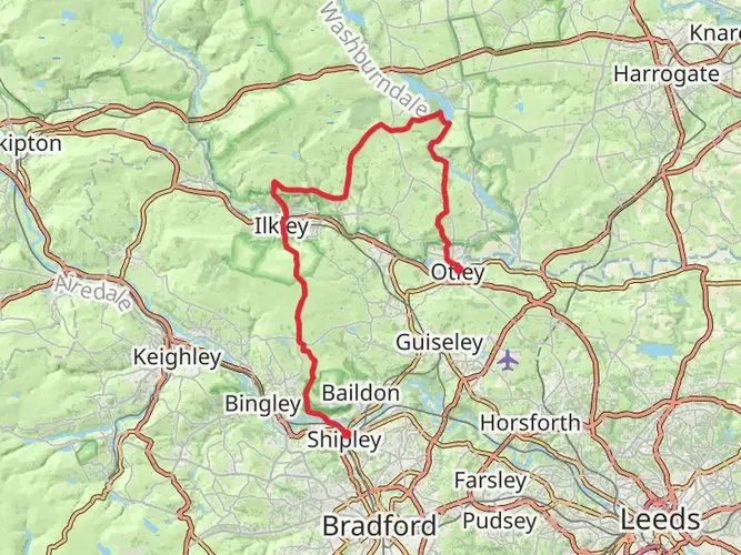
52.9 km
~3 days
1216 m
Multi-Day
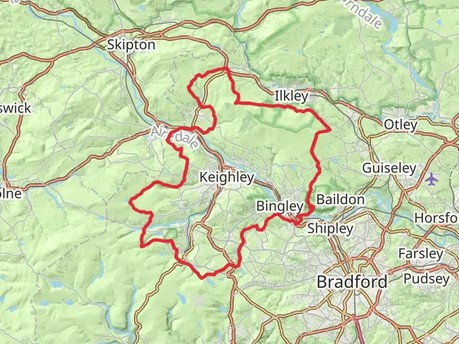
The Bingley Parish Boundary Walk is a 52.9 km trail that starts in Bradford, West Yorkshire, England. Based on our data, the hike is graded as Easy. For information on how we grade trails, please read measuring the difficulty of a hiking trail on hiiker. Also, check our latest community posts for trail updates. This hike can be completed in approx 2 days. Caution is advised on trail times as this depends on multiple variables. For more info read about how we calculate hike time.

What to expect?
Activity types
Frequently asked questions
How long does the Bingley Parish Boundary Walk take to complete?
The Bingley Parish Boundary Walk is about 52.89 km long, so most hikers treat it as a 1 to 3 day route. A strong walker can complete the full circuit in roughly 12 to 16 hours, but splitting it over two days is a more typical pace for a multi-day outing in West Yorkshire.
Is the Bingley Parish Boundary Walk hard?
The Bingley Parish Boundary Walk is generally graded easy, but it is still a substantial outing at 52.89 km with 1,216 m of total ascent. The challenge comes more from the overall distance and time on foot than from technical terrain, so it suits hikers comfortable with a long full-day or short multi-day walk.
Where does the Bingley Parish Boundary Walk start and finish?
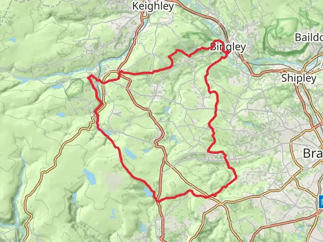
The Bingley Parish Boundary Walk is a circuit, so it finishes where it starts. A commonly used start point is around Nab Wood School on the edge of Bingley, and the route forms a full loop around the historic parish boundary before returning to the same area.
What landmarks are on the Bingley Parish Boundary Walk?
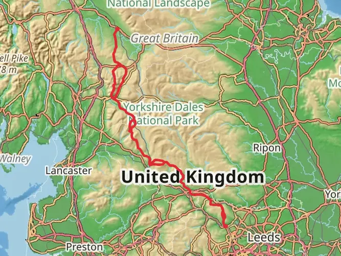
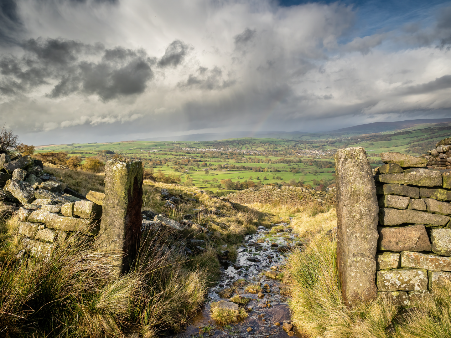
The Bingley Parish Boundary Walk follows the old parish bounds and passes through a mix of moorland and edge country around Bingley. Named features associated with the route include Rombalds Moor, Keighley Gate, Barcroft, Denham Edge, Black Hills, and Wilsden, with broad views over the Aire Valley along the way.
Can the Bingley Parish Boundary Walk be done over two days?
Yes, the Bingley Parish Boundary Walk works well as a two-day hike. At 52.89 km with 1,216 m of climbing, breaking the route into two stages of roughly 26 km each makes the distance much more manageable while still leaving time for the moorland sections and boundary landmarks around Bingley.
Is there public transport near the Bingley Parish Boundary Walk?
Yes. Because the Bingley Parish Boundary Walk is based around Bingley, there are practical public transport links into the area, and parts of the route pass near settlements on the edge of town. Around nearby St Ives Estate, buses including the 616, 619, K17, and K19 stop on Harden Road, which can help with access to sections of the walk.
Comments and Reviews
User comments, reviews and discussions about the Bingley Parish Boundary Walk, England.
4.5
average rating out of 5
2 rating(s)