Download
3D Flyover
Add to list
More
143.9 km
7 days
3994 m
Multi Day
“Embark on a picturesque trek through history and nature on the Dales High Way.”
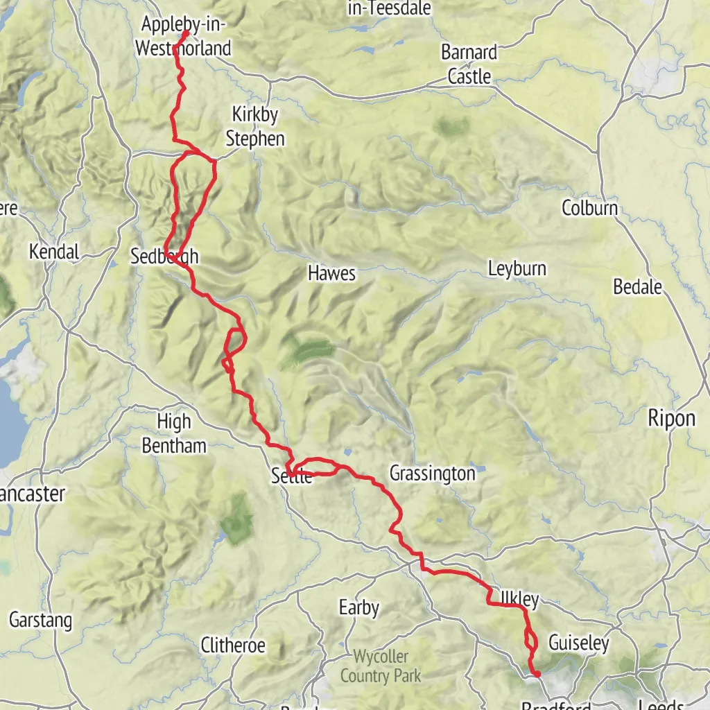
Embarking on the Dales High Way, hikers will traverse a scenic 144 km (approximately 89 miles) journey from the Victorian village of Saltaire, a UNESCO World Heritage Site, to the quaint market town of Appleby-in-Westmorland. With an elevation gain of around 3500 meters (about 11,483 feet), this point-to-point trail offers a medium difficulty rating, presenting a rewarding challenge for avid walkers.
Getting to the Trailhead The trailhead, located near Saltaire, is accessible by public transport. Visitors can take a train to Saltaire Railway Station, which is well-connected to major cities like Leeds and Bradford. For those driving, Saltaire is situated near Shipley, West Yorkshire, and parking can be found in the village or nearby areas.
Trail Overview The Dales High Way kicks off with a gentle start through the historic Saltaire, allowing hikers to admire the well-preserved industrial village before ascending into the rugged beauty of the Yorkshire Dales National Park. The trail meanders through a variety of landscapes, including rolling hills, limestone crags, and verdant valleys dotted with traditional Yorkshire dry stone walls.
Significant Landmarks and Nature As the trail progresses, hikers will encounter the impressive Ilkley Moor, part of the Rombalds Moor, known for its prehistoric rock carvings and the iconic Cow and Calf rocks. The path continues north, reaching the market town of Skipton, often referred to as the 'Gateway to the Dales.'
Further along, the route ascends into the limestone plateau of Malham, where the natural wonders of Malham Cove and Gordale Scar await. These dramatic limestone formations provide a spectacular backdrop and are a haven for peregrine falcons and other wildlife.
Historical Significance The Dales High Way passes through areas rich in history, such as the ancient settlement of Ribblehead, with its impressive viaduct that stands as a testament to Victorian engineering. The trail also offers views of the medieval ruins of Bolton Priory and the chance to walk in the footsteps of Roman soldiers near Ingleborough, where a Roman road once ran.
Wildlife and Flora The Yorkshire Dales are home to a diverse range of wildlife. Red squirrels, roe deer, and a variety of bird species can be spotted along the way. The flora is equally varied, with wildflowers, such as the rare Lady's Slipper Orchid, and the blanket of heather that covers the moors in a purple hue during late summer.
Navigation and Preparation Hikers should be well-prepared with appropriate gear for changeable weather and have the ability to navigate using a reliable tool like HiiKER, which provides detailed maps and trail information. It's essential to carry enough water and food, as some sections of the trail are remote with limited facilities.
Conclusion The Dales High Way offers a rich tapestry of English countryside, steeped in history and natural beauty. Whether you're seeking solitude, a physical challenge, or a journey through England's pastoral and cultural heritage, this trail is a fulfilling adventure for those who set out to explore it.
AI Planner
Days planned around your pace, with somewhere to stay each night.
What to expect?
Activity types
Surfaces
Unknown
Grass
Dirt
Gravel
Asphalt
Ground
Unpaved
Cobblestone
Paved
Wood
Comments and Reviews
User comments, reviews and discussions about the Dales High Way, England.
4.74
average rating out of 5
23 rating(s)