Download
3D Flyover
Add to list
More
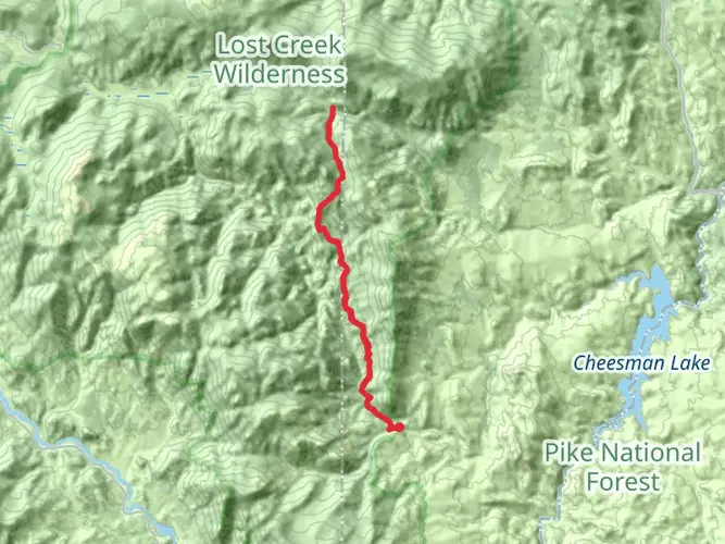
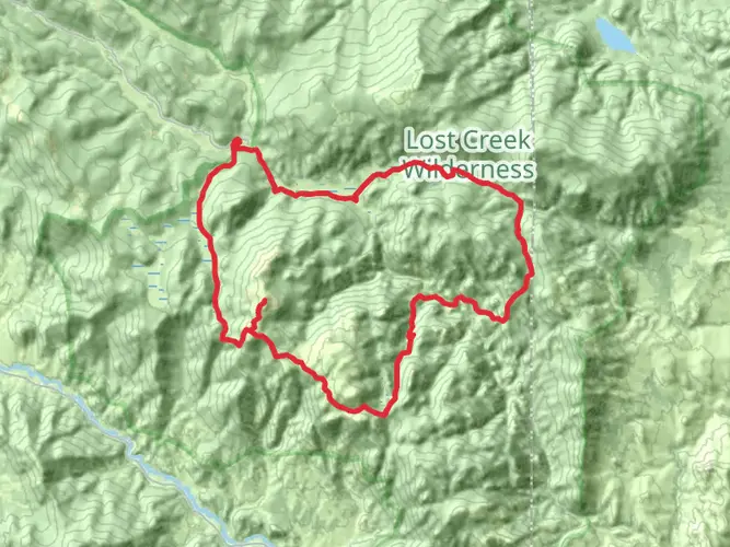
36.0 km
~2 days
1601 m
Multi-Day
“Embark on a captivating 36km journey through Lost Creek's diverse terrains, rich history, and stunning granite wonders.”
Nestled in the heart of the Pike National Forest, the Lost Creek Wilderness Loop - South is a challenging and rewarding trek that spans approximately 36 kilometers (22 miles) with an elevation gain of around 1600 meters (5250 feet). This loop trail is known for its diverse landscapes, from dense forests to open meadows, and the unique granite formations that give Lost Creek its name.
Getting to the Trailhead
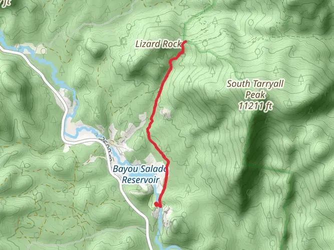
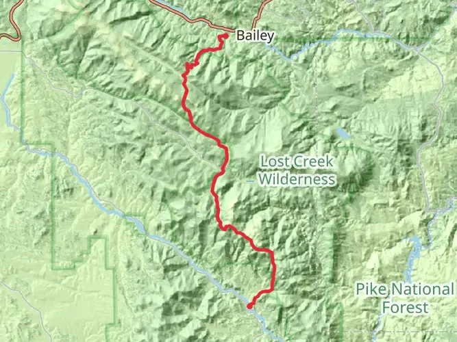
The trailhead is accessible by car and is located near Jefferson County, Colorado. To reach the starting point, take US Highway 285 to Bailey, and then turn onto County Road 68, which leads to the Lost Park Campground. The trailhead is near the campground, providing a convenient location to begin your journey. There is no direct public transportation to the trailhead, so a personal vehicle or car rental is necessary.
The Hike Itself
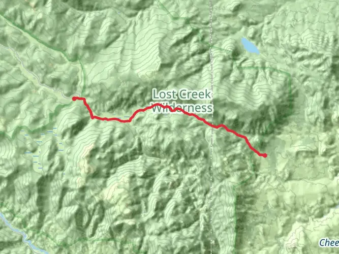
As you embark on the Lost Creek Wilderness Loop, prepare for a strenuous hike that will test your endurance. The trail is a loop, allowing you to experience a variety of terrains and ecosystems without retracing your steps. The path will take you through dense forests of pine and aspen, across rocky outcrops, and into serene meadows where wildflowers bloom in the warmer months.
Wildlife is abundant in the area, with chances to spot elk, mule deer, and even the occasional black bear or mountain lion. Birdwatchers will be delighted by the variety of species that call this wilderness home.
Landmarks and Natural Features
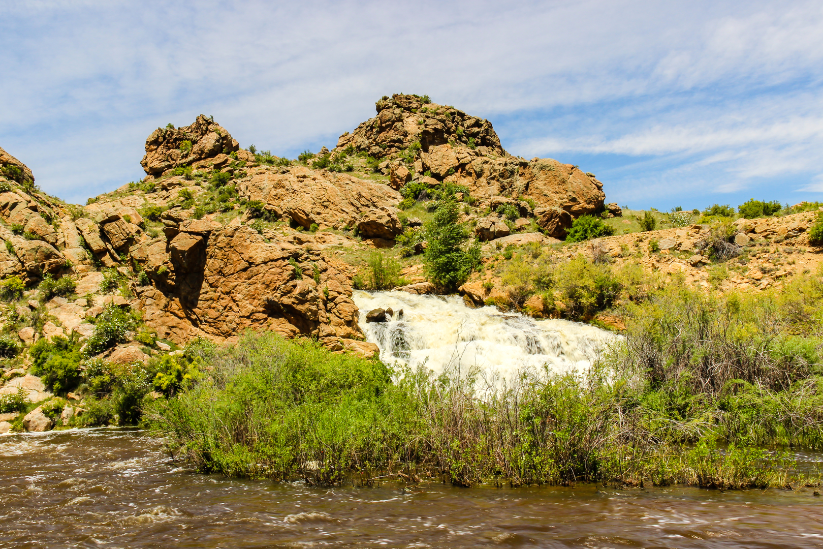
One of the most significant landmarks you'll encounter is the Lost Creek itself, which has carved a winding path through the granite, creating a series of captivating natural sculptures and hidden pools. The creek can disappear underground in places, only to resurface further down the trail, a phenomenon that adds to the mystique of the area.
The loop also takes you near Bison Peak, one of the highest points in the Tarryall Mountains, offering panoramic views of the surrounding wilderness. While the peak itself is not on the loop, a detour to its summit is a popular option for those looking to add an extra challenge to their hike.
Historical Significance
The Lost Creek Wilderness area is rich in history, with evidence of human activity dating back thousands of years. The Ute and Arapaho tribes once roamed these lands, and in the 19th century, it became a site for mining and homesteading. As you hike, you may come across old cabins and mining structures that speak to the area's past.
Navigation and Preparation
Given the trail's difficulty and remote nature, it's essential to be well-prepared. Make sure to bring a map and compass or use a navigation tool like HiiKER to keep track of your location. The trail is well-marked, but weather conditions can change rapidly, and having a reliable means of navigation is crucial.
Water sources are available along the trail, but they should be treated before drinking. Be sure to pack enough food, clothing, and gear for the unpredictable mountain weather, and always leave no trace of your visit to preserve the wilderness for future hikers.
Elevation and Distance
The loop's 36 kilometers will take you up and down through various elevation changes, with a total gain of around 1600 meters. This makes for a challenging hike, often taking two to three days to complete, depending on your pace and experience.
Conclusion
The Lost Creek Wilderness Loop - South is a demanding but incredibly rewarding hike that offers a true wilderness experience. With its stunning natural features, diverse wildlife, and historical landmarks, it's a trail that provides a deep connection to the rugged beauty of Colorado's high country.

What to expect?
Activity types
Frequently asked questions
How long does the Lost Creek Wilderness Loop - South take to hike?
The Lost Creek Wilderness Loop - South covers 35.98 km, or about 22 miles, with 1,601 m of climbing, so it is usually done as a strenuous overnight or 2-day backpacking trip rather than a casual day hike. Strong hikers sometimes complete it in a long single day, but the distance and elevation gain put it firmly in the difficult category.
Where is the trailhead for the Lost Creek Wilderness Loop - South and where do you park?
A common access point for the Lost Creek Wilderness Loop - South is Lost Park Trailhead beside Lost Park Campground in the Lost Creek Wilderness. The Forest Service lists the trailhead at about 39.2844, -105.5085, with restrooms available, no potable water, and the trailhead located just before the campground entrance.
How do you get to the Lost Creek Wilderness Loop - South from US 285?
For the Lost Creek Wilderness Loop - South, the west-side approach uses US Highway 285 to Jefferson, then County Road 56 for roughly 20 miles to Lost Park Campground and Lost Park Trailhead. The road is not maintained in winter, and the Forest Service notes a seasonal closure on County Road 56 from March 2 through June 16.
Are dogs allowed on the Lost Creek Wilderness Loop - South?
Dogs are allowed on the Lost Creek Wilderness Loop - South, but current Lost Creek Wilderness rules require them to be under physical restraint with a leash. That restriction is in effect across the wilderness under a Forest Service order running through December 31, 2027.
Is the Lost Creek Wilderness Loop - South good for backpacking?
Yes. The Lost Creek Wilderness Loop - South is a multi-day route of nearly 36 km with 1,601 m of elevation gain, which makes it well suited to an overnight backpacking trip. The wider Lost Creek Wilderness has a 136-mile trail network and is known for granite domes, granite arches, forested valleys, and high parks between about 8,000 and 12,400 feet.
What is the best time of year to hike the Lost Creek Wilderness Loop - South?
The most reliable season for the Lost Creek Wilderness Loop - South is summer into early fall, when access roads are typically open and snow is less likely to complicate route finding. Spring can be limited by the seasonal closure on County Road 56 through June 16, while the wilderness itself ranges from about 8,000 to 12,400 feet, so lingering snow and cold nights are common outside peak season.
Is there public transportation to the Lost Creek Wilderness Loop - South?
There is no direct public transportation to the Lost Creek Wilderness Loop - South trailhead. Access is generally by private vehicle via US 285 and County Road 56 to Lost Park Trailhead near Lost Park Campground.
Comments and Reviews
User comments, reviews and discussions about the Lost Creek Wilderness Loop - South, Colorado.
4.57
average rating out of 5
7 rating(s)