Download
3D Flyover
Add to list
More
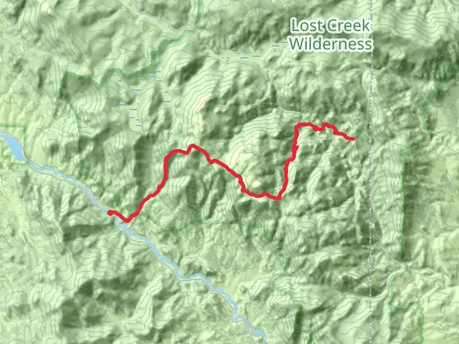
46.1 km
~2 days
1485 m
Multi-Day
“Embark on a breathtaking 28.5-mile hike through the Lost Creek Wilderness, where history and nature entwine under the Rocky Mountain skies.”
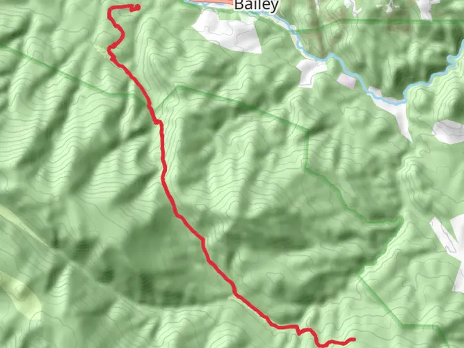
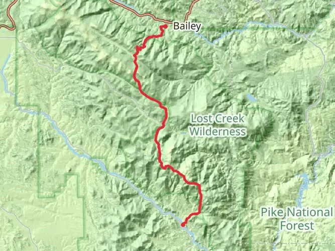
The Lost Creek Wilderness Loop - North is a captivating journey through a diverse landscape that offers a unique blend of natural beauty and historical intrigue. Spanning approximately 46 kilometers (about 28.5 miles) with an elevation gain of around 1400 meters (approximately 4600 feet), this loop trail is nestled in the heart of the Rocky Mountains near Park County, Colorado. It is considered to have a medium difficulty rating, making it accessible to hikers with a reasonable level of fitness and experience.
Getting to the Trailhead
To reach the trailhead, hikers can drive to a location near Park County, which is the nearest significant landmark. From Denver, take US-285 S toward Fairplay for about an hour and a half. After reaching Fairplay, continue on US-285 and follow the signs for the Lost Creek Wilderness area. The trailhead is well-marked and offers parking for those arriving by car. Public transportation options are limited in this region, so driving is the most feasible way to reach the starting point of the hike.
Navigating the Trail
As you embark on the Lost Creek Wilderness Loop - North, it's essential to have a reliable navigation tool. HiiKER is an excellent resource for trail maps and navigation, ensuring you stay on the right path throughout your journey.
Landmarks and Natural Features
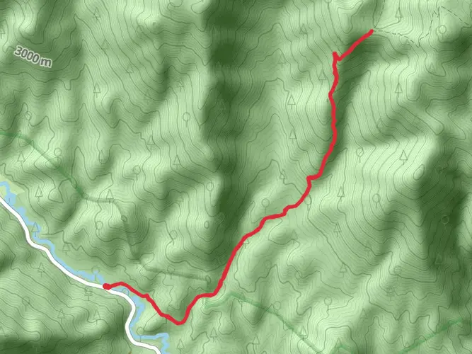
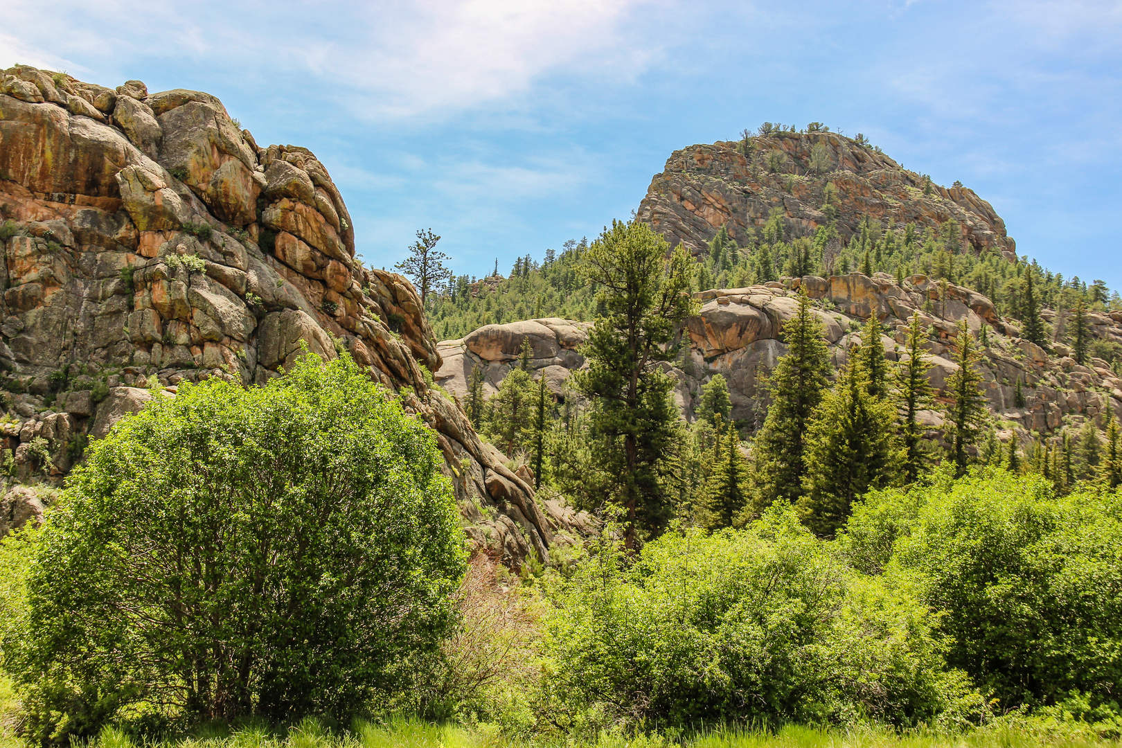
The trail meanders through a variety of terrains, including dense forests, open meadows, and rocky outcrops. One of the most notable features of the hike is the series of dramatic granite formations that punctuate the landscape. These natural sculptures are a testament to the geological forces that have shaped the region over millions of years.
As you progress along the loop, you'll encounter the serenity of Lost Creek itself. This meandering waterway is a lifeline for the local flora and fauna and provides a peaceful soundtrack to your hike. The creek is also home to several beaver ponds, which can be seen along the trail.
Wildlife and Flora
The Lost Creek Wilderness is a haven for wildlife enthusiasts. Keep an eye out for mule deer, elk, and the occasional moose grazing in the meadows. The area is also home to black bears and mountain lions, so it's important to be bear aware and practice safe wildlife etiquette.
The trail is lined with a diverse array of plant life, including wildflowers that bloom in a riot of colors during the spring and summer months. Aspens and ponderosa pines dominate the forested sections, providing shade and a sense of tranquility.
Historical Significance
The region holds historical significance, with evidence of human activity dating back thousands of years. The Ute and Arapaho tribes once roamed these lands, and the area was later explored by miners and settlers during the Colorado Gold Rush. Hikers can reflect on the past as they traverse the same landscapes that these early inhabitants once did.
Preparation and Planning
Before setting out, ensure you are well-prepared with adequate supplies, including water, food, and layers of clothing to accommodate the unpredictable mountain weather. The trail can be completed in a multi-day trek, so bring camping gear if you plan to stay overnight. Always check the weather forecast and trail conditions, and inform someone of your itinerary.
Remember that the Lost Creek Wilderness is a protected area, so it's crucial to follow Leave No Trace principles to preserve its beauty for future generations. Happy hiking!

What to expect?
Activity types
Frequently asked questions
How long does the Lost Creek Wilderness Loop - North usually take to hike?
Lost Creek Wilderness Loop - North is 46.05 km, or about 28.6 miles, with 1,485 meters of climbing, roughly 4,872 feet. Most hikers treat that as a 2 to 3 day backpacking loop rather than a day hike, especially because the route is rated Extra Difficult and includes long stretches of wilderness travel at altitude.
Where do you start the Lost Creek Wilderness Loop - North in Park County, Colorado?
This loop is commonly built from Lost Creek Wilderness access points tied into the Brookside-McCurdy corridor, including trailheads such as Lost Park and Goose Creek on the Park County side. The Brookside-McCurdy Trail is the main north-south spine through the area and connects with loop options through Lost Park, Indian Creek, McCurdy Park, and the Hankins Pass and Goose Creek side of the wilderness.
Is the Lost Creek Wilderness Loop - North dog friendly?
Dogs are allowed on Lost Creek Wilderness Loop - North, but Lost Creek Wilderness has a leash rule in effect. The U.S. Forest Service restriction for the wilderness prohibits possessing a dog that is not under physical restraint of a leash, so off-leash hiking is not permitted on this route.
Do you need a permit for the Lost Creek Wilderness Loop - North?
Yes. Lost Creek Wilderness uses a mandatory self-issued permit system for wilderness entry. The permit is free and is available at trailheads and entry points, and standard wilderness regulations apply throughout the route.
What is the best time of year to hike the Lost Creek Wilderness Loop - North?
The most reliable season for Lost Creek Wilderness Loop - North is generally late summer into early fall, when snow is less likely to block access and the high ridges are usually drier. The Forest Service lists the area as open year-round, but notes that weather can make access difficult in winter and spring, and some approach roads on the west side have seasonal closures or no winter maintenance.
Can you camp along the Lost Creek Wilderness Loop - North?
Yes, this is a multi-day route and backcountry camping is allowed in Lost Creek Wilderness, but there are important spacing rules. Camping is prohibited within 100 feet of lakes, streams, and National Forest System trails, so camps need to be set back from water and from the trail corridor.
What are the main landmarks on the Lost Creek Wilderness Loop - North?
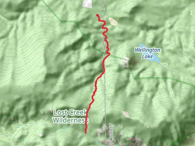
Lost Creek Wilderness Loop - North passes through some of the signature terrain of the Lost Creek area, including Lost Park, Indian Creek, McCurdy Park, and the ridge near the southwest shoulder of Bison Peak. The Brookside-McCurdy Trail section is known for red Pikes Peak granite formations, broad parklands, and big views across the Platte River Range.
Comments and Reviews
User comments, reviews and discussions about the Lost Creek Wilderness Loop - North, Colorado.
4.71
average rating out of 5
7 rating(s)