Download
Preview
Add to list
More
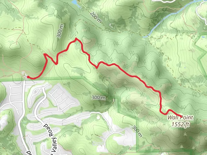
13.6 km
~3 hrs 21 min
391 m
Loop
“Embark on the Sugarloaf-Shell Ridge Loop Trail for a picturesque and historic 14 km hike in Contra Costa's diverse landscapes.”
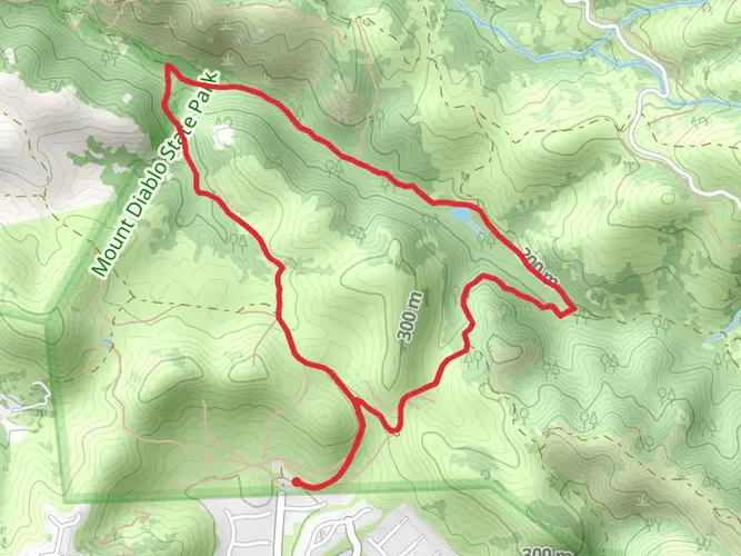
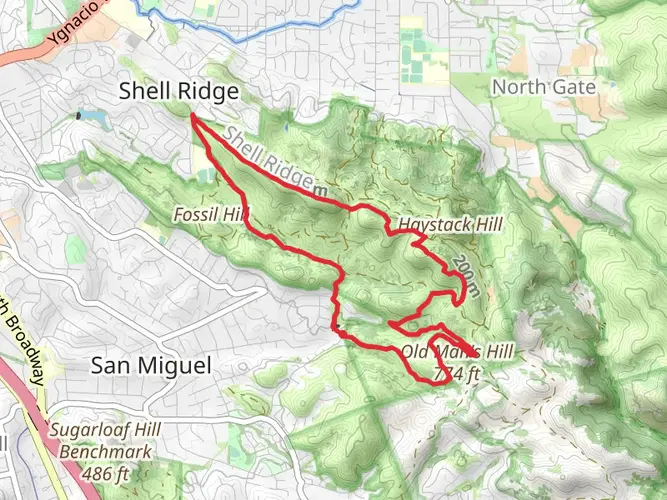
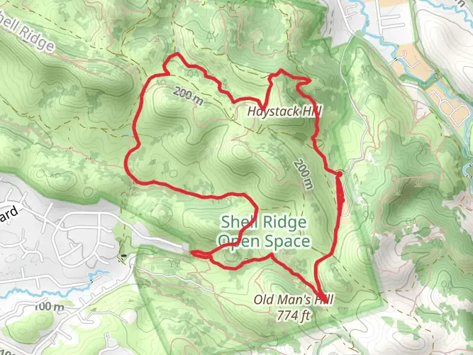
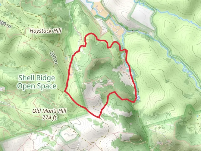
Nestled in the scenic region of Contra Costa County, California, the Sugarloaf-Shell Ridge Loop Trail offers an invigorating 14 km (approximately 8.7 miles) hike with an elevation gain of about 300 meters (roughly 984 feet). This loop trail is a delightful challenge for those looking to engage with the natural beauty of the area while enjoying a moderately demanding outdoor activity.
Getting to the Trailhead To reach the trailhead, hikers can drive to the designated parking area near the intersection of Homestead Avenue and Sutherland Drive, Walnut Creek, CA. For those opting for public transportation, the nearest BART (Bay Area Rapid Transit) station is Walnut Creek, from which you can take a taxi or a bus to the trailhead.
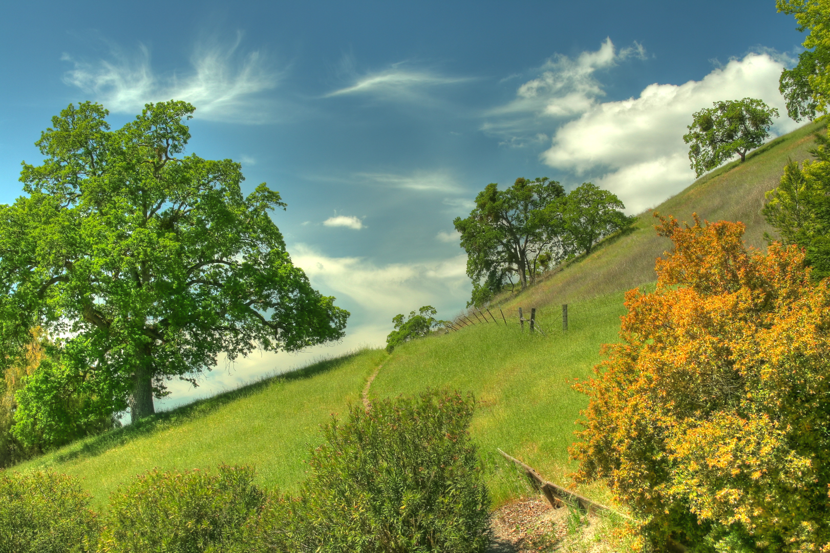
The Hike Experience As you embark on the Sugarloaf-Shell Ridge Loop Trail, you'll be greeted by a diverse landscape that transitions from grassy hillsides to oak woodlands. The initial ascent is gradual, allowing hikers to warm up as they take in the sweeping views of Mount Diablo and the surrounding Diablo Valley.
Flora and Fauna Throughout the hike, keep an eye out for the rich variety of plant life, including chaparral, wildflowers, and the iconic California poppies that add a splash of color in the spring. The area is also home to wildlife such as deer, coyotes, and numerous bird species, so be sure to bring your binoculars for a closer look.
Historical Significance The region holds historical significance, with Shell Ridge named after the marine fossils found in the area, which indicate that it was once under a prehistoric inland sea. As you traverse the trail, consider the geological transformations that have shaped this landscape over millions of years.
Navigating the Trail For navigation, hikers can rely on the HiiKER app to stay on track and ensure they are following the loop correctly. The trail is well-marked, but having a digital tool can provide additional peace of mind.
Key Landmarks Approximately halfway through the hike, you'll reach the summit of Sugarloaf Hill, which stands as a prominent landmark and offers a panoramic vista that is well worth the climb. Here, you can take a moment to rest and enjoy the scenery before continuing on the loop.
Trail Conditions and Preparation The trail can be rocky and uneven in places, so sturdy hiking boots are recommended. The weather can also be quite variable, with hot summers and cool, wet winters, so dressing in layers and bringing adequate water and sun protection is essential.
Conclusion By the time you complete the Sugarloaf-Shell Ridge Loop Trail, you'll have immersed yourself in the natural and historical richness of the area. With its moderate difficulty and engaging terrain, this trail is a rewarding experience for hikers looking to explore the beauty of Contra Costa County.

What to expect?
Activity types
Comments and Reviews
User comments, reviews and discussions about the Sugarloaf-Shell Ridge Loop Trail, California.
4.43
average rating out of 5
7 rating(s)