10.3 km
~2 hrs 41 min
371 m
“Experience the Wenholthausen Rundweg W5: a 10 km loop of scenic beauty, history, and moderate challenge.”
Starting your adventure near Hochsauerlandkreis, Germany, the Wenholthausen Rundweg W5 is a delightful 10 km (6.2 miles) loop trail with an elevation gain of approximately 300 meters (984 feet). This medium-difficulty trail offers a blend of natural beauty, historical landmarks, and serene landscapes, making it a rewarding experience for hikers of various skill levels.
### Getting There To reach the trailhead, you can either drive or use public transport. If you're driving, set your GPS to Wenholthausen, a small village in the Hochsauerlandkreis district. There are parking facilities available near the village center. For those using public transport, take a train to Meschede, the nearest major town, and then a bus to Wenholthausen. The bus stop is conveniently located near the trailhead.
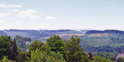
### Trail Highlights #### Scenic Views and Natural Beauty As you embark on the Wenholthausen Rundweg W5, you'll be greeted by lush forests, rolling hills, and picturesque meadows. The trail meanders through the Sauerland region, known for its dense woodlands and tranquil streams. Keep an eye out for local wildlife, including deer, foxes, and a variety of bird species. The diverse flora, especially during spring and summer, adds vibrant colors to the landscape.
#### Historical Landmarks Around the 3 km (1.9 miles) mark, you'll come across the St. Cäcilia Church, a beautiful example of local architecture dating back to the 13th century. This church is not only a place of worship but also a historical monument that offers a glimpse into the region's past. Another significant landmark is the old mill near the 7 km (4.3 miles) point, which has been restored and now serves as a museum showcasing traditional milling techniques.
### Navigation and Waypoints The trail is well-marked with W5 signs, making navigation straightforward. However, for added security and to ensure you stay on track, consider using the HiiKER app, which provides detailed maps and real-time GPS tracking. This can be particularly useful in denser forest sections where the path might be less visible.
### Elevation and Terrain The trail features a moderate elevation gain of 300 meters (984 feet), with a few steep sections that might require a bit of effort. The first significant ascent occurs around the 2 km (1.2 miles) mark, where you'll climb approximately 100 meters (328 feet) over a short distance. The terrain varies from well-maintained paths to more rugged, uneven sections, so sturdy hiking boots are recommended.
### Rest Stops and Amenities There are several rest stops along the trail, including benches and picnic areas, particularly around the halfway point. These spots offer excellent opportunities to take a break, enjoy a packed lunch, and soak in the surrounding beauty. Wenholthausen village itself has a few cafes and restaurants where you can enjoy a meal before or after your hike.
### Seasonal Considerations The Wenholthausen Rundweg W5 is accessible year-round, but the best times to hike are during spring and autumn when the weather is mild, and the scenery is at its most vibrant. In winter, the trail can be icy and slippery, so extra caution and appropriate gear are necessary.
Embark on this journey prepared with water, snacks, and a good pair of hiking boots. Enjoy the blend of natural splendor and historical richness that the Wenholthausen Rundweg W5 has to offer.
Reviews
User comments, reviews and discussions about the Wenholthausen Rundweg W5, Germany.
0.0
average rating out of 5
0 rating(s)


