11.6 km
~3 hrs 0 min
411 m
“The Wenholthausen Rundweg W1 offers a scenic 12 km hike through forests, historical landmarks, and panoramic vistas.”
Starting near Hochsauerlandkreis, Germany, the Wenholthausen Rundweg W1 is a delightful 12 km (7.5 miles) loop trail with an elevation gain of approximately 400 meters (1,312 feet). This medium-difficulty trail offers a mix of natural beauty, historical landmarks, and charming rural landscapes, making it a rewarding experience for hikers of all levels.
### Getting There To reach the trailhead, you can either drive or use public transport. If driving, set your GPS to Wenholthausen, a small village in the Hochsauerlandkreis district. There are parking facilities available near the village center. For those using public transport, take a train to Meschede, the nearest major town, and then a bus to Wenholthausen. The bus stop is conveniently located near the trailhead.
### Trail Highlights #### Nature and Wildlife The trail meanders through dense forests, open meadows, and along serene streams. The diverse flora includes oak, beech, and spruce trees, while the fauna features deer, foxes, and a variety of bird species. Keep an eye out for the European robin and the great spotted woodpecker, both commonly seen in this area.
#### Significant Landmarks At around the 3 km (1.9 miles) mark, you'll come across the historic St. Cäcilia Church in Wenholthausen. This beautiful church, dating back to the 12th century, is a testament to the region's rich history. Another notable landmark is the old mill, located approximately 5 km (3.1 miles) into the hike. This mill, now a museum, offers a glimpse into the traditional milling practices of the region.
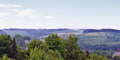
#### Scenic Views As you ascend to the higher elevations, you'll be rewarded with panoramic views of the Sauerland region. The highest point of the trail, at around 6 km (3.7 miles), offers a breathtaking vista of rolling hills and dense forests. This is an excellent spot for a break and some photography.
### Navigation and Safety The trail is well-marked with W1 signs, but it's always a good idea to have a reliable navigation tool. HiiKER is highly recommended for this purpose, offering detailed maps and real-time tracking. The trail can be muddy and slippery after rain, so sturdy hiking boots are essential. Also, bring sufficient water and snacks, as there are limited facilities along the route.
### Historical Significance The Hochsauerlandkreis region has a rich history dating back to medieval times. The area was historically significant for its iron ore mining and milling industries. The remnants of these industries can still be seen along the trail, adding a layer of historical intrigue to your hike.
### Final Stretch The last few kilometers of the trail take you through picturesque farmland and back into the village of Wenholthausen. This section is relatively flat and offers a relaxing end to your hike. As you approach the village, you'll pass by traditional half-timbered houses, giving you a sense of the local culture and architecture.
By the time you complete the loop, you'll have experienced a diverse range of landscapes, historical sites, and natural beauty, making the Wenholthausen Rundweg W1 a memorable hiking adventure.
Reviews
User comments, reviews and discussions about the Wenholthausen Rundweg W1, Germany.
0.0
average rating out of 5
0 rating(s)


