9.9 km
~2 hrs 38 min
401 m
“A captivating 10 km loop with scenic vistas, diverse wildlife, and rich historical significance in Mason County.”
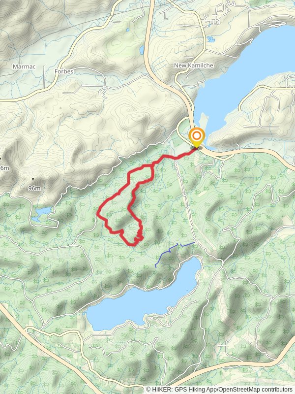
Starting near Mason County, Washington, the Bay View and Mimzie Ridge trail is a captivating 10 km (6.2 miles) loop with an elevation gain of approximately 400 meters (1,312 feet). This medium-difficulty trail offers a blend of scenic vistas, diverse wildlife, and historical significance, making it a rewarding experience for hikers.
### Getting There To reach the trailhead, you can drive or use public transport. If driving, head towards Mason County, Washington, and look for the nearest known address or landmark, which is the Mason County Transit Authority. From there, follow local signage to the trailhead. For those using public transport, the Mason County Transit Authority provides bus services that can get you close to the starting point. Check their schedule for the most convenient route.
### Trail Overview The trail begins with a gentle ascent through a lush forest, where you'll be surrounded by towering Douglas firs and Western hemlocks. As you progress, the path becomes steeper, leading you to the first significant landmark, Bay View Point, approximately 3 km (1.9 miles) into the hike. Here, you can take a break and enjoy panoramic views of the bay, with the Olympic Mountains serving as a stunning backdrop.
### Wildlife and Flora Keep an eye out for local wildlife, including black-tailed deer, bald eagles, and various songbirds. The area is also rich in flora, with seasonal wildflowers like trilliums and lupines adding splashes of color to the landscape.
### Mimzie Ridge Continuing from Bay View Point, the trail ascends further to Mimzie Ridge, the highest point of the hike at around 5 km (3.1 miles). The ridge offers sweeping views of the surrounding valleys and distant peaks. This section of the trail is more exposed, so be prepared for varying weather conditions.
### Historical Significance The region has a rich history, with evidence of Native American presence dating back thousands of years. The trail itself was used by early settlers and loggers, and remnants of old logging equipment can still be seen along the path. Interpretive signs provide insights into the area's past, making the hike both a physical and educational journey.
### Navigation and Safety Given the trail's moderate difficulty, it's advisable to use a reliable navigation tool like HiiKER to stay on track. The trail is well-marked, but having a digital map can be invaluable, especially in foggy or low-visibility conditions.
### Final Stretch The descent from Mimzie Ridge is gradual, taking you through a series of switchbacks that lead back into the forest. The final 2 km (1.2 miles) of the trail loop back to the starting point, offering a serene walk through dense woodland, where you might spot more wildlife and enjoy the tranquility of the forest.
This trail offers a balanced mix of natural beauty, wildlife, and historical context, making it a must-visit for any hiking enthusiast.
Reviews
User comments, reviews and discussions about the Bay View and Mimzie Ridge, Washington.
0.0
average rating out of 5
0 rating(s)


