East Fork Lewis River via Bells Mountain Trail
29.9 km
~1 day 3 hrs
1328 m
“Explore lush forests, historical landmarks, and breathtaking summit views on the rewarding Bells Mountain Trail.”
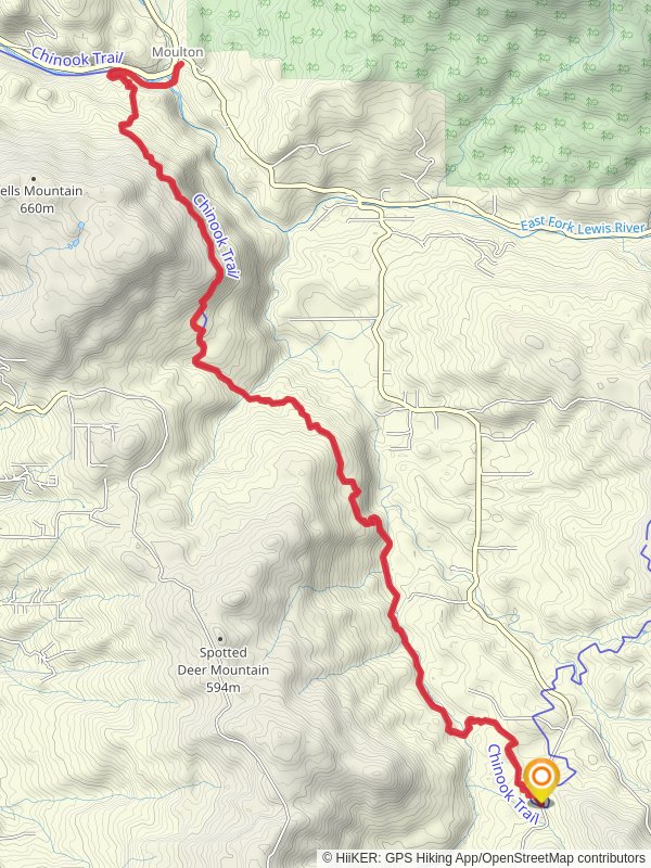
Starting near Clark County, Washington, the East Fork Lewis River via Bells Mountain Trail offers a rewarding out-and-back hike that spans approximately 30 kilometers (18.6 miles) with an elevation gain of around 1300 meters (4265 feet). This trail is rated as medium difficulty, making it suitable for moderately experienced hikers.
### Getting There To reach the trailhead, you can drive or use public transportation. If driving, head towards Moulton Falls Regional Park, which is a well-known landmark near the trailhead. For those using public transport, the nearest major city is Vancouver, Washington. From Vancouver, you can take a bus to Battle Ground, and then a taxi or rideshare service to Moulton Falls Regional Park.
### Trail Overview The trail begins near Moulton Falls Regional Park, a picturesque area known for its scenic waterfalls and lush greenery. As you start your hike, you'll follow the Bells Mountain Trail, which gradually ascends through dense forest. The first few kilometers are relatively gentle, allowing you to acclimate to the terrain.
### Key Landmarks and Sections - Moulton Falls (0 km / 0 miles): The trailhead is near this beautiful waterfall, a perfect spot to take some initial photos and enjoy the serene environment. - Yacolt Burn State Forest (5 km / 3.1 miles): As you progress, you'll enter the Yacolt Burn State Forest. This area is rich in history, having been the site of a massive forest fire in 1902. The forest has since regenerated, offering a mix of young and mature trees. - Cedar Creek (10 km / 6.2 miles): Around the 10-kilometer mark, you'll encounter Cedar Creek. This is a good spot to take a break and enjoy the sound of flowing water. The elevation gain starts to become more noticeable from this point. - Bells Mountain Summit (15 km / 9.3 miles): The trail reaches its highest point at Bells Mountain Summit. Here, you'll be rewarded with panoramic views of the surrounding landscape, including glimpses of the East Fork Lewis River. This is the turnaround point for the out-and-back hike.
### Flora and Fauna The trail is abundant with diverse plant life, including Douglas fir, western red cedar, and various ferns. Wildlife is also plentiful; keep an eye out for deer, elk, and a variety of bird species. The area is particularly known for its vibrant wildflowers in the spring and early summer.
### Navigation and Safety Given the trail's moderate difficulty, it's advisable to use a reliable navigation tool like HiiKER to stay on track. The trail is well-marked, but having a digital map can be very helpful, especially in areas where the path may be less clear.
### Historical Significance The Yacolt Burn State Forest is a significant historical site due to the 1902 fire, which was one of the largest in Washington's history. The forest's recovery over the past century is a testament to nature's resilience and offers a unique opportunity to witness ecological succession firsthand.
### Final Stretch As you make your way back, you'll retrace your steps, descending gradually and enjoying the downhill sections. The return journey offers a different perspective of the landscape, allowing you to appreciate the trail's beauty from another angle.
This hike is a fantastic way to experience the natural beauty and historical significance of the Clark County region. Make sure to pack plenty of water, snacks, and a first-aid kit, and always practice Leave No Trace principles to keep the trail pristine for future hikers.
Reviews
User comments, reviews and discussions about the East Fork Lewis River via Bells Mountain Trail, Washington.
5.0
average rating out of 5
13 rating(s)


