Download
3D Flyover
Add to list
More
51.2 km
~3 days
1556 m
Multi-Day
“Embark on the Llangollen Circular Trail, a historical and scenic Welsh adventure with diverse terrain and captivating wildlife.”
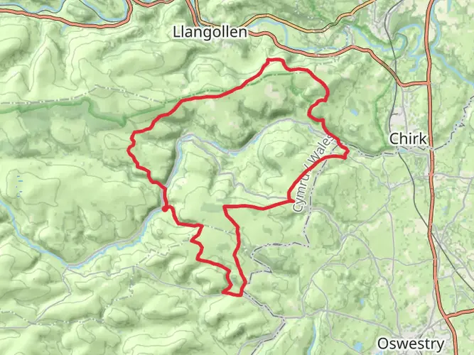
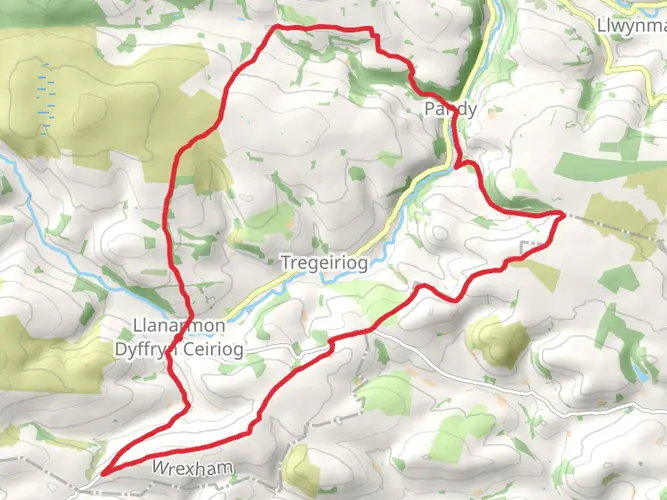
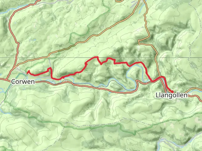
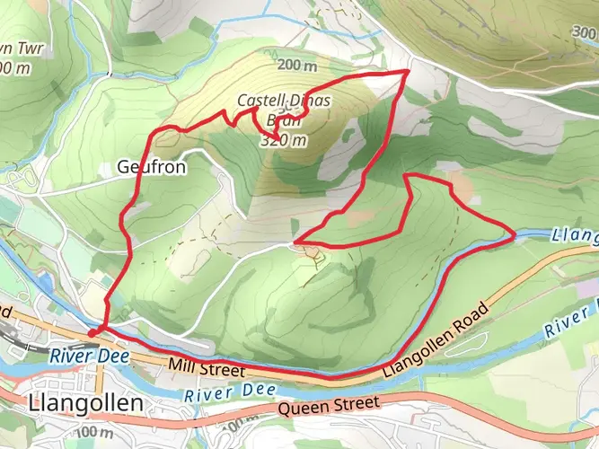
The Llangollen Circular Trail is a captivating journey that spans approximately 51 kilometers (around 31.7 miles) with an elevation gain of roughly 1500 meters (about 4921 feet), offering hikers a medium difficulty level trek. This loop trail is nestled near the town of Wrexham in Wales, providing a rich tapestry of historical landmarks, stunning natural beauty, and diverse wildlife.
Getting to the Trailhead
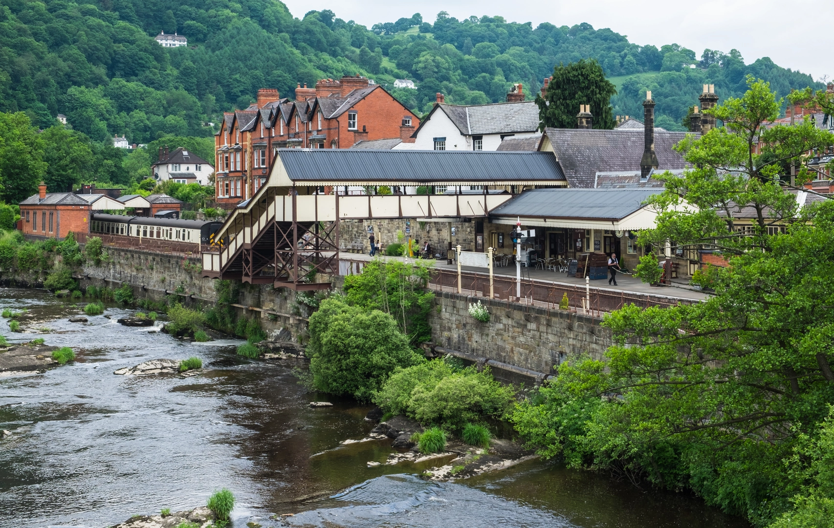
To reach the trailhead, hikers can drive to the vicinity of Wrexham, where parking is available. For those preferring public transport, buses and trains serve the area, with the nearest stations being in Llangollen itself. From there, local buses or a short taxi ride can bring you to the starting point of the trail.
Navigating the Trail
As you embark on the Llangollen Circular Trail, it's advisable to use a reliable navigation tool like HiiKER to keep track of your progress and ensure you're on the right path. The trail is well-marked, but having a digital map can be invaluable, especially in areas where the trail may become less distinct.
Historical Significance and Landmarks
The region is steeped in history, with the trail offering views of the UNESCO World Heritage Site of the Pontcysyllte Aqueduct. This remarkable feat of engineering, completed in the early 19th century, carries the Llangollen Canal over the River Dee valley. Hikers will also encounter the remains of Castell Dinas Brân, a medieval castle perched high above Llangollen, offering panoramic views of the surrounding landscape.
Natural Beauty and Wildlife
The trail traverses a variety of terrains, from serene riverbanks to rugged heathland. The Clwydian Range and Dee Valley Area of Outstanding Natural Beauty are highlights, showcasing the region's geological diversity and providing habitats for a wide array of wildlife. Keep an eye out for birds of prey, such as peregrine falcons, and the rare black grouse.
Trail Experience
The first section of the trail takes you along the River Dee, where the gentle sound of flowing water accompanies you. As you ascend into the hills, the path becomes more challenging, with some steep sections that contribute to the overall elevation gain. The descent back towards Llangollen offers a different perspective, with lush valleys and the historical Horseshoe Falls, a man-made weir designed by Thomas Telford.
Preparation and Planning
Before setting out, ensure you have adequate water, food, and clothing for the trail's conditions. Weather can change rapidly in the Welsh hills, so waterproof gear and layered clothing are essential. It's also wise to inform someone of your hiking plans and expected return time.
Conclusion
The Llangollen Circular Trail is a journey through time, nature, and the picturesque landscapes of Wales. With its historical significance and natural wonders, it promises an enriching experience for every hiker who traverses its path.

What to expect?
Activity types
Comments and Reviews
User comments, reviews and discussions about the Llangollen Circular Trail, Wales.
4.5
average rating out of 5
60 rating(s)