Celtic Way trail stages
stage 1
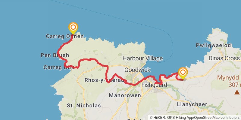
Starting at: Pembrokeshire, SA64 0JL
Ending at: Fishguard, Pembrokeshire, SA65 9SR
Distance: 19.1 km
Elevation gain: 704 m
Duration: 04:59:58
stage 2
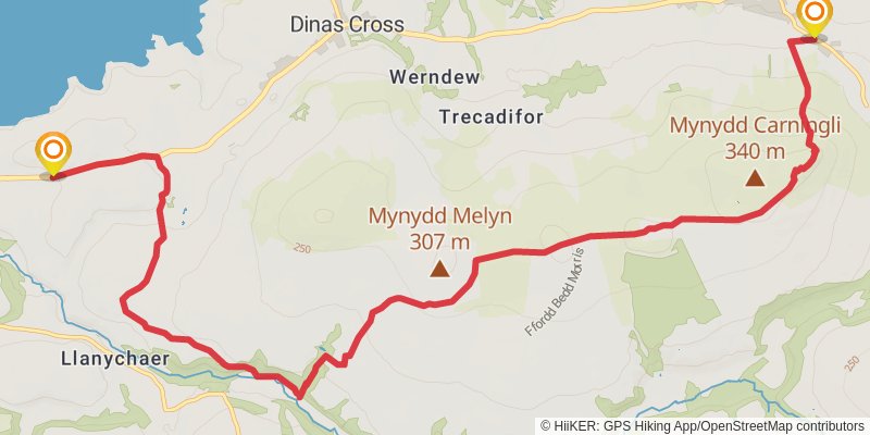
Starting at: Pembrokeshire, SA65 9SR
Ending at: Newport, Pembrokeshire, SA42 0QF
Distance: 14.1 km
Elevation gain: 413 m
Duration: 03:30:52
stage 3
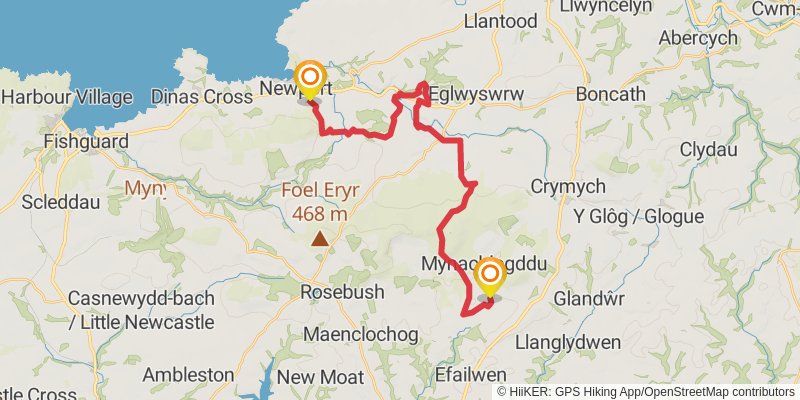
Starting at: Pembrokeshire, SA42 0QF
Ending at: Mynachlogddu, Pembrokeshire, SA66 7RU
Distance: 27.0 km
Elevation gain: 706 m
Duration: 06:35:02
stage 4
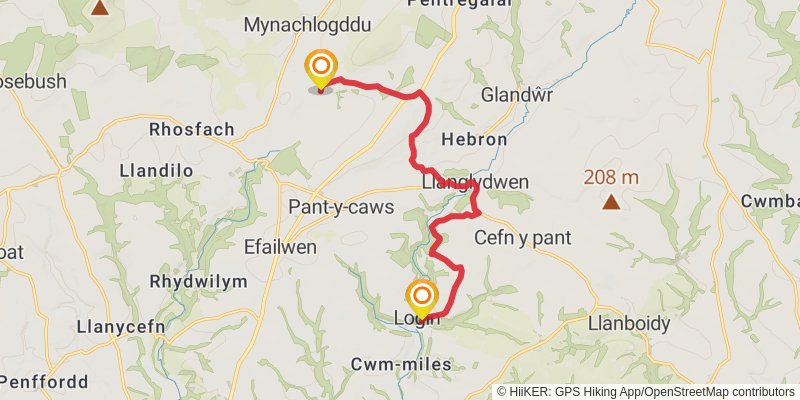
Starting at: Mynachlogddu, Pembrokeshire, SA66 7RU
Ending at: Login, Carmarthenshire, SA34 0TH
Distance: 11.8 km
Elevation gain: 251 m
Duration: 02:46:36
stage 5
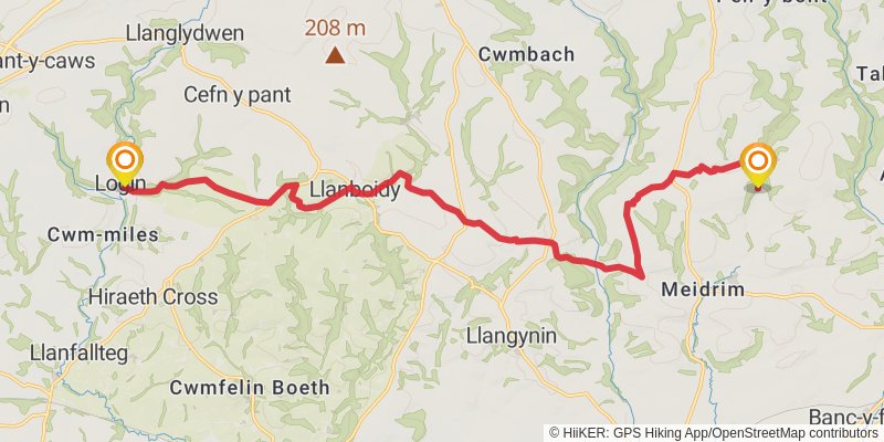
Starting at: Login, Carmarthenshire, SA34 0TH
Ending at: Meidrim, Carmarthenshire, SA33 5PD
Distance: 18.8 km
Elevation gain: 468 m
Duration: 04:32:35
stage 6
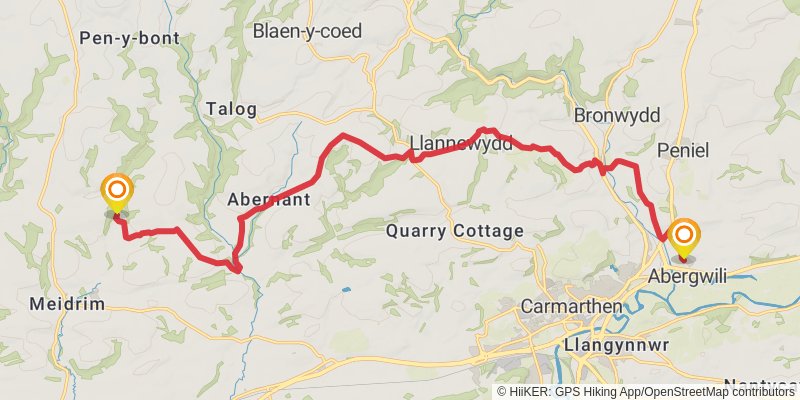
Starting at: Meidrim, Carmarthenshire, SA33 5PD
Ending at: Abergwili, Carmarthenshire, SA31 2JN
Distance: 20.6 km
Elevation gain: 492 m
Duration: 04:56:24
stage 7
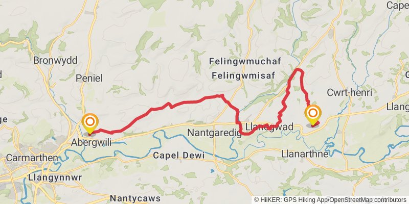
Starting at: Abergwili, Carmarthenshire, SA31 2JN
Ending at: Llanarthney, Carmarthenshire, SA32 8RG
Distance: 17.9 km
Elevation gain: 366 m
Duration: 04:11:25
stage 8
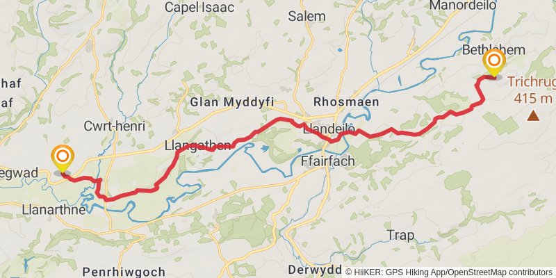
Starting at: Llanarthney, Carmarthenshire, SA32 8RG
Distance: 19.3 km
Elevation gain: 538 m
Duration: 04:45:29
stage 9
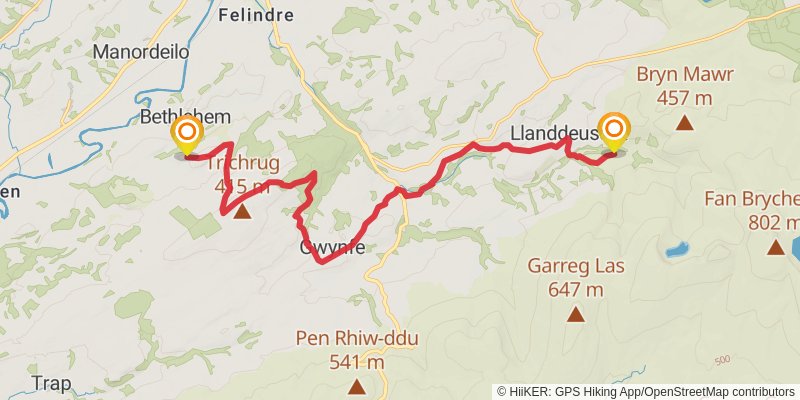
Starting at: Bethlehem, Carmarthenshire, SA19 6YW
Distance: 17.3 km
Elevation gain: 563 m
Duration: 04:23:58
stage 10
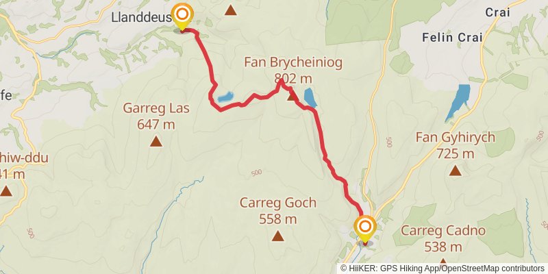
Starting at: Llanddeusant, Carmarthenshire, SA19 9UW
Ending at: Llywel, Powys, SA9 1GR
Distance: 13.5 km
Elevation gain: 715 m
Duration: 03:53:33
stage 11
stage 12
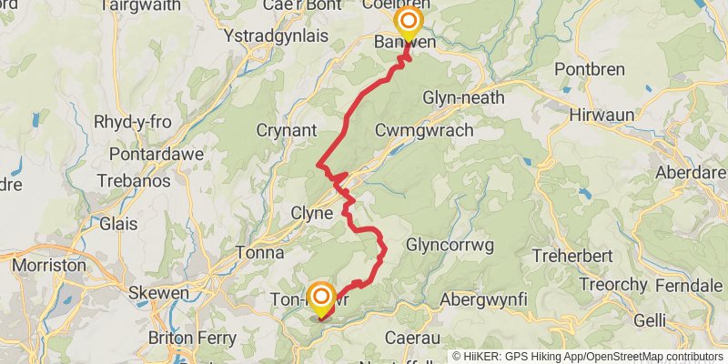
Starting at: Banwen, Neath Port Talbot, SA10 9LH
Distance: 24.6 km
Elevation gain: 794 m
Duration: 06:14:22
stage 13
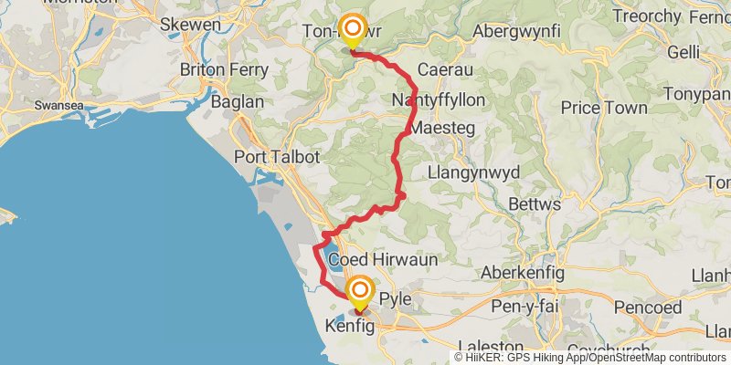
Starting at: Ton-Mawr, Neath Port Talbot, SA12 9SP
Distance: 23.9 km
Elevation gain: 549 m
Duration: 05:42:01
stage 14
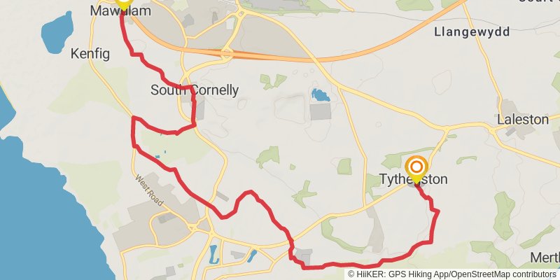
Starting at: Mawdlam, Bridgend County Borough, CF33 4PN
Distance: 12.5 km
Elevation gain: 136 m
Duration: 02:43:30
stage 15
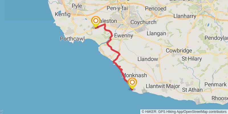
Starting at: Tythegston, Bridgend County Borough, CF32 0ND
Ending at: Marcross, Vale of Glamorgan, CF61 1ZH
Distance: 17.3 km
Elevation gain: 370 m
Duration: 04:05:02
stage 16
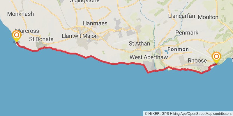
Starting at: Marcross, Vale of Glamorgan, CF61 1ZH
Distance: 18.9 km
Elevation gain: 303 m
Duration: 04:17:37
stage 17
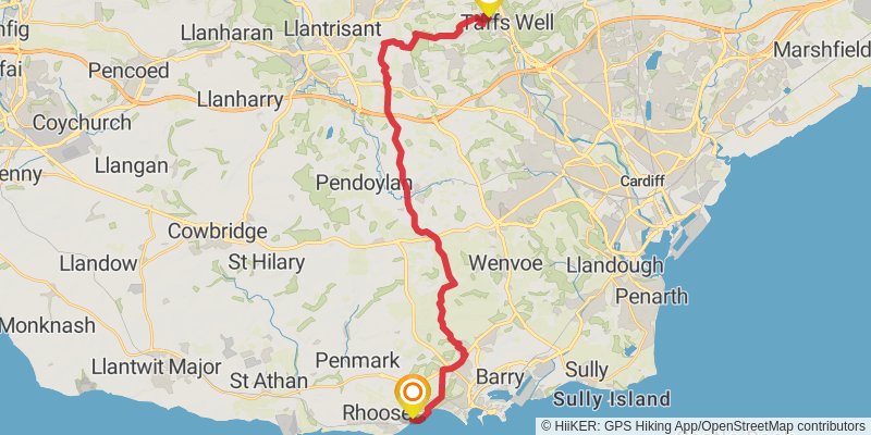
Starting at: Rhoose, Vale of Glamorgan, CF62 3ZP
Ending at: Gwaelod-y-garth, Cardiff, CF15 9HJ
Distance: 27.5 km
Elevation gain: 598 m
Duration: 06:29:58
stage 18
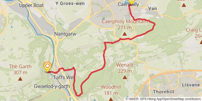
Starting at: Gwaelod-y-garth, Cardiff, CF15 9HP
Distance: 11.1 km
Elevation gain: 325 m
Duration: 02:46:03
stage 19
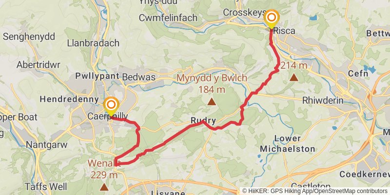
Starting at: Denscombe, Caerphilly County Borough, CF83 1UE
Ending at: Risca, Caerphilly County Borough, NP11 6GP
Distance: 17.4 km
Elevation gain: 510 m
Duration: 04:19:47
stage 20
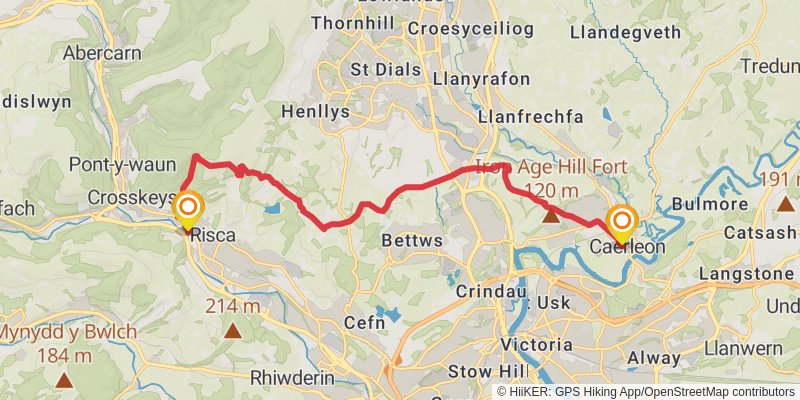
Starting at: Caerphilly County Borough, NP11 6GP
Ending at: Isca Augusta, Newport, Gwent, NP18 3QR
Distance: 15.5 km
Elevation gain: 546 m
Duration: 04:00:34
stage 21
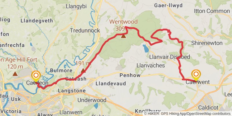
Starting at: Ultra Pontem, Newport, Gwent, NP18 3QR
Distance: 24.2 km
Elevation gain: 603 m
Duration: 05:51:18
stage 22
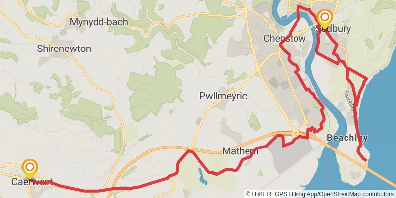
Starting at: Caerwent, Monmouthshire, NP26 5JJ
Ending at: Forest of Dean, Gloucestershire, NP16 7AE
Distance: 21.4 km
Elevation gain: 345 m
Duration: 04:51:41
stage 23
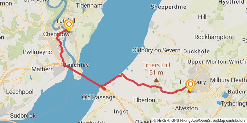
Starting at: Sedbury, Forest of Dean, Gloucestershire, NP16 7AE
Distance: 16.9 km
Elevation gain: 232 m
Duration: 03:45:42
stage 24
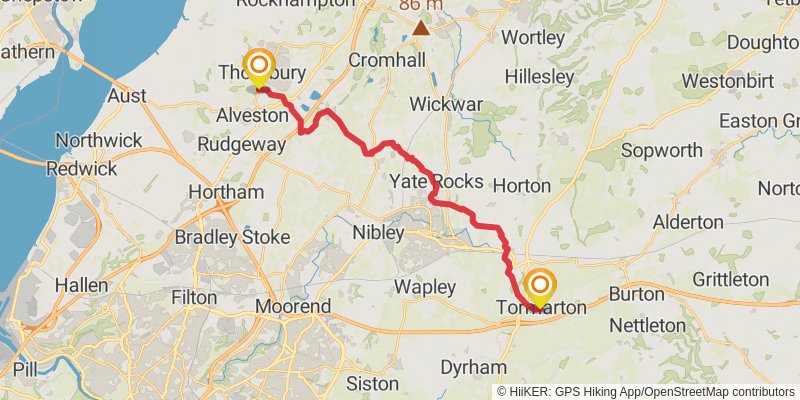
Starting at: Bristol, South Gloucestershire, BS35 2BX
Distance: 23.1 km
Elevation gain: 318 m
Duration: 05:08:47
stage 25
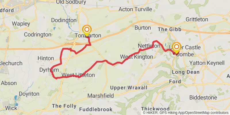
Starting at: Tormarton, South Gloucestershire, GL9 1HT
Distance: 20.2 km
Elevation gain: 281 m
Duration: 04:30:35
stage 26
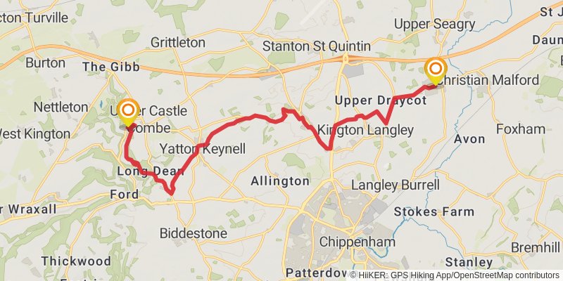
Starting at: Upper Castle Combe, Wiltshire, SN14 7HN
Ending at: Sutton Benger, Wiltshire, SN15 4RH
Distance: 17.6 km
Elevation gain: 192 m
Duration: 03:50:04
stage 27
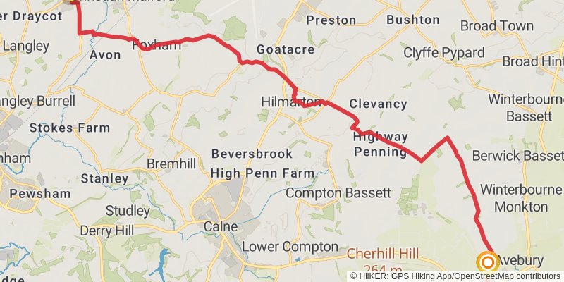
Starting at: Sutton Benger, Wiltshire, SN15 4RH
Distance: 22.2 km
Elevation gain: 291 m
Duration: 04:55:35
stage 28
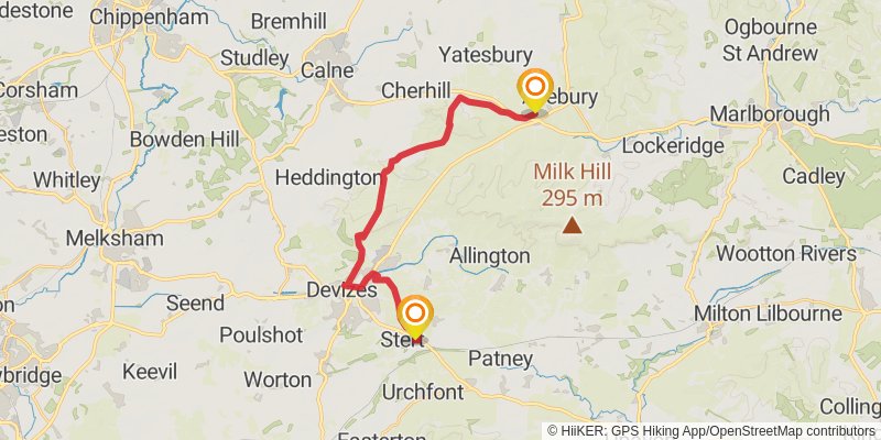
Starting at: Avebury, Wiltshire, SN8 1QU
Ending at: Stert, Wiltshire, SN10 3HY
Distance: 20.5 km
Elevation gain: 333 m
Duration: 04:39:17
stage 29
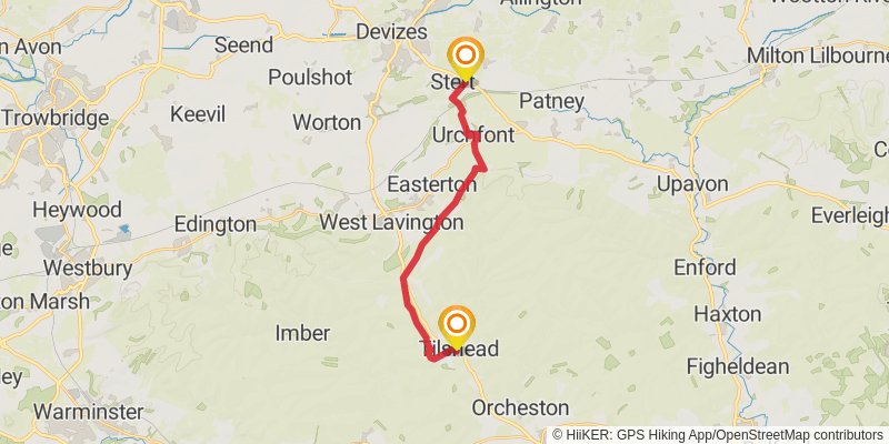
Starting at: Stert, Wiltshire, SN10 3JB
Ending at: Tilshead, Wiltshire, SP3 4RY
Distance: 16.2 km
Elevation gain: 206 m
Duration: 03:35:32
stage 30
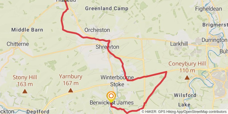
Starting at: Tilshead, Wiltshire, SP3 4RZ
Distance: 21.3 km
Elevation gain: 245 m
Duration: 04:40:33