6.6 km
~1 hrs 21 min
15 m
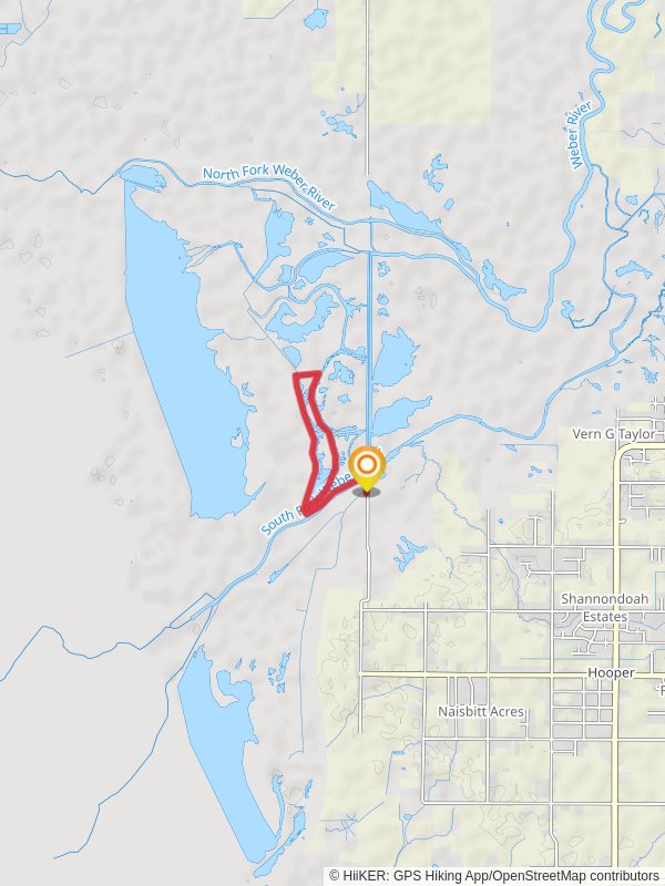
“The South Fork Weber River Loop offers a scenic, accessible 7 km hike with diverse landscapes and rich history.”
Starting your adventure near Weber County, Utah, the South Fork Weber River Loop is a delightful 7 km (approximately 4.3 miles) loop trail with no significant elevation gain, making it accessible for a wide range of hikers. The trailhead is conveniently located near the South Fork Campground, which serves as a great landmark for those driving in. If you're using public transport, the nearest major town is Ogden, Utah, from where you can catch a local bus or arrange a taxi to the campground.
### Trail Navigation and Terrain
The trail is well-marked and relatively flat, making it a medium difficulty hike primarily due to its length rather than challenging terrain. For navigation, HiiKER is an excellent tool to use, providing detailed maps and real-time updates. The path meanders through a mix of dense forest and open meadows, offering a variety of landscapes to enjoy.
### Flora and Fauna
As you hike, you'll be surrounded by a rich tapestry of flora. The trail is lined with towering pines and aspens, and during the spring and summer months, you'll find an array of wildflowers such as lupines and Indian paintbrush. Wildlife is abundant; keep an eye out for deer, elk, and a variety of bird species including hawks and woodpeckers. The South Fork Weber River itself is a haven for trout, so you might spot anglers trying their luck in the clear waters.
### Significant Landmarks
About 2 km (1.2 miles) into the hike, you'll come across a charming wooden bridge that spans the South Fork Weber River. This is a great spot for a quick rest and some photos. Another 3 km (1.9 miles) further along, you'll find a small, serene meadow that offers panoramic views of the surrounding mountains. This is an ideal place for a picnic or a short break.
### Historical Significance
The region around the South Fork Weber River Loop has a rich history. It was originally inhabited by the Shoshone people, who utilized the river and surrounding forests for sustenance. In the 19th century, the area became a significant route for trappers and later settlers moving westward. Remnants of old cabins and mining equipment can still be found off the beaten path, offering a glimpse into the past.
### Getting There
If you're driving, take I-84 East from Ogden and exit at the South Fork Campground. There is ample parking available at the trailhead. For those relying on public transport, Ogden is the nearest hub. From there, you can catch a local bus or arrange for a taxi or rideshare to take you to the South Fork Campground.
### Final Tips
Given the moderate difficulty and length of the trail, it's advisable to bring plenty of water, snacks, and a good pair of hiking boots. Weather can be unpredictable, so layers are recommended. Always check the trail conditions on HiiKER before setting out, and be mindful of local wildlife and natural features to ensure a safe and enjoyable hike.
Reviews
User comments, reviews and discussions about the South Fork Weber River Loop, Utah.
5.0
average rating out of 5
2 rating(s)


