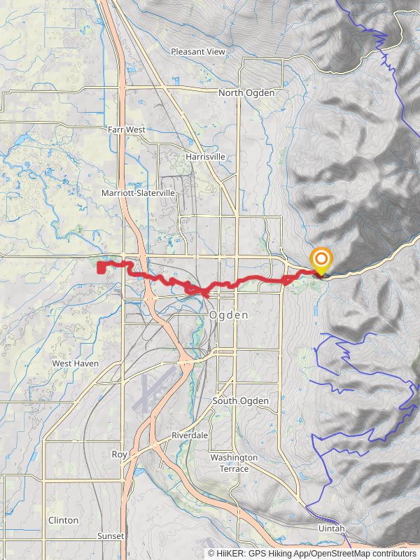
26.9 km
~1 day 0 hrs
160 m
“Explore the 27-kilometer Ogden River Parkway and West Haven Trail for scenic views and historical landmarks.”
Starting near Weber County, Utah, the Ogden River Parkway and West Haven Trail is a loop trail that spans approximately 27 kilometers (around 16.8 miles) with an elevation gain of about 100 meters (328 feet). This trail offers a medium difficulty rating, making it suitable for moderately experienced hikers.
### Getting There To reach the trailhead, you can drive or use public transportation. If driving, head towards the Ogden Nature Center, located at 966 W 12th St, Ogden, UT 84404. This is a convenient starting point with ample parking. For those using public transport, the Utah Transit Authority (UTA) provides bus services that can drop you off near the Ogden Nature Center. From there, it's a short walk to the trailhead.
### Trail Navigation For navigation, it's highly recommended to use HiiKER, which provides detailed maps and real-time updates. The trail is well-marked, but having a reliable navigation tool will enhance your hiking experience.
### Trail Highlights The trail meanders along the Ogden River, offering picturesque views of the waterway and surrounding landscapes. Early on, you'll pass through lush riparian zones teeming with wildlife such as deer, beavers, and a variety of bird species. Keep an eye out for the Great Blue Heron, often seen fishing along the riverbanks.
### Historical Significance The region has a rich history, with the Ogden River playing a crucial role in the development of the area. The river was named after Peter Skene Ogden, a fur trapper and explorer for the Hudson's Bay Company in the early 19th century. The trail itself follows parts of the old rail lines that were once vital for transporting goods and people across the region.
### Key Landmarks - Ogden Nature Center (0 km / 0 miles): Starting point with educational exhibits and nature programs. - Fort Buenaventura (4 km / 2.5 miles): A historical site where you can explore reconstructed fort buildings and learn about early settlers. - Kayak Park (8 km / 5 miles): A popular spot for water sports enthusiasts, offering a chance to see kayakers navigating the river's rapids. - West Haven Trail Junction (13.5 km / 8.4 miles): Midway point where the trail intersects with the West Haven Trail, providing options for extending your hike.
### Flora and Fauna The trail is abundant with native plants such as cottonwoods, willows, and various wildflowers, especially vibrant in the spring and summer months. Wildlife sightings are common, so bring binoculars for birdwatching and a camera to capture the scenic beauty.
### Trail Conditions and Safety The trail surface varies from paved sections to dirt paths, so wear appropriate footwear. While the elevation gain is modest, some sections can be steep and may require careful footing. Always carry sufficient water, snacks, and a basic first aid kit. Weather can change rapidly, so check forecasts and dress in layers.
### Accessibility The trail is accessible year-round, but the best times to hike are during the spring and fall when temperatures are moderate. Winter hikes are possible but be prepared for icy conditions and potentially snow-covered paths.
By following these guidelines and using HiiKER for navigation, you'll be well-prepared to enjoy the Ogden River Parkway and West Haven Trail.
Reviews
User comments, reviews and discussions about the Ogden River Parkway and West Haven Trail, Utah.
0.0
average rating out of 5
0 rating(s)


