6.4 km
~2 hrs 21 min
651 m
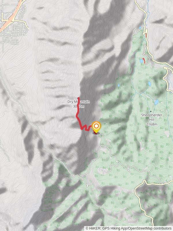
“Explore the scenic and historically rich Dry Mountain Trail, a rewarding 6 km loop in Utah County.”
Starting near Utah County, Utah, the Dry Mountain Trail is a 6 km (approximately 3.7 miles) loop with an elevation gain of around 600 meters (about 1,968 feet). This medium-difficulty trail offers a rewarding experience for hikers looking to explore the natural beauty and historical significance of the region.
### Getting There To reach the trailhead, you can drive or use public transport. If driving, head towards the nearest known landmark, the Dry Mountain Trailhead Parking Lot, located off of West 8000 South in Utah County. For those using public transport, the nearest bus stop is at the intersection of West 8000 South and South 1300 West, from where you can walk to the trailhead.
### Trail Overview The trail begins with a gentle ascent through a mixed forest of pinyon pines and junipers. As you progress, the path becomes steeper, offering panoramic views of the surrounding valleys and distant mountain ranges. The first significant landmark is a large rock outcrop approximately 1.5 km (0.9 miles) into the hike, which provides an excellent spot for a short break and some photography.
### Flora and Fauna The Dry Mountain Trail is home to a variety of plant and animal species. Keep an eye out for mule deer, which are commonly seen grazing in the early morning and late afternoon. Birdwatchers will enjoy spotting species such as the Mountain Bluebird and the Western Tanager. The trail is also adorned with wildflowers during the spring and early summer months, including Indian paintbrush and lupine.
### Historical Significance This region holds historical significance dating back to the Native American tribes who once inhabited the area. Artifacts and petroglyphs have been found nearby, offering a glimpse into the lives of the early inhabitants. Additionally, the trail passes near the remnants of an old mining operation from the late 19th century, approximately 3 km (1.86 miles) into the hike. This site provides an interesting historical context and a tangible connection to the past.
### Navigation and Safety Given the elevation gain and the sometimes rugged terrain, it's advisable to use a reliable navigation tool like HiiKER to stay on track. The trail is well-marked, but having a digital map can be very helpful, especially in areas where the path may be less distinct.
### Final Stretch As you near the end of the loop, the trail descends gradually, offering a different perspective of the landscape. The final 1 km (0.62 miles) is relatively easy, allowing you to cool down and reflect on the hike. The loop brings you back to the trailhead, where you can rest and enjoy the satisfaction of completing this scenic and historically rich trail.
Reviews
User comments, reviews and discussions about the Dry Mountain Trail, Utah.
0.0
average rating out of 5
0 rating(s)


