19.6 km
~1 day 0 hrs
1113 m
“Explore diverse landscapes and rich history on this 20-kilometer trail near Tooele County, Utah.”
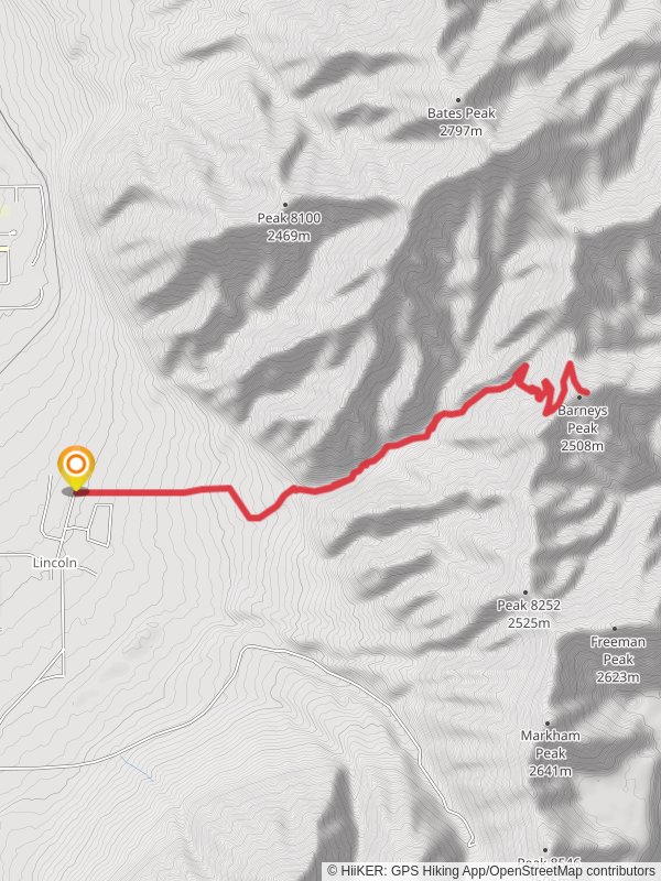
Starting near Tooele County, Utah, this out-and-back trail spans approximately 20 kilometers (12.4 miles) with an elevation gain of around 1100 meters (3609 feet). The trailhead is accessible by car, and the nearest significant landmark is the Tooele Army Depot. Public transport options are limited, so driving is the most practical way to reach the starting point.
### Trail Overview
The trail begins with a gentle ascent through a mix of sagebrush and juniper, offering expansive views of the surrounding Tooele Valley. As you progress, the trail becomes steeper, winding through dense pine forests. At around the 5-kilometer (3.1-mile) mark, you'll encounter the first significant elevation gain, climbing approximately 300 meters (984 feet) over a series of switchbacks.
### Key Landmarks and Points of Interest
#### Pass Canyon
At roughly 8 kilometers (5 miles) in, you'll reach Pass Canyon, a narrow gorge flanked by towering rock formations. This section is particularly scenic, with opportunities to spot local wildlife such as mule deer and various bird species. The canyon walls are adorned with ancient petroglyphs, offering a glimpse into the region's rich Native American history.
#### Barneys Peak
Continuing onward, the trail ascends sharply towards Barneys Peak. The final 2 kilometers (1.2 miles) involve a strenuous climb, gaining about 400 meters (1312 feet) in elevation. Upon reaching the summit, you'll be rewarded with panoramic views of the Great Salt Lake and the Oquirrh Mountains. This is an excellent spot for a rest and some photography.
### Flora and Fauna
The trail traverses diverse ecosystems, from arid scrublands to lush alpine meadows. In spring and early summer, wildflowers such as Indian paintbrush and lupine are in full bloom. Keep an eye out for local fauna, including coyotes, bobcats, and a variety of raptors.
### Navigation and Safety
Given the trail's moderate difficulty, it's advisable to use a reliable navigation tool like HiiKER to stay on course. The trail is well-marked, but weather conditions can change rapidly, especially at higher elevations. Carry sufficient water, snacks, and layers of clothing to adapt to varying temperatures.
### Historical Significance
The region around Tooele County has a storied past, from its Native American heritage to its role in the westward expansion of the United States. The nearby Tooele Army Depot, established during World War II, adds a layer of modern historical significance to the area.
### Getting There
To reach the trailhead, drive towards the Tooele Army Depot and follow local signage to the designated parking area. Ensure your vehicle is parked in a safe and legal spot before beginning your hike. Public transport options are sparse, so car travel is recommended.
This trail offers a blend of natural beauty, challenging terrain, and historical intrigue, making it a rewarding experience for hikers of all levels.
Reviews
User comments, reviews and discussions about the Pass Canyon and Barneys Peak Walk, Utah.
0.0
average rating out of 5
0 rating(s)


