5.3 km
~1 hrs 51 min
480 m
“The Honaker Trail offers stunning views, historical intrigue, and moderate challenges for adventurous hikers.”
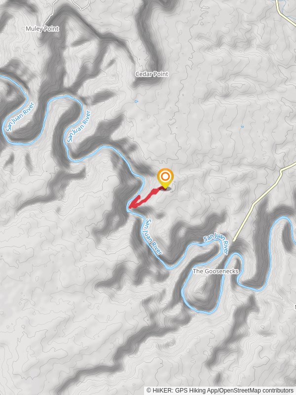
Starting near San Juan County, Utah, the Honaker Trail offers a unique hiking experience with a distance of around 5 km (3.1 miles) and an elevation gain of approximately 400 meters (1,312 feet). This out-and-back trail is estimated to be of medium difficulty, making it suitable for moderately experienced hikers.
### Getting There To reach the trailhead, you can drive or use public transport. If driving, head towards the town of Mexican Hat, Utah. From there, take the US-163 N and turn onto Honaker Trail Road. The trailhead is located near the San Juan River, close to the Goosenecks State Park. For those relying on public transport, the nearest major bus stop is in Bluff, Utah, from where you can arrange a taxi or shuttle service to the trailhead.
### Trail Overview The trail begins with a descent into the canyon, offering stunning views of the San Juan River below. The initial section is relatively steep, so be prepared for a challenging start. As you descend, you'll notice the unique geological formations that make this area famous. The trail is well-marked, but it's advisable to use HiiKER for navigation to ensure you stay on the correct path.
### Significant Landmarks and Nature At approximately 1 km (0.6 miles) into the hike, you'll encounter a series of switchbacks that provide breathtaking panoramic views of the canyon. These switchbacks are a great spot for photography, so have your camera ready. Continuing down, you'll reach a flat section around 2 km (1.2 miles) in, where you can take a break and enjoy the serene environment.
### Historical Significance The Honaker Trail is not just a natural wonder but also a historical one. It was originally constructed in the late 19th century by gold prospectors seeking fortune in the San Juan River. Remnants of their efforts can still be seen along the trail, including old mining equipment and makeshift shelters. This adds a layer of historical intrigue to your hike, making it a journey through both time and nature.
### Wildlife and Flora The trail is home to a variety of wildlife, including mule deer, bighorn sheep, and various bird species. Keep an eye out for these animals, especially in the early morning or late afternoon. The flora is equally diverse, with desert plants like yucca, sagebrush, and various cacti dotting the landscape. Springtime hikers will be treated to a display of wildflowers, adding a splash of color to the arid surroundings.
### Final Stretch As you approach the 4 km (2.5 miles) mark, the trail levels out and follows the riverbank. This section is less strenuous and offers a peaceful end to your hike. The turnaround point is a great spot to relax, have a snack, and take in the beauty of the San Juan River before making your way back up the trail.
### Preparation Tips Given the elevation change and the arid climate, it's crucial to bring plenty of water and wear appropriate footwear. The trail can be slippery in places, especially after rain, so take care with your footing. Using HiiKER for real-time navigation and updates is highly recommended to ensure a safe and enjoyable hike.
This trail offers a blend of natural beauty, historical significance, and moderate physical challenge, making it a rewarding experience for those who undertake it.
Reviews
User comments, reviews and discussions about the Honaker Trail, Utah.
0.0
average rating out of 5
0 rating(s)


