5.9 km
~1 hrs 42 min
320 m
“An invigorating 6-kilometer hike near Salt Lake County offering stunning views and moderate difficulty for seasoned hikers.”
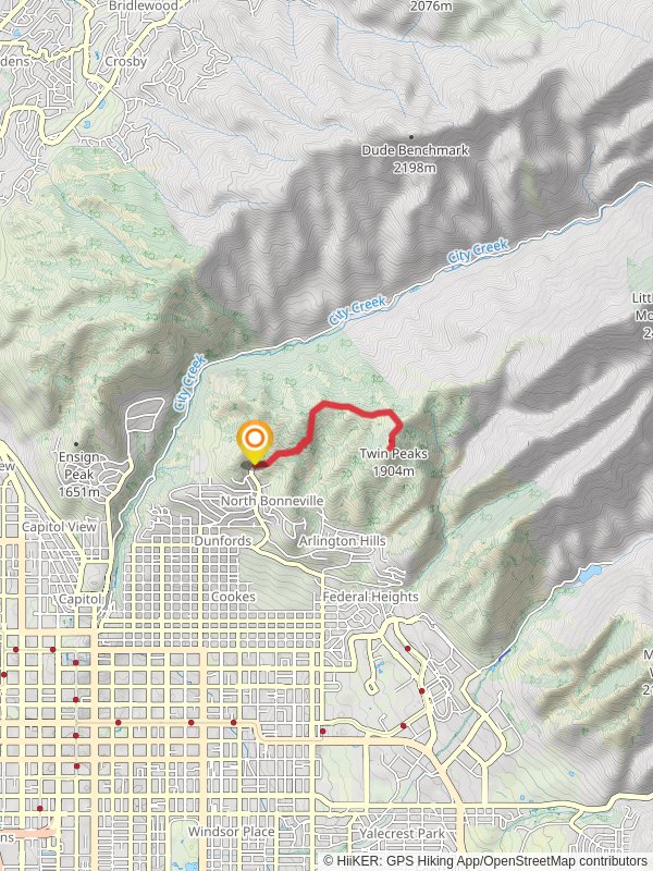
Starting near Salt Lake County, Utah, the Terrace Hills East Trail and Twin Peaks Trail is an invigorating out-and-back hike that spans approximately 6 kilometers (around 3.7 miles) with an elevation gain of about 300 meters (roughly 984 feet). This trail is rated as medium difficulty, making it suitable for moderately experienced hikers.
### Getting There To reach the trailhead, you can drive or use public transportation. If driving, head towards the Terrace Hills Drive area in Salt Lake City. The nearest significant landmark is the Terrace Hills Trailhead, located at the end of Terrace Hills Drive. For those using public transport, you can take a bus to the intersection of 11th Avenue and Terrace Hills Drive, and then walk a short distance to the trailhead.
### Trail Overview The trail begins with a steady ascent, offering panoramic views of the Salt Lake Valley almost immediately. As you climb, you'll notice the terrain is a mix of dirt paths and rocky sections, so sturdy hiking boots are recommended. The first kilometer (0.6 miles) gains about 100 meters (328 feet) in elevation, providing a good warm-up for the more challenging sections ahead.
### Significant Landmarks and Nature At around the 2-kilometer (1.2-mile) mark, you'll encounter a fork in the trail. Taking the left path leads you towards the Twin Peaks, while the right path continues along the Terrace Hills East Trail. The Twin Peaks offer a more strenuous climb but reward you with breathtaking views of the Wasatch Range and the Great Salt Lake. This section adds another 100 meters (328 feet) in elevation over the next kilometer (0.6 miles).
### Flora and Fauna The trail is rich in native flora, including sagebrush, juniper, and various wildflowers that bloom in the spring and early summer. Wildlife is abundant; you might spot mule deer, red-tailed hawks, and even the occasional rattlesnake, so be cautious and respectful of the natural habitat.
### Historical Significance This region holds historical significance as part of the larger Wasatch Range, which has been a vital area for Native American tribes, early settlers, and miners. The trails were originally used by indigenous peoples for hunting and later by settlers for accessing higher elevations.
### Navigation and Safety Given the trail's moderate difficulty and varying terrain, it's advisable to use a reliable navigation tool like HiiKER to keep track of your progress and ensure you stay on the correct path. The trail is well-marked, but having a digital map can provide extra assurance.
### Final Stretch As you approach the final kilometer (0.6 miles) of the trail, the path levels out slightly, making for a more relaxed descent back to the trailhead. The return journey offers a different perspective of the landscape, with the setting sun casting long shadows over the valley if you're hiking in the late afternoon.
This trail offers a balanced mix of physical challenge and natural beauty, making it a rewarding experience for those looking to explore the scenic landscapes near Salt Lake County.
Reviews
User comments, reviews and discussions about the Terrace Hills East Trail and Twin Peaks Trail, Utah.
0.0
average rating out of 5
0 rating(s)


