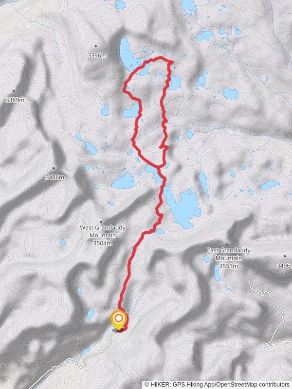
22.3 km
~1 day 0 hrs
706 m
“Discover diverse landscapes, wildlife, and ancient petroglyphs on the moderately challenging Hades Rock Sea Pass Trail.”
Starting near Duchesne County, Utah, the Hades Rock Sea Pass Trail and Pine Island Loop Trail offers a captivating 22 km (approximately 13.7 miles) journey through diverse landscapes with an elevation gain of around 700 meters (2,297 feet). This loop trail is rated as medium difficulty, making it suitable for moderately experienced hikers.
### Getting There To reach the trailhead, you can drive or use public transport. If driving, head towards Duchesne County, Utah, and look for the nearest known landmark, the Duchesne County Fairgrounds. From there, follow local signage to the trailhead. For those using public transport, the nearest bus stop is at the Duchesne County Fairgrounds, from where you can either hike or take a short taxi ride to the trailhead.
### Trail Overview The trail begins with a gentle ascent, allowing hikers to acclimate to the terrain. The initial 3 km (1.9 miles) meander through a dense forest of pines and aspens, providing ample shade and a serene atmosphere. As you progress, the trail opens up to reveal stunning vistas of the surrounding valleys and distant mountain ranges.
### Significant Landmarks and Nature Around the 5 km (3.1 miles) mark, you'll encounter Hades Rock, a prominent geological formation that offers a great spot for a short break and photo opportunities. The rock's unique striations and colors are a testament to the area's rich geological history.
Continuing on, the trail ascends more steeply, gaining approximately 300 meters (984 feet) over the next 4 km (2.5 miles). This section can be challenging, but the effort is rewarded with panoramic views from the Sea Pass. Here, you can see the vast expanse of the Uinta Basin and, on clear days, even spot the distant peaks of the Uinta Mountains.
### Wildlife and Flora The trail is home to a variety of wildlife, including mule deer, elk, and occasionally black bears. Birdwatchers will delight in spotting species such as the mountain bluebird and the golden eagle. The flora is equally diverse, with wildflowers like Indian paintbrush and lupine adding splashes of color during the spring and summer months.
### Historical Significance This region holds historical significance, particularly for the Ute Tribe, who have inhabited the area for centuries. The trail passes near several ancient petroglyph sites, which are protected and should be respected by all visitors. These petroglyphs offer a glimpse into the rich cultural heritage of the indigenous people.
### Navigation and Safety Given the trail's moderate difficulty and varying terrain, it's advisable to use a reliable navigation tool like HiiKER to stay on track. The app provides detailed maps and real-time updates, ensuring you don't miss any key waypoints or landmarks.
### Final Stretch The final 5 km (3.1 miles) of the trail loop back towards the starting point, descending gradually through a mixed forest. This section is less strenuous, allowing you to enjoy the tranquil surroundings and reflect on the journey.
### Preparation Tips Ensure you carry enough water, especially during the hotter months, as water sources along the trail can be scarce. Sturdy hiking boots are recommended due to the rocky and uneven terrain. Always check the weather forecast before heading out, as conditions can change rapidly in this region.
By following these guidelines and being well-prepared, hikers can fully enjoy the natural beauty and historical richness of the Hades Rock Sea Pass Trail and Pine Island Loop Trail.
Reviews
User comments, reviews and discussions about the Hades Rock Sea Pass Trail and Pine Island Loop Trail, Utah.
0.0
average rating out of 5
0 rating(s)


