Deep Canyon, Stewart Pass and Rattlesnake Canyon Trail
17.9 km
~1 day 1 hrs
1540 m
“Embark on a scenic 18 km hike through Utah's diverse terrains from Deep Canyon to Rattlesnake Canyon!”
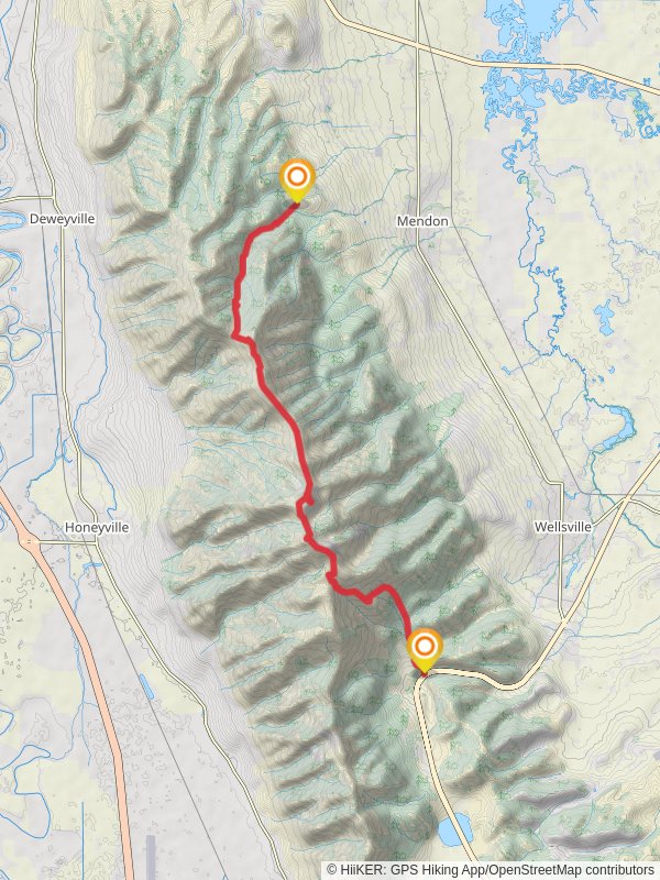
Starting your adventure near Cache County, Utah, the Deep Canyon, Stewart Pass, and Rattlesnake Canyon Trail offers an 18 km (approximately 11.2 miles) journey through diverse landscapes with an elevation gain of around 1500 meters (4921 feet). This point-to-point trail is rated as medium difficulty, making it suitable for moderately experienced hikers.
### Getting There To reach the trailhead, you can drive or use public transportation. If driving, head towards Logan, Utah, and follow signs to Cache County. The nearest significant landmark to the trailhead is the Tony Grove Lake, which is a popular starting point for many hikes in the area. For those using public transport, buses from Logan can take you close to the trailhead, but you may need a short taxi ride or a local shuttle service to reach the exact starting point.
### Trail Overview The trail begins with a gradual ascent through Deep Canyon, where you'll be surrounded by dense forests of pine and aspen. This initial section covers about 5 km (3.1 miles) and gains approximately 300 meters (984 feet) in elevation. Keep an eye out for mule deer and various bird species that inhabit this area.
### Stewart Pass As you approach Stewart Pass, the trail becomes steeper, gaining another 600 meters (1968 feet) over the next 6 km (3.7 miles). The pass itself offers stunning panoramic views of the surrounding mountains and valleys. This is a great spot to take a break and enjoy the scenery. Historically, Stewart Pass was used by early settlers and Native American tribes as a route through the rugged terrain.
### Rattlesnake Canyon Descending into Rattlesnake Canyon, the trail becomes more challenging with rocky terrain and narrow paths. This section spans about 7 km (4.3 miles) and includes an elevation loss of around 600 meters (1968 feet). The canyon is named for the rattlesnakes that are occasionally spotted here, so be cautious and stay on the trail. The area is also home to a variety of flora, including wildflowers in the spring and summer months.
### Navigation and Safety Given the trail's complexity, it's advisable to use a reliable navigation tool like HiiKER to stay on track. The app provides detailed maps and real-time updates, which can be crucial in areas with limited cell service.
### Wildlife and Flora Throughout the hike, you'll encounter a rich diversity of wildlife and plant species. From the dense forests of Deep Canyon to the rocky outcrops of Rattlesnake Canyon, the trail offers a unique opportunity to observe Utah's natural beauty up close. Keep your camera handy for potential sightings of elk, hawks, and even the occasional black bear.
### Historical Significance The trail traverses areas that were historically significant for both Native American tribes and early European settlers. Artifacts and remnants of old settlements can sometimes be found near Stewart Pass, adding a layer of historical intrigue to your hike.
### Final Stretch The trail concludes near the outskirts of Cache County, where you can arrange for a pickup or use public transport to return to your starting point. The nearest significant landmark at the end of the trail is the Beaver Mountain Ski Area, which can serve as a convenient meeting point.
Prepare well, stay safe, and enjoy the breathtaking landscapes and rich history that this trail has to offer.
Reviews
User comments, reviews and discussions about the Deep Canyon, Stewart Pass and Rattlesnake Canyon Trail, Utah.
0.0
average rating out of 5
0 rating(s)


