Download
3D Flyover
Add to list
More
51.4 km
~3 days
1943 m
Multi-Day
“Embark on a breathtaking 32-mile trek through Big Bend's varied terrain and witness its majestic beauty.”
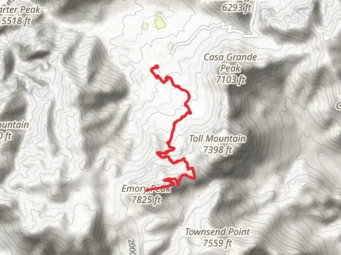
The Outer Mountain Loop is a challenging and rewarding trek that takes you through some of the most remote and stunning landscapes of Big Bend National Park. Spanning approximately 51 kilometers (about 32 miles), with an elevation gain of around 1900 meters (approximately 6234 feet), this trail is not for the faint-hearted. It is a true test of endurance and self-sufficiency, as it winds through the Chisos Mountains and the surrounding Chihuahuan Desert.
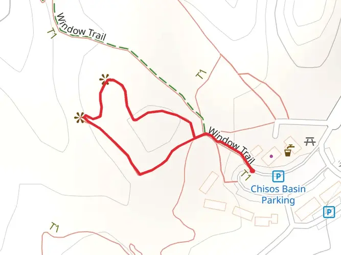
Getting to the Trailhead To begin your adventure on the Outer Mountain Loop, you'll need to make your way to Big Bend National Park, located in Brewster County, Texas. The closest major airport is in Midland, Texas, from which you can rent a car for the roughly 235-mile drive to the park. There is no direct public transportation to Big Bend, so a personal vehicle is necessary. Once inside the park, follow the signs to the Chisos Basin Visitor Center, where you can park and find the trailhead.
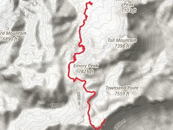
Navigating the Trail The loop can be hiked in either direction, but many choose to start at the Chisos Basin and proceed counterclockwise. HiiKER can be an invaluable tool for navigation, providing detailed maps and waypoints that can help you stay on track. The first section of the trail ascends the Pinnacles Trail, offering breathtaking views as you climb towards Emory Peak. This is the highest point in the park, and a side trip to the summit adds about 3.5 kilometers (2.2 miles) to your journey.
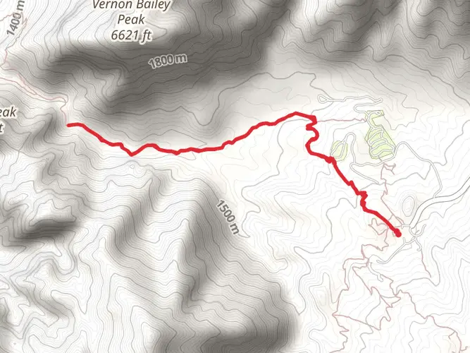
Descending from the high Chisos, you'll enter the desert environment of the Dodson Trail. This section is known for its arid conditions and sparse water sources, so carrying an adequate water supply is critical. The trail here is less defined, and careful navigation is essential.
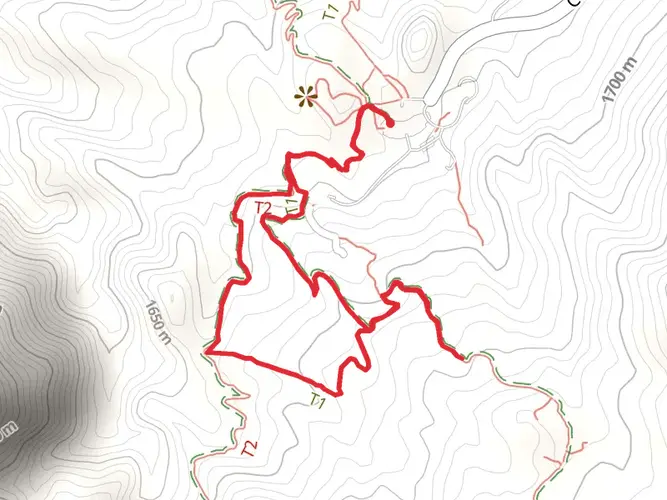
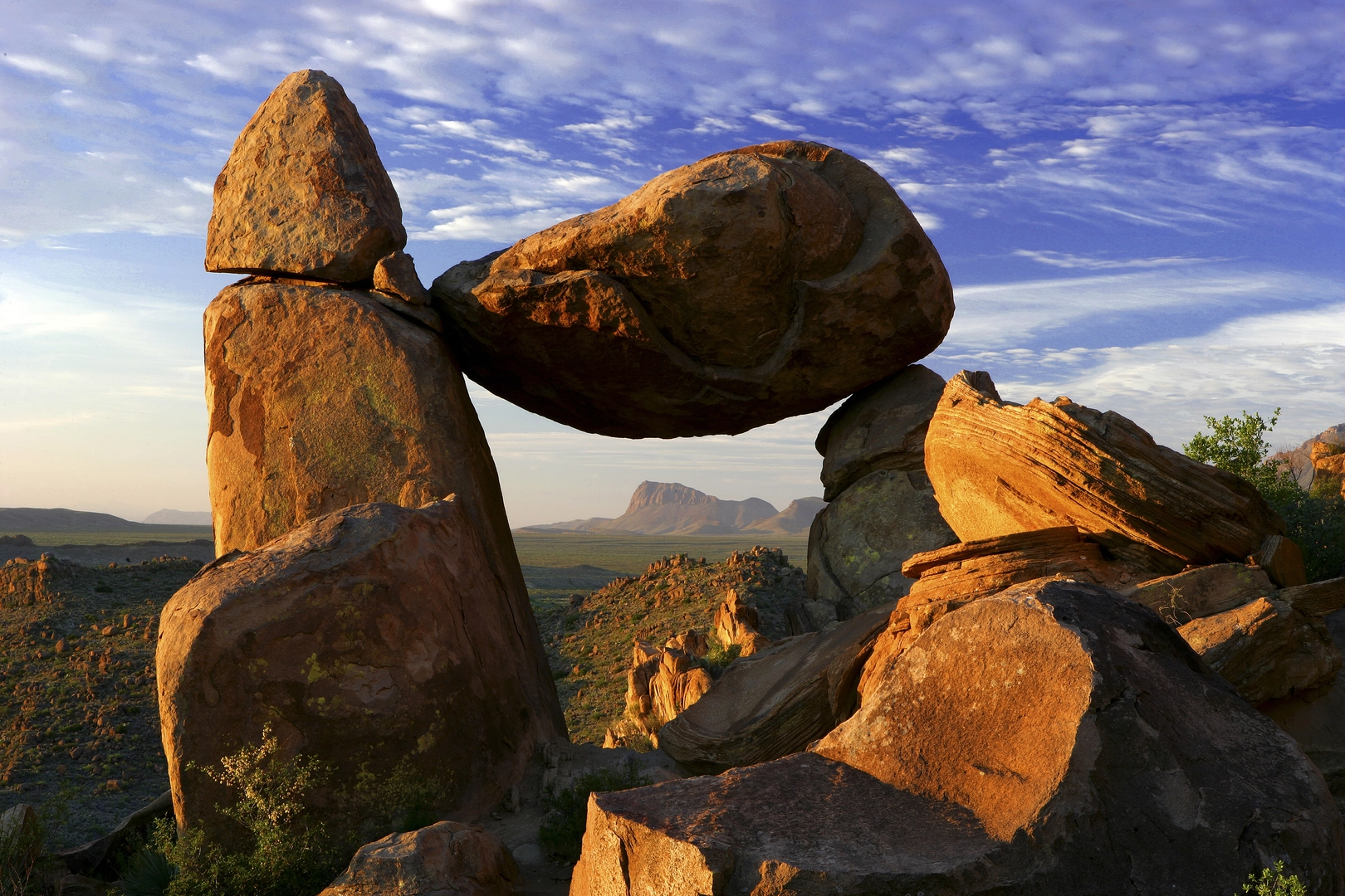
Landmarks and Natural Features As you traverse the Outer Mountain Loop, you'll encounter a variety of landscapes. The South Rim offers panoramic vistas of the desert below, while Boot Canyon provides a shaded respite with its lush woodlands and seasonal creek. The Juniper Canyon Trail descends steeply, leading you towards the desert floor.
Wildlife and Flora The diverse ecosystems of Big Bend are home to a wide array of wildlife, including black bears, mountain lions, and numerous bird species. Vegetation ranges from the towering Douglas firs of the high Chisos to the resilient cacti and yuccas of the desert. Always maintain a safe distance from wildlife and practice Leave No Trace principles to protect this delicate environment.
Historical Significance Big Bend has a rich history, with evidence of human habitation dating back thousands of years. The region was shaped by the forces of nature, volcanic activity, and the Rio Grande. More recently, it was the home of ranchers and miners before becoming a national park in 1944.
Preparation and Safety Due to the trail's difficulty and remote nature, it is imperative to be well-prepared. This includes bringing a detailed map, a compass, and a GPS device with the HiiKER app downloaded for offline use. Water sources are scarce, so plan to carry enough water or have the means to treat water from natural sources. Check in at the visitor center for the latest trail conditions and weather forecasts before setting out.
Conclusion The Outer Mountain Loop is a demanding hike that offers an immersive experience in one of America's most unique and rugged landscapes. With proper preparation and respect for the natural environment, hikers can enjoy a truly unforgettable adventure.

What to expect?
Activity types
Comments and Reviews
User comments, reviews and discussions about the Outer Mountain Loop, Texas.
4.43
average rating out of 5
7 rating(s)