Mid State Trail trail stages
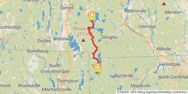
stage 1

Ending at: Douglas, Worcester County, 01516
Distance: 19.7 km
Elevation gain: 354 m
Duration: 04:31:13
stage 2

Starting at: Douglas, Worcester County, 01516
Ending at: Charlton, Worcester County, 01507
Distance: 20.6 km
Elevation gain: 418 m
Duration: 04:49:19
stage 3

Starting at: Charlton, Worcester County, 01507
Distance: 26.0 km
Elevation gain: 664 m
Duration: 06:18:28
stage 4

Starting at: Mid State Shelter, Spencer, Worcester County, 01562
Ending at: Rutland, Worcester County, 01543
Distance: 9.7 km
Elevation gain: 189 m
Duration: 02:14:52
stage 5

Starting at: Treasure Valley, Rutland, Worcester County, 01543
Ending at: Rutland, Worcester County, 01543
Distance: 19.3 km
Elevation gain: 395 m
Duration: 04:31:37
stage 6

Starting at: Rutland, Worcester County, 01543
Ending at: Princeton, Worcester County, 01541
Distance: 20.4 km
Elevation gain: 625 m
Duration: 05:07:47
stage 7

Starting at: Redemption Rock, Princeton, Worcester County, 01541
Ending at: Ashburnham, Worcester County, 01430
Distance: 19.4 km
Elevation gain: 576 m
Duration: 04:50:30
stage 8

Starting at: Ashburnham, Worcester County, 01430
Ending at: New Ipswich, Hillsborough County, 03071
Distance: 24.5 km
Elevation gain: 1071 m
Duration: 06:40:33
alt 2

Starting at: Ashburnham, Worcester County, 01430
Ending at: Ashburnham, Worcester County, 01431
Distance: 1.5 km
Elevation gain: 105 m
Duration: 00:28:45
alt 1

Starting at: Ashburnham, Worcester County, 01430
Ending at: Ashburnham, Worcester County, 01430
Distance: 959 m
Elevation gain: 104 m
Duration: 00:21:52