Download
3D Preview
Add to list
More
442.7 km
~18 days
10625 m
Multi-Day
“Embark on the Main Sudety Trail for an epic Polish mountain adventure rich in natural wonders and history.”
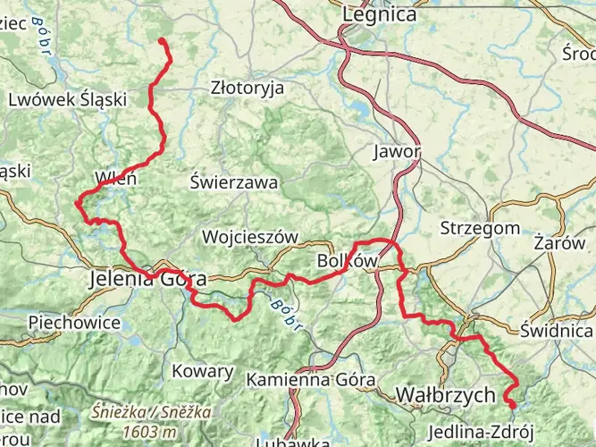
Spanning approximately 443 kilometers (275 miles) and with an elevation gain of around 10,600 meters (34,777 feet), the Main Sudety Trail is a challenging yet rewarding trek that traverses the Sudetes mountain range in southwestern Poland. This point-to-point trail begins near the spa town of Świeradów-Zdrój and winds its way through the diverse landscapes of the Sudetes, ending in the historic town of Prudnik.
Getting to the Trailhead
To reach the starting point near Świeradów-Zdrój, hikers can use public transportation or drive. The nearest major city is Wrocław, which has an international airport and extensive rail connections. From Wrocław, you can take a train or bus to Świeradów-Zdrój. If driving, the town is accessible via the DK3/E65 road, which connects to the A4 motorway.
Trail Overview
The Main Sudety Trail, marked by red trail signs, is known for its varied terrain, which includes dense forests, rocky ridges, and open mountain meadows. The trail is divided into several sections, each with its own unique characteristics and challenges.
Section Highlights and Landmarks
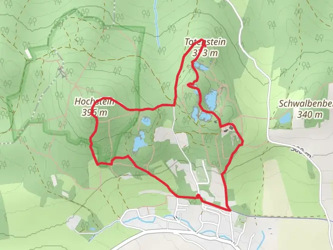
As you embark on the trail, the first section leads you through the Izerskie Mountains with their rolling hills and peat bogs. The trail then ascends into the Karkonosze National Park, home to Śnieżka, the highest peak in the Sudetes at 1,603 meters (5,259 feet). This area is rich in glacial features like cirques and moraines, and it's also where you'll encounter the stunning Krkonose tundra.
Continuing on, the trail passes through the Stołowe Mountains National Park, famous for its unique rock formations and table-like mountain structures. The Błędne Skały and Szczeliniec Wielki are notable landmarks here, offering panoramic views and intriguing rock labyrinths.
The trail then meanders through the Bardzkie Mountains and the Sowie Mountains, where you'll find the impressive Sowie Mountain Fortress, a complex of underground tunnels and bunkers dating back to World War II.
As you approach the end of the trail, the Golden Mountains and the Opawskie Mountains offer a mix of serene valleys and historic sites, including the medieval castle of Grodno and the picturesque town of Złoty Stok, known for its gold-mining history.
Flora and Fauna
The Sudetes are home to a rich biodiversity. Hikers can expect to see a variety of plant species, including rare mountain flowers and ancient beech forests. Wildlife in the area includes deer, boar, and birds of prey, such as the eagle owl. The higher altitudes provide habitats for the elusive lynx and the European bison.
Navigation and Planning
Given the trail's length and difficulty, thorough planning is essential. Hikers should be prepared for multiple days of trekking and consider staying in mountain huts or camping where permitted. It's crucial to carry a detailed map or use a navigation tool like HiiKER to track your progress and plan your stops.
Weather and Safety
The weather in the Sudetes can be unpredictable, with sudden changes and cooler temperatures at higher elevations. Hikers should be prepared for all conditions and carry appropriate gear. It's also important to be aware of the trail's difficulty, as some sections may require advanced hiking skills and proper equipment.
Historical Significance
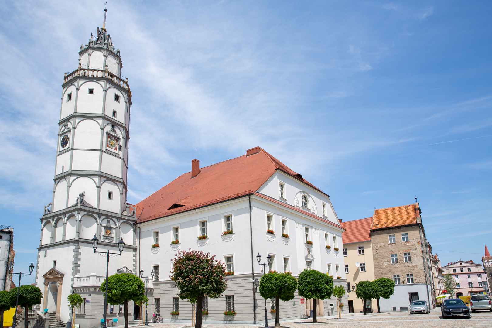
The Sudetes region is steeped in history, with evidence of human settlement dating back to prehistoric times. The trail itself often crosses paths with ancient trade routes and military roads. The area's complex history, influenced by Bohemian, Polish, and Germanic cultures, is reflected in the architecture and traditions of the towns and villages along the route.
Access and Conservation
The Main Sudety Trail is maintained by the Polish Tourist and Sightseeing Society (PTTK), and hikers are encouraged to respect the trail and its surroundings. Stick to marked paths to minimize your impact on the environment and support conservation efforts by staying in designated accommodations.
Whether you're seeking a challenging adventure or an opportunity to immerse yourself in the natural beauty and history of the Sudetes, the Main Sudety Trail offers an unforgettable experience for seasoned hikers.

Frequently asked questions
How long is the Main Sudety Trail and where does the route go?
The Main Sudety Trail is 442.68 km long and runs point to point across southwestern Poland. It starts in Świeradów-Zdrój, follows the Sudetes eastward on red waymarks, passes through major ranges including the Izerskie Mountains and Karkonosze, and finishes in Prudnik.
How difficult is the Main Sudety Trail and how much climbing is on the route?
The Main Sudety Trail is a difficult multi-day trek with 10,625 m of total elevation gain. That combination of nearly 443 km and sustained climbing makes it a demanding long-distance route rather than a casual hut walk or weekend trail.
What are the main highlights on the Main Sudety Trail route?
One of the best-known highlights on the Main Sudety Trail is Śnieżka in the Karkonosze, the highest peak in the Sudetes at 1,603 m. The route also crosses the Izerskie Mountains near Świeradów-Zdrój and continues all the way to the Opawskie Mountains near Prudnik, linking several of the most important Sudeten ranges on one red-blazed trail.
Is the Main Sudety Trail waymarked and easy to follow?
The Main Sudety Trail is marked with red trail blazes, the standard color used for this long-distance route in Poland. Navigation is still important because the trail covers 442.68 km through multiple mountain ranges, but the route is established and recognized as the Główny Szlak Sudecki.
Can dogs go on the Main Sudety Trail?
Dogs may be possible on some sections of the Main Sudety Trail, but not every part of the route has the same rules. A key section crosses Karkonosze National Park, where there is dedicated information for hiking with a dog and park access rules apply, so dog access should be checked section by section rather than assumed for the full 442.68 km route.
Can you bike or use an e-bike on the Main Sudety Trail?
The Main Sudety Trail is a hiking route, not a bikepacking or e-bike trail. Some areas it passes through, including Karkonosze National Park, allow cycling only on specific roads or designated routes, so the full red-blazed Main Sudety Trail should not be treated as a continuous legal bike or e-bike line from Świeradów-Zdrój to Prudnik.
Comments and Reviews
User comments, reviews and discussions about the Main Sudety Trail, Poland.
5.0
average rating out of 5
7 rating(s)