43.8 km
~1 day 4 hrs
223 m
“Embark on a scenic 27-mile historical trek through Montgomery County's natural and cultural tapestry.”
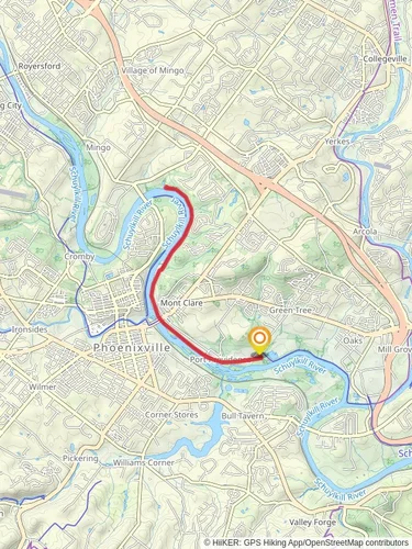
The Schuylkill River and Perkiomen Trails offer a combined journey of approximately 44 kilometers (around 27 miles) with an elevation gain of about 200 meters (roughly 656 feet), presenting a medium difficulty level for hikers. This point-to-point trail is nestled in the scenic Montgomery County, Pennsylvania, and is a fusion of natural beauty, historical richness, and community connectivity.
Getting to the Trailhead
To reach the trailhead, hikers can drive to the starting point near Montgomery County. For those preferring public transportation, regional rail services are available to bring you close to the trail's beginning. From the nearest station, local buses or a short taxi ride can complete the journey to the trailhead.
Navigating the Trail
As you embark on the trail, you can rely on the HiiKER app for detailed maps and navigation assistance. The trail is well-marked, but having a digital tool can enhance the experience and ensure you stay on the right path.
Historical Significance and Landmarks
The Schuylkill River Trail weaves through a region steeped in history. As you traverse the path, you'll encounter landmarks such as the Valley Forge National Historical Park, which is a short detour away and commemorates the site where the American Continental Army spent the winter of 1777-78 during the Revolutionary War.
Natural Beauty and Wildlife
The trail offers a diverse landscape, with sections running alongside the Schuillkill River, providing serene water views and opportunities to spot local wildlife. Birdwatchers may catch glimpses of various species, including herons and eagles. The Perkiomen Trail portion meanders through wooded areas and open fields, allowing hikers to immerse themselves in the tranquility of nature.
Trail Experience
Starting near the confluence of the Schuylkill River and Perkiomen Creek, the trail leads you through a mix of urban and rural settings. You'll pass through several parks and recreational areas, ideal for rest stops or picnics. The trail is popular among cyclists and joggers as well, so be prepared to share the path.
As you progress, the elevation gain is gradual, making the climbs manageable for most hikers. The trail surface varies from paved sections to gravel and natural earth, so wearing appropriate footwear is advisable.
Preparation and Planning
Before setting out, ensure you have sufficient water and snacks, as the trail length can take several hours to complete. Sun protection and insect repellent are also recommended, especially during the warmer months. Check the weather forecast in advance to prepare for any conditions you might encounter.
Remember, the trail is a point-to-point hike, so plan your return transportation accordingly. You may arrange for a pick-up at the end of the trail or use public transport options available in the area.
By following these guidelines and preparing adequately, hikers can look forward to an enriching experience on the Schuylkill River and Perkiomen Trails, where the beauty of Pennsylvania's landscapes and the echoes of its historical past come together to create a memorable outdoor adventure.
Reviews
User comments, reviews and discussions about the Schuylkill River and Perkiomen Trails, Pennsylvania.
4.0
average rating out of 5
11 rating(s)


