Download
3D Flyover
Add to list
More
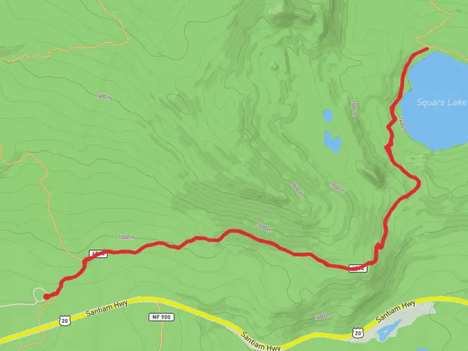
69.6 km
~3 days
2095 m
Multi-Day
“Traverse the heart of Oregon's Cascades on a breathtaking, challenging 70 km journey through the Mount Jefferson Wilderness.”
Embarking on the Mount Jefferson Wilderness Traverse is a journey through one of Oregon's most stunning landscapes, offering a challenging yet rewarding experience for seasoned hikers. This approximately 70 km (43.5 miles) point-to-point trail weaves through the heart of the Mount Jefferson Wilderness, with an elevation gain of around 2000 meters (6562 feet), showcasing the raw beauty of the Cascade Range.
Getting to the Trailhead The trailhead is accessible near Linn County, Oregon. If you're driving, you can reach the starting point by taking Highway 22 to the town of Detroit, Oregon, and then following signs to the appropriate entry point for the traverse. For those relying on public transport, options are limited, but during the hiking season, there may be shuttle services available from nearby towns to the trailhead.
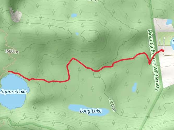
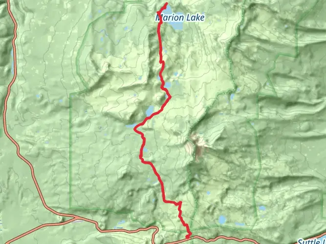
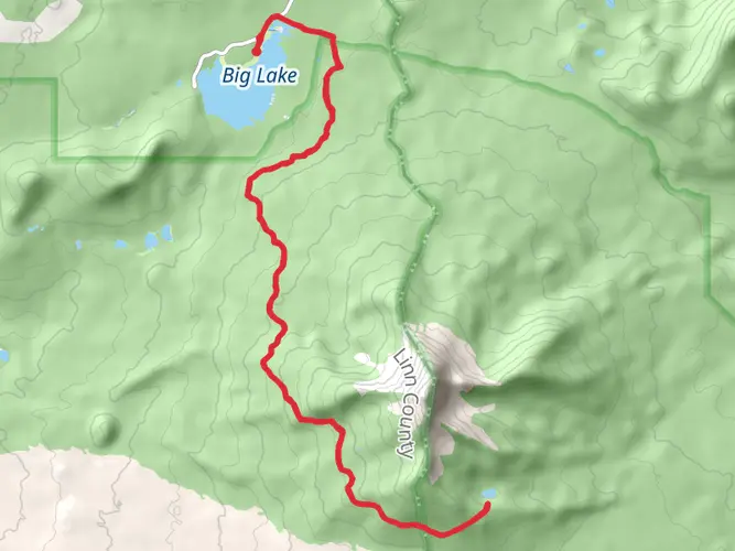
Navigating the Trail To navigate the trail, hikers should use the HiiKER app, which provides detailed maps and GPS coordinates for the entire route. This will be especially useful in areas where the trail may be less defined or in the event of poor weather conditions that can obscure the path.
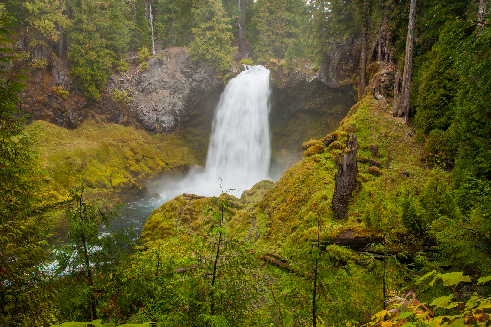
Trail Highlights and Landmarks As you begin your hike, the dense forests of Douglas fir and western hemlock envelop you, with the occasional break in the canopy offering glimpses of the towering Mount Jefferson. The trail climbs steadily, and within the first 10 km (6.2 miles), you'll encounter the first of many alpine lakes, which are perfect spots for a rest or a refreshing swim on a warm day.
Continuing on, the path leads you through vibrant wildflower meadows, especially from late spring to early summer. The colorful displays of lupine, Indian paintbrush, and bear grass are a sight to behold. Wildlife is abundant, with the chance to spot black bears, elk, and deer, as well as a variety of bird species, including the majestic peregrine falcon.
Historical Significance The Mount Jefferson area is steeped in history, with Native American tribes such as the Molalla and Warm Springs having traversed and lived in these lands for thousands of years. The region was later explored by European settlers in the 19th century, and Mount Jefferson itself was named in honor of President Thomas Jefferson.
Challenging Terrain and Safety As you approach the halfway mark, the trail becomes more rugged, with rocky outcrops and steep ridgelines that require careful navigation. The elevation gain is most pronounced in this section, with some parts of the trail climbing sharply. It's essential to be prepared with proper footwear, trekking poles, and to take your time through these challenging sections.
Preparing for the Hike Given the trail's difficulty rating and length, hikers should be well-prepared with adequate supplies, including food, water, and layers for changing weather conditions. It's also wise to inform someone of your hiking plans and expected return time due to the remote nature of the wilderness area.
Conclusion The Mount Jefferson Wilderness Traverse is a true test of endurance and a showcase of the Pacific Northwest's natural splendor. With careful planning and respect for the trail's challenges, hikers will find themselves immersed in an unforgettable outdoor adventure.

What to expect?
Activity types
Frequently asked questions
How long is the Mount Jefferson Wilderness Traverse and how hard is it?
The Mount Jefferson Wilderness Traverse is 69.62 km, or about 43.5 miles, with 2,095 meters of elevation gain. It is rated Extra Difficult and is best treated as a serious multi-day backpacking route through the Mount Jefferson Wilderness rather than a casual overnight trip.
How many days does the Mount Jefferson Wilderness Traverse usually take?
Most hikers would plan the Mount Jefferson Wilderness Traverse as a 3 to 5 day trip. Covering 69.62 km with 2,095 meters of climbing, the route is long enough that daily mileage, pack weight, weather, and snow conditions can make a major difference to pace.
Do you need a permit for the Mount Jefferson Wilderness Traverse?
A permit is commonly required for travel in the Mount Jefferson Wilderness during the main season. The U.S. Forest Service manages this area under the Central Cascades Wilderness permit system, with permit requirements applying for overnight use and for some day use between June 15 and October 15, so entry trailhead rules matter on a traverse.
What is the best time of year to hike the Mount Jefferson Wilderness Traverse?
The usual hiking window for the Mount Jefferson Wilderness Traverse is mid-summer into early fall, when high-country trails are more likely to be snow-free. Some access roads and trailheads in the Central Cascades may not open until mid or late June, and conditions can change quickly again in fall with early snow or wildfire restrictions.
Where do hikers start the Mount Jefferson Wilderness Traverse?
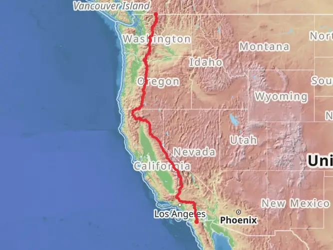
The Mount Jefferson Wilderness Traverse is in Linn County, Oregon, and access is typically arranged from the Detroit area on the west side or from trailheads tied into the Mount Jefferson Wilderness and Pacific Crest Trail corridor. Because it is a point-to-point route, transportation logistics usually need to be planned before setting out.
Is the Mount Jefferson Wilderness Traverse a loop trail or a point-to-point hike?
The Mount Jefferson Wilderness Traverse is a point-to-point multi-day hike, not a loop. That means the finish is in a different location from the start, so a car shuttle, second vehicle, or pickup arrangement is usually needed unless the route is being combined with a longer through-hike itinerary.
Are there seasonal closures or hazards on the Mount Jefferson Wilderness Traverse?
Yes. The Mount Jefferson Wilderness Traverse can be affected by lingering snow, washed-out access, wildfire smoke, and temporary trail or area closures in summer and early fall. This part of the Oregon Cascades has seen fire-related restrictions before, so current forest and wilderness conditions should always be checked close to departure.
Comments and Reviews
User comments, reviews and discussions about the Mount Jefferson Wilderness Traverse, Oregon.
4.67
average rating out of 5
9 rating(s)