Download
3D Flyover
Add to list
More
54.2 km
~3 days
1533 m
Multi-Day
“Embark on a serene coastal odyssey through New Zealand's vibrant Abel Tasman track, rich with history and natural splendor.”
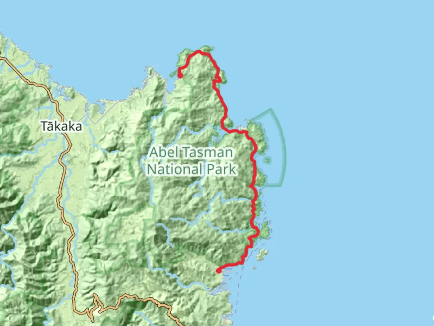
The Abel Tasman Coastal Track is a stunning journey along the northern coast of New Zealand's South Island, offering hikers a unique blend of golden beaches, lush native forest, and crystal-clear waters. Spanning approximately 54 kilometers (about 33.5 miles) with an elevation gain of around 1500 meters (nearly 4921 feet), this point-to-point trail is a medium-difficulty adventure that typically takes 3 to 5 days to complete.
Getting to the Trailhead
To start your hike, you'll need to reach the trailhead near the small town of Tasman. If you're driving, you can park your car at Marahau, the southern entrance to the track, which is about an hour's drive from Nelson. For those relying on public transport, there are bus services from Nelson and Motueka that can drop you off at the trailhead.
Navigating the Trail
The track is well-marked and maintained, making it easy to follow without the need for advanced navigation skills. However, it's always wise to carry a reliable navigation tool like HiiKER to keep track of your progress and ensure you're on the right path.
Key Sections and Landmarks
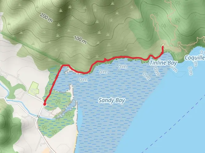
As you embark on the Abel Tasman Coastal Track, you'll traverse a variety of landscapes, from wide sandy beaches to rocky headlands. One of the first significant landmarks you'll encounter is the Astrolabe Roadstead, a historic anchorage named by French explorer Dumont D'Urville in 1827. Here, you can take in the history while enjoying the views of Adele and Fisherman Islands.
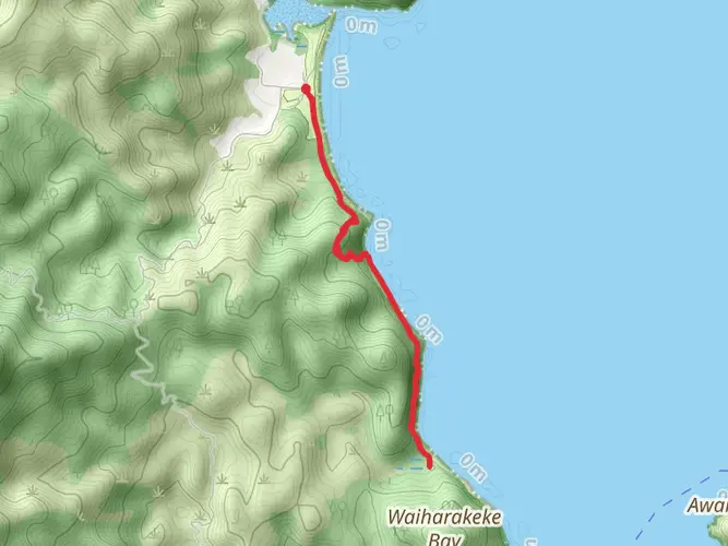
Continuing north, you'll reach Torrent Bay, an ideal spot for a refreshing swim or a rest on its inviting beach. The trail then leads you to Bark Bay, about 12 kilometers (7.5 miles) from the start, where you can explore the Bark Bay Waterfall or relax at the Bark Bay Hut if you're staying overnight.
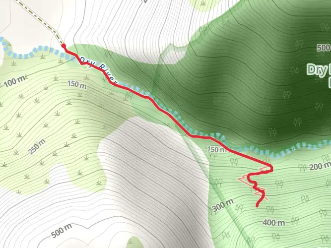
The next stretch includes a series of climbs and descents through native bush, offering glimpses of the turquoise sea below. You'll eventually arrive at the Awaroa Inlet, which can only be crossed within a few hours either side of low tide. Plan your journey accordingly to ensure you can safely traverse this section.
Wildlife and Natural Features
Throughout your hike, keep an eye out for the diverse wildlife, including fur seals basking on the rocks and a variety of bird species like the tui and bellbird. The trail also passes through regenerating forests of manuka and kanuka, with the occasional ancient rimu and rata trees towering above.
Historical Significance
The Abel Tasman Coastal Track is not only a natural wonder but also a region rich in history. The area is named after Dutch explorer Abel Tasman, who was the first European to sight New Zealand in 1642. The track itself runs through land that holds cultural significance for the local Maori iwi (tribes), and you'll find various historical sites along the way.
Preparation and Planning
Before setting out, ensure you have all the necessary permits and bookings for campsites or huts if you plan to stay overnight. The weather can be unpredictable, so pack for all conditions, including rain gear and sun protection. Fresh water is available at designated points, but it's advisable to treat it before drinking.
Remember, the Abel Tasman Coastal Track is a carry in, carry out trail, so be prepared to take all your rubbish with you to preserve the pristine environment for future hikers.

Comments and Reviews
User comments, reviews and discussions about the Abel Tasman Coastal Track, New Zealand.
4.53
average rating out of 5
15 rating(s)