Download
3D Flyover
Add to list
More
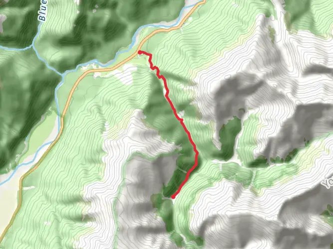
26.9 km
~2 days
1740 m
Multi-Day
“Embark on a demanding yet breathtaking trek through New Zealand's alpine wilderness on the Gillespie Pass Circuit.”
Embarking on the Gillespie Pass Circuit is a journey through the heart of New Zealand's Southern Alps, offering hikers a chance to immerse themselves in the rugged wilderness of the Mount Aspiring National Park. This challenging point-to-point trail spans approximately 27 kilometers (about 17 miles) and involves a significant elevation gain of around 1700 meters (approximately 5577 feet), making it a demanding trek suited for experienced hikers.
Getting to the Trailhead
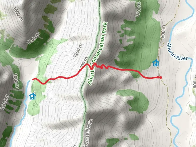
The adventure begins near Queenstown-Lakes, with the trailhead accessible by car. From Queenstown, you can drive to the small settlement of Makarora, which is the closest landmark to the start of the trail. If you're relying on public transport, there are bus services that run from Queenstown to Makarora, where you can then make your way to the trailhead.
The Trek Itself
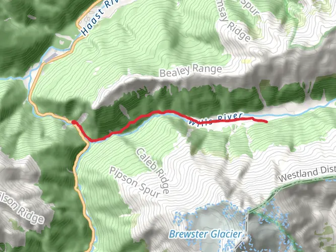
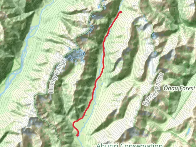
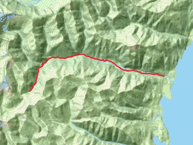
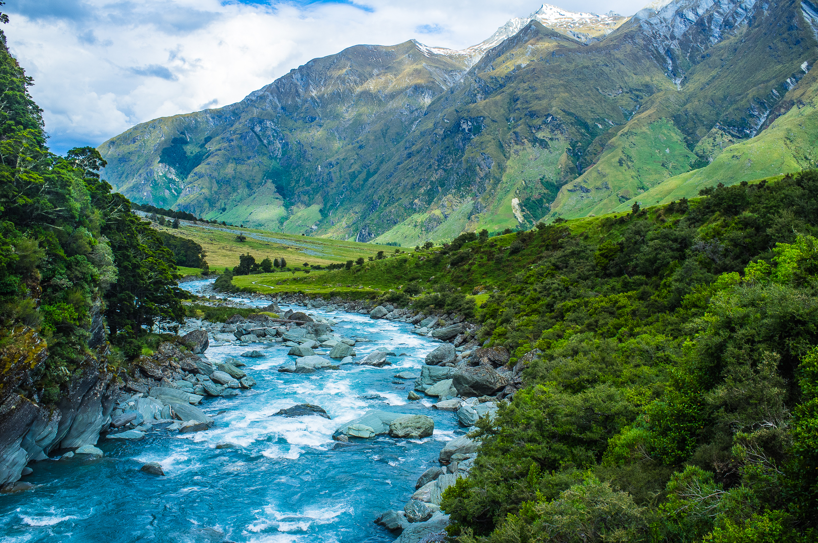
As you set out on the Gillespie Pass Circuit, the path takes you along the Young River, where you'll be treated to the sight of pristine waters cutting through dense beech forests. The initial section is relatively flat, but don't let this fool you; the trail soon begins its steep ascent towards the Young Saddle. This climb covers a distance of around 8 kilometers (5 miles) and is where you'll encounter the majority of the elevation gain.
Crossing the Saddle
Upon reaching the Young Saddle, you'll find yourself at an altitude of over 1500 meters (4921 feet). Here, the panoramic views of the surrounding peaks and valleys are truly breathtaking. The descent from the saddle leads you into the Siberia Valley, another highlight of the circuit. This valley is a vast expanse of open land, bordered by towering mountains, and is a great spot to observe the local wildlife, including the elusive tahr and chamois.
Historical Significance
The region holds a rich history, with the trails originally used by Māori for greenstone (pounamu) trading and later by European settlers for prospecting and farming. The Gillespie Pass Circuit traverses this historical landscape, allowing hikers to walk in the footsteps of those who shaped the history of this remote part of New Zealand.
Navigating the Trail
For navigation, HiiKER is an excellent tool to use while trekking the Gillespie Pass Circuit. It provides detailed maps and trail information that can help you stay on track and be aware of upcoming changes in terrain or elevation.
Final Stretch and Preparations
The final leg of the circuit takes you along the Wilkin River, with a gentle descent back towards the trailhead. This section is around 10 kilometers (6.2 miles) long and offers a more relaxed pace compared to the earlier parts of the hike.
Before embarking on the Gillespie Pass Circuit, it's crucial to be well-prepared. The trail's difficulty rating is estimated to be difficult, so ensure you have the appropriate gear, including sturdy hiking boots, weather-appropriate clothing, and enough food and water. It's also wise to check the weather forecast and trail conditions, as the circuit can be challenging during adverse weather.
By taking the necessary precautions and respecting the natural environment, hikers can enjoy a memorable experience on the Gillespie Pass Circuit, surrounded by the awe-inspiring landscapes of New Zealand's Southern Alps.

What to expect?
Activity types
Comments and Reviews
User comments, reviews and discussions about the Gillespie Pass Circuit, New Zealand.
4.67
average rating out of 5
9 rating(s)