Download
3D Flyover
Add to list
More
76.2 km
~3 days
1394 m
Multi-Day
“Embark on a scenic, historic 47-mile trek from High Point to Fox Gap, a medium-difficulty hiker's delight.”
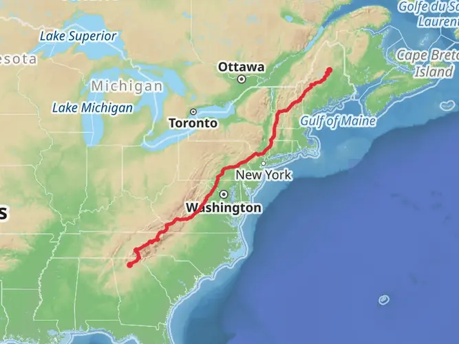
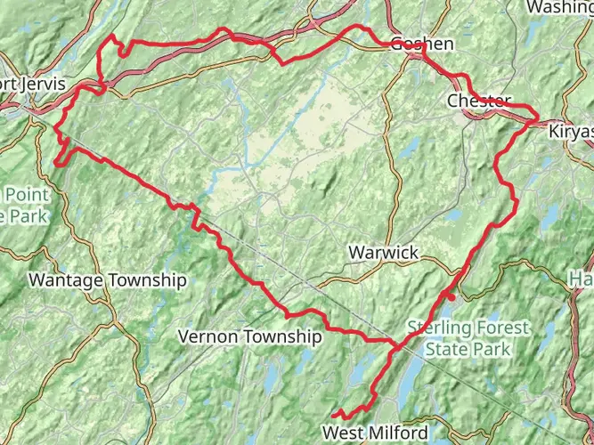
Embarking on the Appalachian Trail Section Hike from High Point to Fox Gap, hikers will traverse approximately 76 kilometers (about 47 miles) of diverse landscapes, with an elevation gain of around 1,300 meters (approximately 4,265 feet). This point-to-point journey begins near Sussex County, New Jersey, and is rated as medium difficulty, offering a challenging yet rewarding experience for avid hikers.
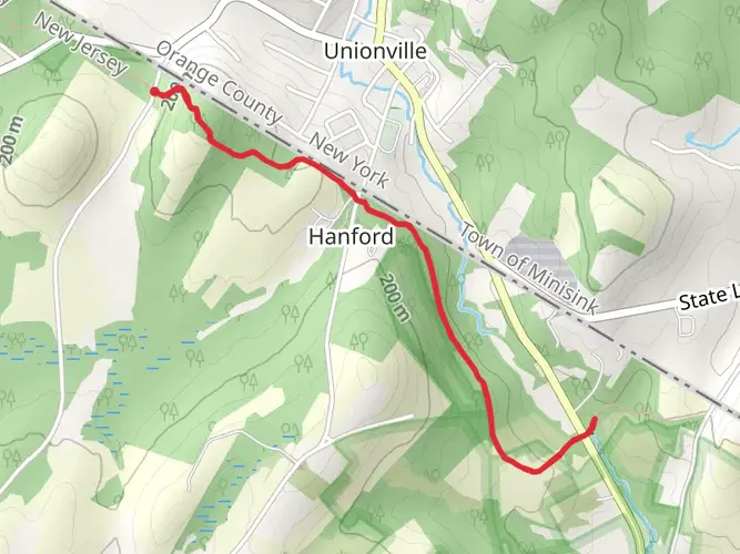
Getting to the Trailhead The starting point of the hike is accessible by car, located near the intersection of Route 23 and County Road 519 in Sussex County, New Jersey, close to High Point State Park. For those relying on public transportation, options may be limited, and it is advisable to check local transit resources for the latest schedules and routes to the nearest towns, from where a taxi or rideshare service can be arranged to the trailhead.
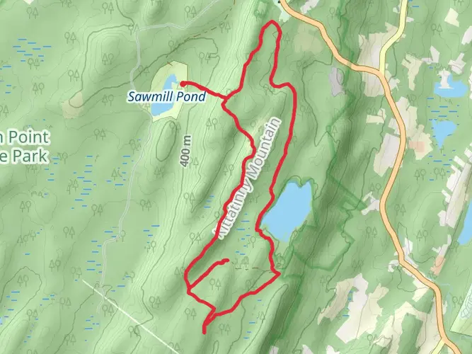
Navigating the Trail As you set out from the northern terminus near High Point, the highest elevation in New Jersey, you'll be greeted with expansive views from the High Point Monument, a prominent landmark dedicated to New Jersey's veterans. The trail meanders through mixed hardwood forests, over streams, and across rolling hills, offering a variety of terrains.
Hikers can rely on the HiiKER app for detailed maps and navigation assistance throughout their journey. The app provides real-time location tracking and waypoints, ensuring that even in the most remote sections, you'll have a digital guide at your fingertips.
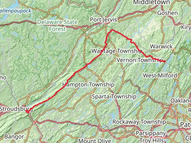
Landmarks and Natural Beauty Approximately 10 miles into the hike, the trail crosses Stokes State Forest, a haven for wildlife and a great spot for birdwatching. As you continue, the trail intersects with the Sunrise Mountain Road, where you can take a short detour to the Sunrise Mountain Pavilion for another panoramic vista.
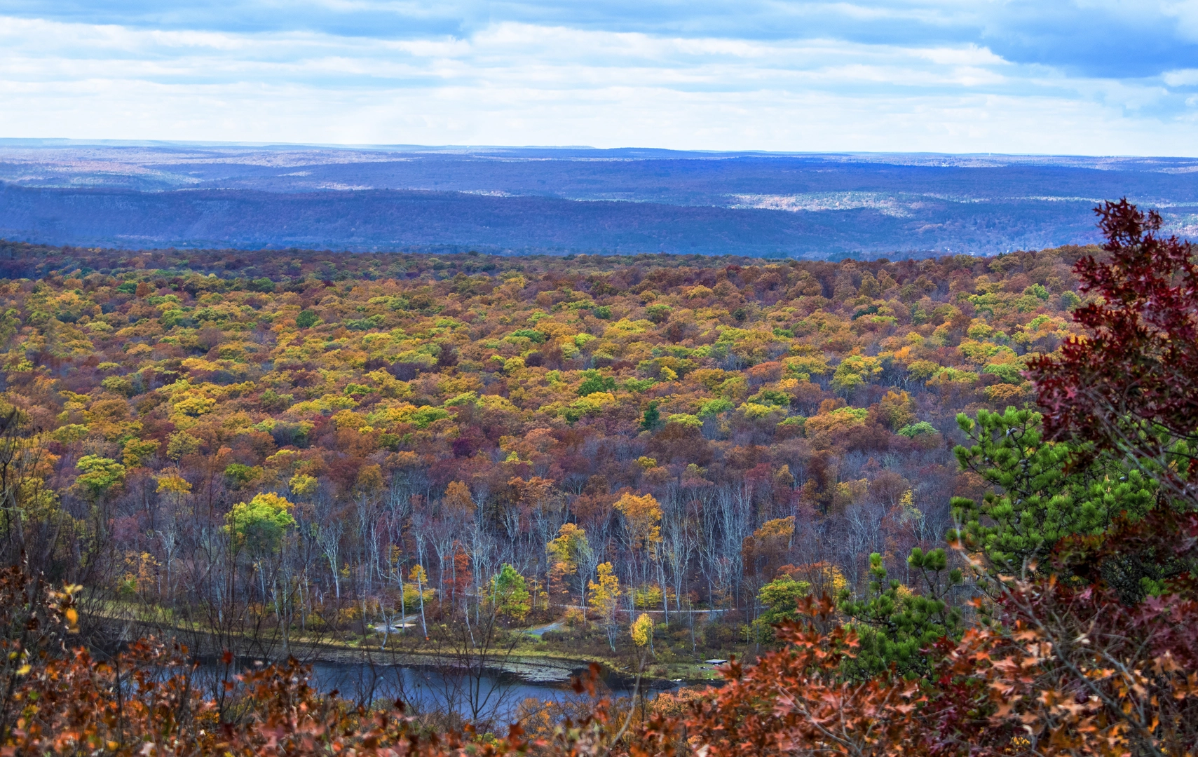
The midway point of the hike is marked by the Delaware Water Gap National Recreation Area, a significant natural landmark where the Delaware River cuts through a mountain ridge. Here, the trail offers a mix of serene river scenes and rugged mountain terrain.
Historical Significance The region is steeped in history, with the trail itself following paths once used by Native Americans and early European settlers. The Delaware Water Gap has been a crossroads for various cultures for thousands of years, and the area is dotted with historical sites and old settlements that reflect its rich past.
Wildlife and Flora Throughout the hike, you'll encounter a diverse array of flora and fauna. The forests are home to black bears, white-tailed deer, and a multitude of bird species. The changing seasons bring a kaleidoscope of colors, from the vibrant greens of spring to the fiery hues of autumn.
Preparation and Planning Before setting out, ensure you have adequate supplies, as there are limited resupply points along the route. Water sources are generally plentiful, but always carry a means of purification. Weather can be unpredictable, so pack layers and be prepared for sudden changes in conditions.
Conclusion The Appalachian Trail Section Hike from High Point to Fox Gap is a journey through natural beauty, historical landscapes, and diverse ecosystems. With careful planning and a spirit of adventure, hikers will find this trail to be a memorable and enriching experience.

What to expect?
Activity types
Comments and Reviews
User comments, reviews and discussions about the Appalachian Trail Section Hike - High Point To Fox Gap, New Jersey.
4.67
average rating out of 5
15 rating(s)