Download
3D Flyover
Add to list
More
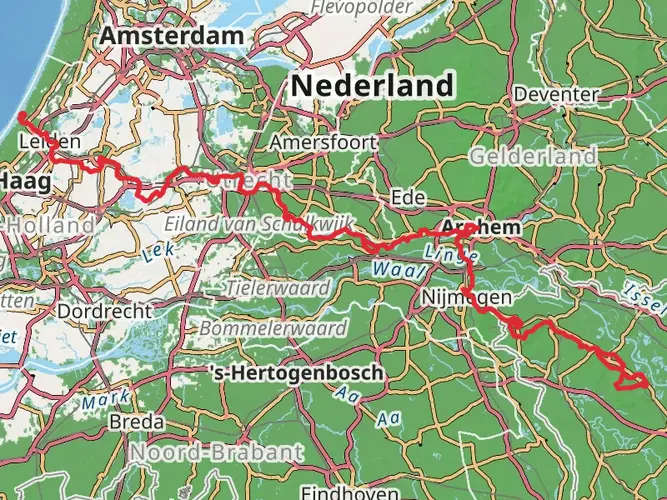
112.6 km
~4 days
488 m
Multi-Day
“Embark on a scenic 113km journey through history and nature on the culturally rich Streekpad Nijmegen trail.”
Embarking on the Streekpad Nijmegen, hikers will traverse approximately 113 kilometers (about 70 miles) of varied landscapes, with an elevation gain of around 400 meters (roughly 1,300 feet). This point-to-point trail offers a medium difficulty rating, making it accessible to hikers with a moderate level of experience.
Getting to the Trailhead
The trailhead is conveniently located near the vibrant city of Nijmegen, which is well-connected by public transport. Travelers can take a train to Nijmegen Central Station and then a bus to reach the starting point. For those arriving by car, parking is available in the vicinity of the trailhead.
The Journey Through History and Nature
As hikers set out from the outskirts of Nijmegen, they will quickly find themselves enveloped by the rich tapestry of the Netherlands' countryside. The trail meanders through a mix of dense woodlands, open meadows, and alongside serene waterways. The region is steeped in history, with Nijmegen itself being one of the oldest cities in the Netherlands. Hikers will encounter historical landmarks such as ancient Roman ruins and remnants of medieval fortifications.
Flora and Fauna
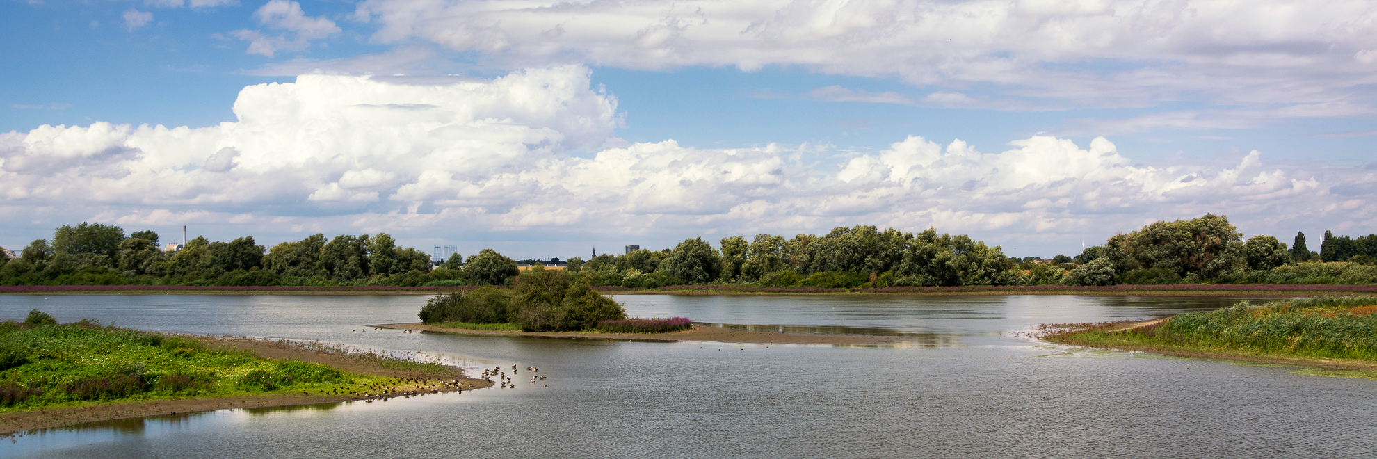
The path leads through the Gelderse Poort, an area known for its natural beauty and wildlife. Here, hikers might spot a variety of birds, including rare species that nest in the riverbanks. The changing seasons bring different hues to the landscape, with spring offering vibrant wildflowers and autumn presenting a mosaic of fall colors.
Notable Landmarks
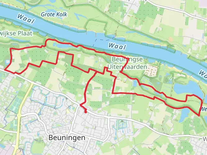
One of the highlights along the route is the passage through the Ooijpolder, a picturesque floodplain where the Waal River meanders. This area is characterized by its traditional Dutch windmills and farms, providing a glimpse into the rural life of the region.
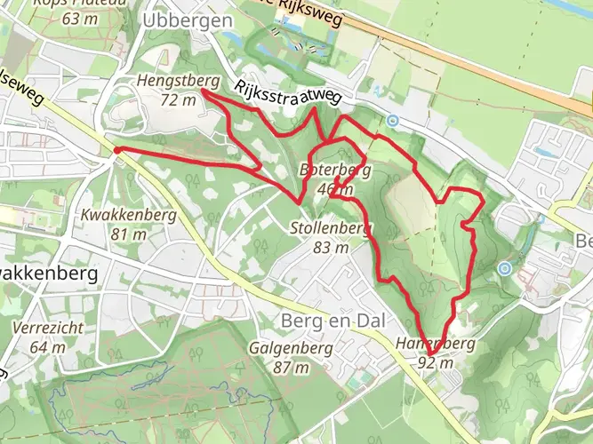
Further along, the trail ascends the Duivelsberg (Devil's Mountain), a modest hill that offers panoramic views of the surrounding area. Despite its ominous name, the climb is relatively gentle, and the summit is a perfect spot for a rest and a picnic.
Navigation and Preparation
Hikers can utilize the HiiKER app to navigate the trail, ensuring they stay on the correct path and can plan their stops accordingly. It's advisable to download the trail maps beforehand, as some sections may have limited cellular reception.
Practical Tips
Given the trail's length, it's recommended to tackle it in sections or plan for a multi-day hike with overnight stays in the quaint villages along the route. There are various accommodations available, from campsites to bed and breakfasts, allowing for a comfortable journey.
Water and food supplies should be replenished in the towns encountered on the way, as some stretches of the trail are quite remote. Always check the weather forecast before setting out and pack accordingly, as conditions can change rapidly.
Cultural Experiences
The Streekpad Nijmegen is not just a physical journey but also a cultural one. Hikers will have the opportunity to engage with the local culture, taste regional cuisine, and perhaps partake in local festivals or markets, depending on the timing of their hike.
Conservation and Respect
As with any natural trail, it's crucial to respect the environment and adhere to the principles of Leave No Trace. This ensures that the trail remains pristine for future hikers and that the local wildlife is undisturbed.
By preparing adequately and respecting the trail's natural and historical significance, hikers can look forward to an enriching experience on the Streekpad Nijmegen, full of scenic beauty and cultural depth.

Frequently asked questions
How long does the Streekpad Nijmegen take to hike from start to finish?
The Streekpad Nijmegen is 112.62 km long, so most hikers treat it as a multi-day route rather than a single-day walk. A practical schedule is about 6 to 7 days, which works out to roughly 16 to 19 km per day across the full route.
Where does the Streekpad Nijmegen start and finish?
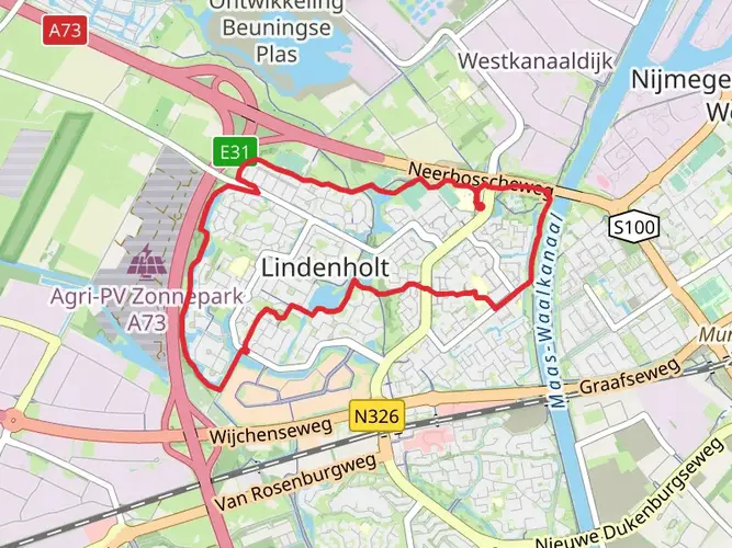
The Streekpad Nijmegen is a point-to-point style multi-day route based around Nijmegen, and the commonly used start and finish point is Nijmegen station. Stage listings for the route begin at Nijmegen Station and return there on the final stage, making rail access straightforward for walkers arriving from the city.
How difficult is the Streekpad Nijmegen and is there much climbing?
The Streekpad Nijmegen is rated easy overall, with 488 m of total elevation gain spread across 112.62 km. That means the route is not especially steep by long-distance standards, although the hillier stretches around Groesbeek, Plasmolen, and the Rijk van Nijmegen feel more undulating than the river sections.
How many stages are there on the Streekpad Nijmegen?
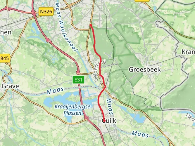
The Streekpad Nijmegen is commonly divided into 7 stages. Published stage breakdowns include sections such as Nijmegen to Deest, Deest to Wijchen, Wijchen to Grave, Grave to Malden, Malden to Plasmolen, Plasmolen to Wyler, and Wyler back to Nijmegen Station.
What is stage 2 of the Streekpad Nijmegen?
Stage 2 of the Streekpad Nijmegen is generally listed as Deest to Wijchen. That section is about 20.7 km long and passes through places including Afferden, Bergharen, Hernen, Ewijk, and Leur before reaching Wijchen.
What is stage 5 of the Streekpad Nijmegen?
Stage 5 of the Streekpad Nijmegen is usually described as Malden to Plasmolen. It is about 13.9 km long and is one of the shorter stages, passing through the greener, more wooded part of the route near Groesbeek, Molenhoek, Mook, Middelaar, and Plasmolen.
What kind of scenery does the Streekpad Nijmegen pass through?
The Streekpad Nijmegen crosses a notably varied part of the eastern Netherlands. The route links river dikes and floodplains along the Waal and Maas, wooded sections in the Rijk van Nijmegen and Reichswald, and low-lying polder landscapes in the Land van Maas en Waal and the Gelderse Poort.
Comments and Reviews
User comments, reviews and discussions about the Streekpad Nijmegen, Netherlands.
4.57
average rating out of 5
7 rating(s)