Download
3D Preview
Add to list
More
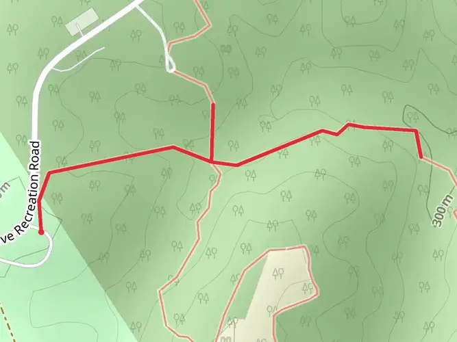
35.7 km
~7 hrs 11 min
33 m
Multi-Day
“Embark on the serene, historic Steamboat Trace Trail, a picturesque journey through Nebraska's diverse and tranquil landscapes.”
The Steamboat Trace Trail stretches approximately 36 kilometers (about 22 miles) through the scenic landscape of Nebraska, offering hikers a tranquil experience with virtually no elevation gain, making it an accessible path for all skill levels. This point-to-point trail is nestled near Otoe County and is known for its easy-going terrain, which follows an old railroad corridor.
Getting to the Trailhead
To reach the starting point of the Steamboat Trace Trail, hikers can drive to the trailhead located near Otoe County. For those relying on public transportation, options may be limited, and it is advisable to check local transit resources for the nearest routes and schedules. Once at the trailhead, ample parking is available for those who arrive by car.
Navigating the Trail
As you embark on your journey, you can use the HiiKER app to navigate the trail and keep track of your progress. The trail is well-marked, and the app will help ensure you stay on the right path.
Natural Beauty and Wildlife
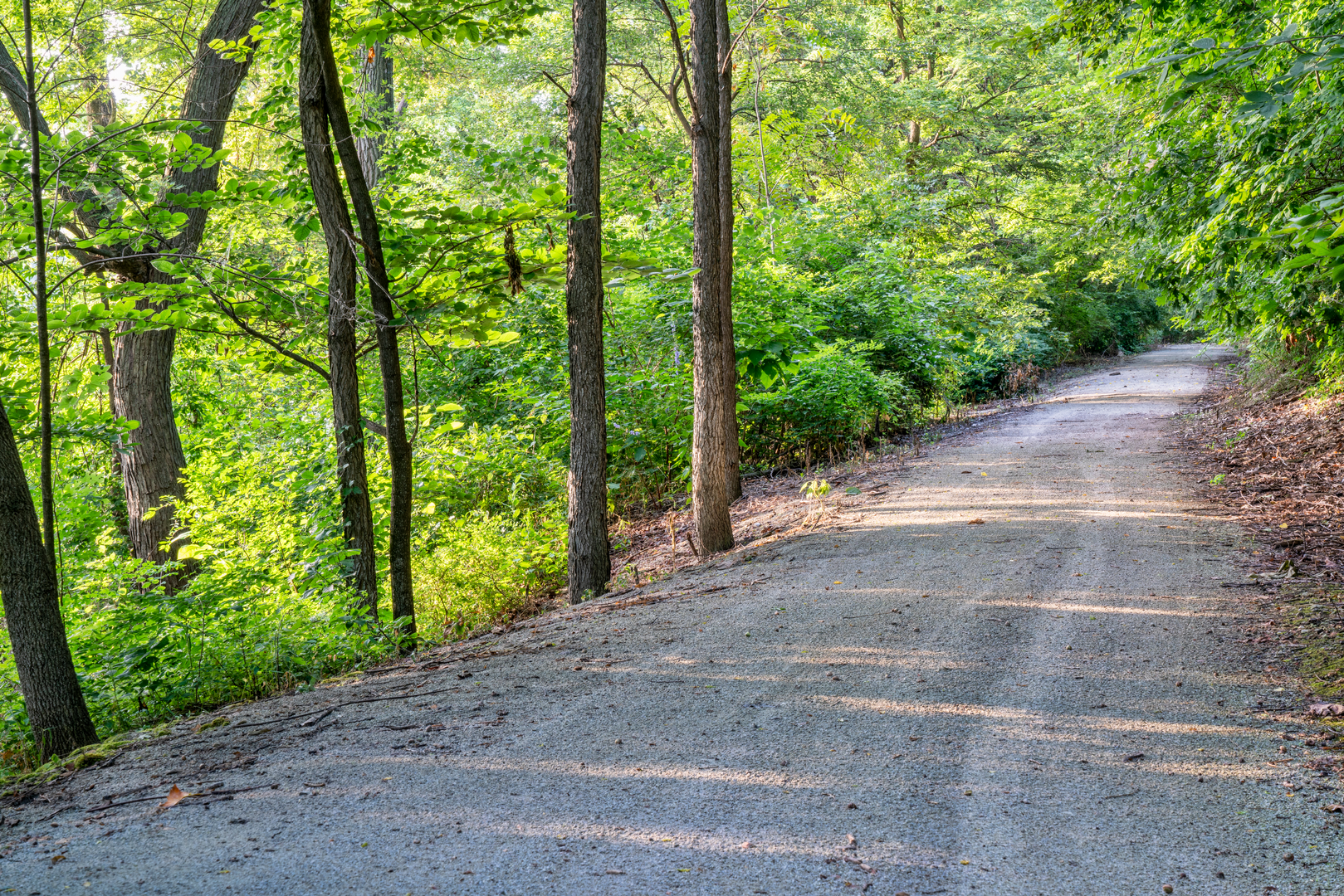
The trail meanders through lush woodlands, open prairies, and alongside the Missouri River, offering a diverse array of landscapes. The canopy of trees provides shade on sunny days, making it a pleasant hike even in warmer weather. Birdwatchers will delight in the variety of species that can be observed, including bald eagles, bluebirds, and wild turkeys. Deer are also commonly sighted along the trail, so keep your camera ready for wildlife encounters.
Historical Significance
The Steamboat Trace Trail holds historical significance as it follows the former corridor of the Missouri Pacific Railroad. The name itself is a nod to the steamboats that once frequented the nearby Missouri River, an integral part of the region's development. As you walk the trail, you'll be retracing the steps of early settlers and traders who were pivotal in shaping the history of Nebraska.
Landmarks and Points of Interest
Approximately halfway through the trail, hikers will come across the small town of Peru, Nebraska, which offers a perfect spot for a rest break. Here, you can explore local shops and grab a bite to eat before continuing on your journey. The trail also features several bridges and trestles, remnants of the railroad era, which provide picturesque views of the surrounding landscape.
Preparation and Planning
Before setting out, ensure you have enough water and snacks for the journey, as there are limited facilities along the trail. The flat terrain makes it suitable for both walking and biking, so consider your mode of travel when preparing. Since the trail is point-to-point, plan your return trip in advance, whether it's arranging for a pick-up at the trail's end or planning to hike back to the starting point.
Remember, the Steamboat Trace Trail offers a serene hiking experience through the heart of Nebraska's natural and historical landscapes. Whether you're seeking a leisurely walk or a full-day adventure, this trail is a delightful choice for hikers of all ages and abilities.

What to expect?
Activity types
Frequently asked questions
How long is the Steamboat Trace Trail and how much climbing is on it?
The Steamboat Trace Trail is 35.68 km, or about 22 miles, and it has only 33 m of total elevation gain. It follows a former railroad corridor, so the grade stays very gentle for most of the route, which is why it is generally considered an easy point-to-point trail.
Where are the main trailheads and parking areas for the Steamboat Trace Trail?
The main access points for the Steamboat Trace Trail are at Brownville, Peru, and south of Nebraska City near the OPPD power plant. Parking is available at all three trailheads, and the Peru trailhead also has restrooms, drinking water, and a picnic shelter, while Brownville has parking with restrooms available in town.
What is the surface like on the Steamboat Trace Trail in Nebraska?
The Steamboat Trace Trail has a crushed limestone surface along its roughly 22-mile route between the Nebraska City area and Brownville. Because it runs on an old rail bed with minimal elevation change, the tread is typically smoother and more even than a rugged dirt trail, making it suitable for an easy walk or multi-day outing.
Is the Steamboat Trace Trail closed during deer season?
Yes. The Steamboat Trace Trail is closed to all users during Nebraska rifle deer seasons for safety. The managing district states that the trail is always closed during the November rifle season and again for roughly two weeks in January, so winter trip plans should be checked carefully before setting out.
Is the Steamboat Trace Trail good for beginners or families?
The Steamboat Trace Trail is one of the more approachable long trails in southeast Nebraska because it is easy, nearly flat, and stretches 35.68 km with only 33 m of climbing. Families and newer hikers often use shorter out-and-back sections from Peru or Brownville rather than covering the full point-to-point distance in one go.
What towns and landmarks does the Steamboat Trace Trail connect?
The Steamboat Trace Trail runs through Missouri River country from just south of Nebraska City to Brownville, with Peru near the middle of the route. It passes the area near the OPPD power station south of Nebraska City and is recognized as an official Lewis and Clark site, linking several historic river towns on one corridor.
Comments and Reviews
User comments, reviews and discussions about the Steamboat Trace Trail, Nebraska.
4.54
average rating out of 5
57 rating(s)