7.0 km
~1 hrs 27 min
45 m
“Explore Finger Lakes State Park Water Trail for scenic lakes, wildlife, and rich history, all in 7 km.”
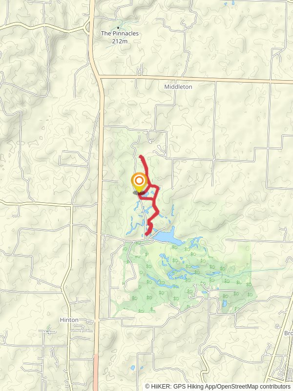
Nestled near Boone County, Missouri, the Finger Lakes State Park Water Trail offers a unique hiking experience with a distance of approximately 7 km (4.3 miles) and minimal elevation gain, making it accessible for a wide range of hikers. This loop trail is estimated to be of medium difficulty, providing a balanced mix of leisurely strolls and more challenging sections.
### Getting There To reach the trailhead, you can drive or use public transportation. If driving, head towards Finger Lakes State Park, located off U.S. Route 63, approximately 10 miles north of Columbia, Missouri. For those using public transport, the nearest significant landmark is the Columbia Transit system, which can get you close to the park, but you may need a taxi or rideshare service for the final leg of the journey.
### Trail Navigation For navigation, it's highly recommended to use the HiiKER app, which provides detailed maps and real-time updates. This will ensure you stay on track and can easily find points of interest along the way.
### Trail Highlights The trail meanders through a diverse landscape, featuring serene lakes, dense woodlands, and open meadows. One of the most striking features is the series of interconnected lakes formed from old coal mining pits, now repurposed into a beautiful recreational area. These lakes are perfect for spotting various waterfowl and other wildlife.
### Flora and Fauna As you hike, you'll encounter a variety of plant species, from towering oaks and hickories to vibrant wildflowers in the spring and summer months. Wildlife is abundant, with frequent sightings of deer, raccoons, and a plethora of bird species. Keep an eye out for the Great Blue Heron, often seen fishing in the lakes.
### Historical Significance The area has a rich history tied to its past as a coal mining region. The transformation of these mining pits into recreational lakes is a testament to successful land reclamation efforts. Informational plaques along the trail provide insights into the area's mining history and its ecological restoration.
### Points of Interest - Lakeside Views: Approximately 2 km (1.2 miles) into the hike, you'll reach a scenic viewpoint overlooking one of the larger lakes. This is an excellent spot for a break and some photography. - Wildlife Observation Deck: Around the 4 km (2.5 miles) mark, there's a designated observation deck perfect for bird watching and taking in the tranquil surroundings. - Picnic Areas: Scattered along the trail are several picnic spots, ideal for a mid-hike snack or a leisurely lunch.
### Safety and Preparation Given the trail's medium difficulty rating, it's advisable to wear sturdy hiking boots and bring plenty of water, especially during the warmer months. The trail can get muddy after rain, so be prepared for potentially slippery conditions. Always check the weather forecast before heading out and let someone know your hiking plans.
### Final Stretch As you near the end of the loop, the trail will guide you back through a shaded forest area, offering a cool and relaxing finish to your hike. The entire loop should take around 2-3 hours to complete, depending on your pace and how often you stop to enjoy the scenery.
This trail offers a perfect blend of natural beauty, historical significance, and recreational opportunities, making it a must-visit for any hiking enthusiast.
Reviews
User comments, reviews and discussions about the Finger Lakes State Park Water Trail, Missouri.
0.0
average rating out of 5
0 rating(s)


