Download
3D Flyover
Add to list
More
53.1 km
~2 days
622 m
Multi-Day
“Hike the South Section of the North South Trail, a medium-difficulty journey through Kentucky's captivating history and landscapes.”
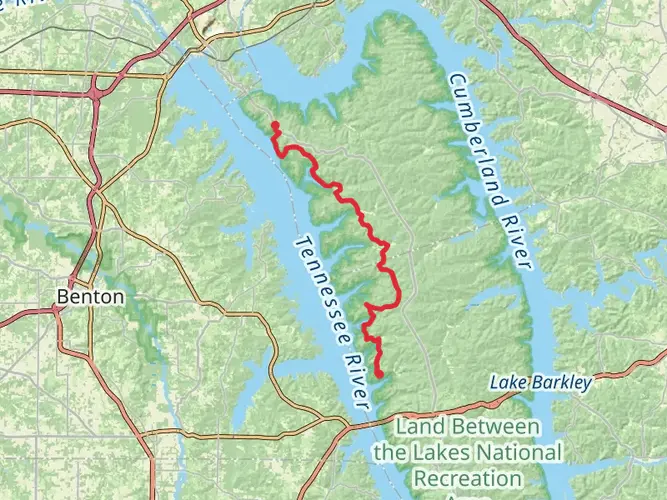
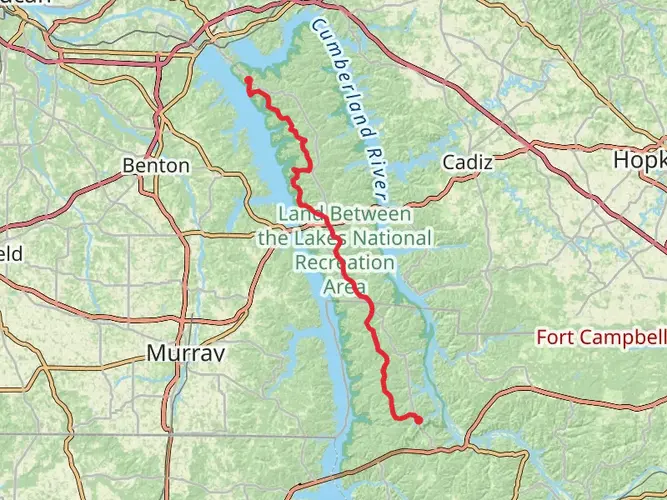
Embarking on the South Section of the North South Trail, hikers will traverse approximately 53 kilometers (about 33 miles) of diverse terrain, with an elevation gain of around 600 meters (roughly 1,968 feet). This point-to-point trail is nestled in the natural beauty of western Kentucky, starting near Trigg County, and is rated as medium difficulty, offering a rewarding challenge for both seasoned and intermediate hikers.
Getting to the Trailhead
To reach the trailhead, hikers can drive to the area near Trigg County, Kentucky. For those using public transportation, options may be limited, so it's advisable to check local transit routes for the closest drop-off points to the trail's starting location. Once in the vicinity, the trailhead is accessible by local roads, and parking is typically available nearby.
Navigating the Trail
As you set out on your hike, it's essential to have a reliable navigation tool. HiiKER is an excellent resource for trail maps and navigation, ensuring you stay on the right path throughout your journey. The trail is well-marked, but having a digital map can be invaluable, especially in areas where the trail may become less distinct.
Landmarks and Natural Features
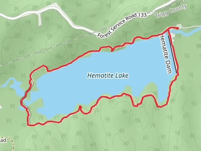
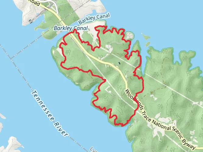
The trail meanders through a tapestry of lush forests, rolling hills, and serene lakes. Early on, hikers will encounter the Land Between the Lakes National Recreation Area, a highlight offering picturesque views and opportunities for wildlife observation. Keep an eye out for deer, turkeys, and a variety of bird species that call this area home.
As you progress, the trail will guide you through a mix of hardwood forests and open meadows. Around the halfway mark, you'll find yourself at the Cumberland River, a historical waterway that played a significant role in the development of the region. Here, the trail offers a gentle descent to the riverbanks before continuing on.
Historical Significance
The region is steeped in history, with the trail itself crossing paths with remnants of old homesteads and civil war battlefields. Hikers will walk through areas that were once bustling with early settlers and may encounter old stone walls and foundations, silent witnesses to the past.
Flora and Fauna
The diverse ecosystems along the trail support a rich variety of plant life, from towering oaks and hickories to vibrant wildflowers in the spring and summer months. The changing seasons bring a dynamic display of colors, with autumn offering a particularly spectacular array of fall foliage.
Preparation and Planning
Before embarking on this multi-day hike, it's crucial to plan accordingly. Ensure you have enough water, as sources along the trail may be limited or require treatment before drinking. Pack food that will sustain you for the duration of your hike and consider the need for overnight camping gear if you plan to break the journey into segments.
Weather Considerations
The weather in Kentucky can be unpredictable, so check the forecast before starting your hike and prepare for a range of conditions. Layered clothing will help you adjust to temperature changes, and rain gear is advisable to keep dry during unexpected showers.
By preparing adequately and respecting the natural and historical significance of the trail, hikers can look forward to an enriching experience on the South Section of the North South Trail.

Activity types
Comments and Reviews
User comments, reviews and discussions about the North South Trail - South Section, Kentucky.
4.69
average rating out of 5
16 rating(s)