Download
3D Flyover
Add to list
More
42.9 km
~2 days
657 m
Multi-Day
“Embark on the Perry Lake Trail's 43-km loop through forests, bluffs, and lake vistas steeped in history and biodiversity.”
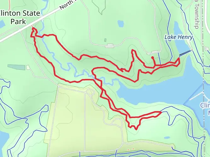
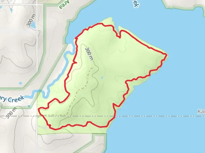
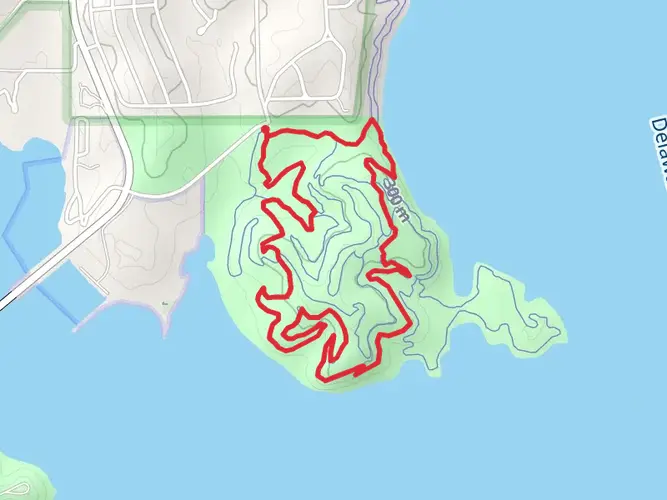
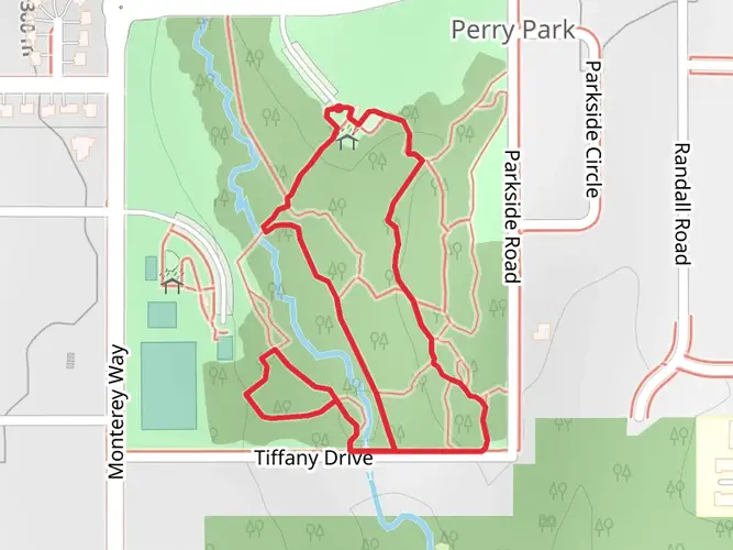
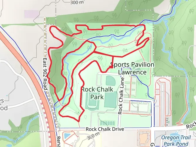
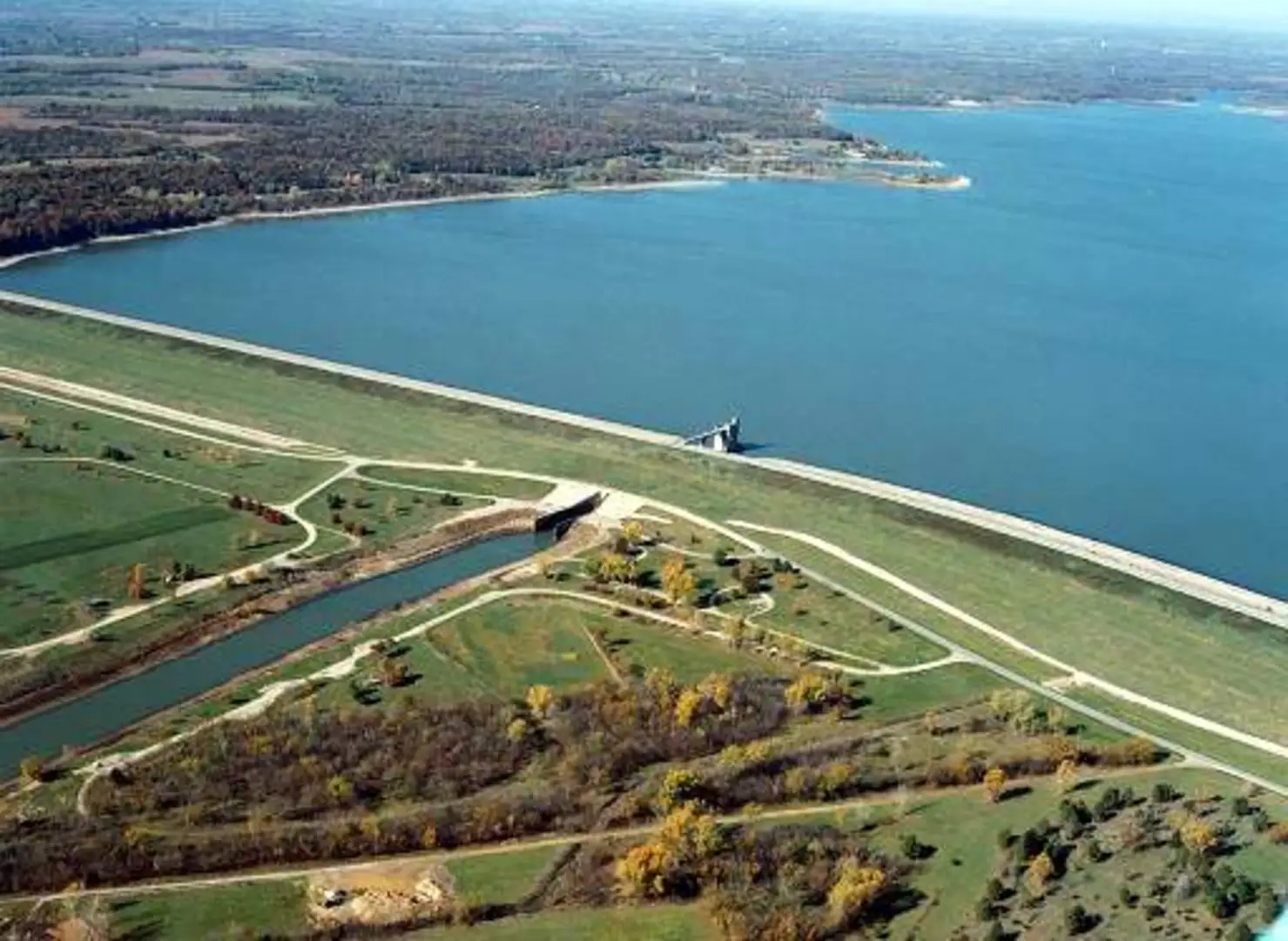
The Perry Lake Trail is a scenic loop that spans approximately 43 kilometers (about 26.7 miles) with an elevation gain of around 600 meters (roughly 1968 feet), offering a medium difficulty level for hikers. This trail is nestled near Jefferson County, Kansas, and is known for its diverse landscapes, including forested areas, rocky bluffs, and serene lake views.
Getting to the Trailhead
To reach the trailhead, hikers can drive to the Perry State Park, which is the nearest significant landmark. The park is accessible via local roads branching off from US-24 W/US-59 N. For those relying on public transportation, options may be limited, but checking with local transit authorities for any available routes to Perry State Park is advisable. Once at the park, signage will direct you to the trailhead, where ample parking is available.
Trail Experience
As you embark on the Perry Lake Trail, you'll traverse through a mix of terrains, starting with a gentle incline through deciduous forests. The trail is well-marked, but carrying a navigation tool like HiiKER is recommended to stay on track and monitor your progress.
Landmarks and Scenery
One of the first significant landmarks you'll encounter is the Perry Lake itself. The trail offers several vantage points for panoramic views of the lake, especially during the early miles. As you continue, you'll come across a series of clearings that provide a glimpse of the surrounding countryside.
The trail meanders through various ecosystems, including tallgrass prairies and wetlands, which are home to an array of wildlife. Keep an eye out for deer, wild turkeys, and numerous bird species, particularly near water sources.
Historical Significance
The region around Perry Lake is steeped in history. The area was once inhabited by Native American tribes, and later became a significant site during the westward expansion of the United States. Hikers will find interpretive signs along the trail that offer insights into the historical events that shaped the region.
Elevation and Terrain
The trail's elevation gain is gradual, with the most significant ascents occurring in the bluffs overlooking the lake. These rocky outcrops provide a moderate challenge and are a highlight for many hikers. The terrain is a mix of packed earth, rock, and occasional muddy patches, so wearing sturdy hiking boots is advisable.
Preparing for the Hike
Before setting out, ensure you have enough water and food for the journey, as there are limited facilities along the trail. The weather can be unpredictable, so pack layers and rain gear. Also, consider bringing insect repellent, especially during the warmer months when mosquitoes are prevalent.
Conclusion
The Perry Lake Trail offers a rich hiking experience with its diverse landscapes, wildlife, and historical context. Whether you're looking for a day hike or planning to tackle the entire loop over a couple of days, this trail provides a rewarding adventure for hikers of all levels. Remember to respect the natural environment and practice Leave No Trace principles to preserve the beauty of the trail for future visitors.

What to expect?
Activity types
Frequently asked questions
How long does it take to hike the Perry Lake Trail in Jefferson County, Kansas?
The Perry Lake Trail is 42.88 km, or about 26.7 miles, so most hikers treat it as a 2- to 3-day trip rather than a short day hike. With 657 m of total elevation gain, stronger hikers can cover it in a long single day, but the trail is generally better suited to a multi-day pace around Perry Lake.
Is the Perry Lake Trail a loop and how difficult is the full Perry Lake Trail hike?
The Perry Lake Trail is a loop route near Perry Lake in Jefferson County, Kansas. It covers 42.88 km with 657 m of climbing and is rated easy overall, although the full distance still makes it a substantial outing, especially when done as a backpacking trip.
Are dogs allowed on the Perry Lake Trail?
Dogs are allowed around Perry Lake, but they need to be kept on a leash. Federal recreation rules for the Perry Lake area require pets to be restrained on a leash up to 6 feet long, so the same standard should be expected at trailheads, camp areas, and shoreline access points around the hike.
Where can you park for the Perry Lake Trail?
Parking is available in the Perry Lake recreation area, including access points near Perry State Park and lake parks such as Rock Creek and Slough Creek. The area is reached from US-24 near Perry, Kansas, and parking is expected to be in designated paved or graveled areas rather than on grass or roadside pull-offs.
Can you camp on the Perry Lake Trail or near the route?
Camping is available around Perry Lake, and the lake has both developed campgrounds and more primitive camping options. Recreation.gov lists multiple campgrounds in the area, including Rock Creek, Slough Creek, Old Town, Longview, and Perry, which makes the 42.88 km trail practical as an overnight or weekend backpacking route.
Is the Perry Lake Trail good for backpacking?
Yes. The Perry Lake Trail's 42.88 km length, moderate 657 m elevation gain, and multi-day format make it one of the more practical backpacking hikes in northeast Kansas. Its route around Perry Lake also gives access to shoreline scenery, wooded sections, and several nearby camping areas for staging or overnight stops.
Comments and Reviews
User comments, reviews and discussions about the Perry Lake Trail, Kansas.
4.48
average rating out of 5
29 rating(s)